
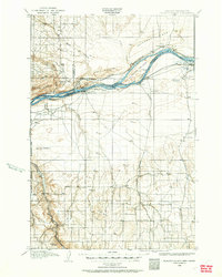
1906 Map of Blalock Island
USGS Topo · Published 1954About this map
Columbia River commerce and early irrigation efforts define this 1906 survey of the borderlands between Oregon and Washington. The river is the central artery, dominated by the large Blalock Island and smaller landmasses like Thanksgiving Island. Along the southern bank, the Oregon-Washington Railroad and Navigation Co serves the budding settlement of Irrigon and the landmark at Castle Rock. To the north, the Spokane Portland and Seattle line tracks the base of Paterson Ridge near the town of Paterson.
Find a feature on this map
46 named features on this map. Tap any name to fly to it.
Don’t see what you’re looking for? This feature index may not catch every label — zoom into the map to look around manually.
Map Details
Editions of this 1906 Blalock Island Map
2 editions found
Other maps of this area

1908 · Blalock Island
USGS Topo · 1:125,000

1908 · Umatilla
USGS Topo · 1:125,000

1910 · Zillah
USGS Topo · 1:125,000

1915 · Prosser
USGS Topo · 1:125,000

1916 · Arlington
USGS Topo · 1:125,000

1916 · Condon
USGS Topo · 1:125,000

1917 · Pasco
USGS Topo · 1:125,000

1917 · Prosser
USGS Topo · 1:125,000

1950 · Yakima
USGS Topo · 1:250,000

1953 · Pendleton
USGS Topo · 1:250,000