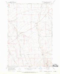
1968 Map of Strawberry Canyon SE
USGS Topo · Published 1970About this map
Alpine sits at the northern edge of this high-plateau landscape in Morrow County, where the dry drainage of Sand Hollow cuts through the rolling terrain. The map documents an agricultural economy defined by the Base Line and the presence of a Grain Elevator located near the intersection of the drainage ways. The rural infrastructure of the late 1960s is preserved here, showing the course of Strawberry Road and several localized extraction sites including a Gravel Pit and Borrow Pit.
Find a feature on this map
12 named features on this map. Tap any name to fly to it.
Don’t see what you’re looking for? This feature index may not catch every label — zoom into the map to look around manually.
Map Details
Editions of this 1968 Strawberry Canyon SE Map
This is the sole edition of this map. No revisions or reprints were ever made.
Other maps of this area

1906 · Blalock Island
USGS Topo · 1:125,000

1908 · Blalock Island
USGS Topo · 1:125,000

1908 · Umatilla
USGS Topo · 1:125,000

1953 · Pendleton
USGS Topo · 1:250,000

1956 · Pendleton
USGS Topo · 1:250,000

1968 · Service Buttes NW
USGS Topo · 1:24,000

1968 · Swaggart Buttes
USGS Topo · 1:24,000

1968 · Lexington
USGS Topo · 1:24,000

1968 · Gleason Butte
USGS Topo · 1:24,000

1968 · Butter Creek Junction
USGS Topo · 1:24,000