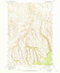
1969 Map of Balm Canyon
USGS Topo · Published 1973About this map
Rhea Creek winds through the northern landscape of this 1969 Morrow County survey, serving as a focal point for early settlement activity marked by the Rhea Creek Cem. The terrain is defined by a complex network of drainage systems, including Lunceford Creek, Thorn Creek, and Spring Hollow Cr, which carve deep into the plateau. Evidence of land use and local heritage is visible in the numerous named canyons like Ridgeway Canyon and Gene Wood Canyon, while the southern portion of the quadrangle reaches into the Umatilla National Forest. Family-named landmarks such as Saling Spring and Warm Hill suggest a history of ranching and early homesteading in this part of Oregon. This survey captures the rural character of the area before modern developments, preserved through precise topographic contouring of features like Pine Hollow and Six Dollar Canyon.
Find a feature on this map
34 named features on this map. Tap any name to fly to it.
Don’t see what you’re looking for? This feature index may not catch every label — zoom into the map to look around manually.
Map Details
Editions of this 1969 Balm Canyon Map
2 editions found
Other maps of this area

1953 · Pendleton
USGS Topo · 1:250,000

1956 · Pendleton
USGS Topo · 1:250,000

1968 · Ruggs
USGS Topo · 1:24,000

1968 · Heppner
USGS Topo · 1:24,000

1968 · Skinners Fork
USGS Topo · 1:24,000

1969 · Summerfield Ridge
USGS Topo · 1:24,000

1969 · Chapin Creek
USGS Topo · 1:24,000

1969 · Madison Butte
USGS Topo · 1:24,000

1969 · Hardman
USGS Topo · 1:24,000

1969 · Big Rock Flat
USGS Topo · 1:24,000