
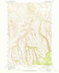
1968 Map of Skinners Fork
USGS Topo · Published 1971About this map
Skinners Fork and Hinton Fork cut through the high plateau of Morrow County in the late 1960s, revealing a landscape defined by sharp drainages and isolated springs. The drainage network is particularly dense here, with Willow Creek and Hinton Creek carving out major paths through the terrain. The map records several named geographical features that suggest local history and land usage, including Stingel Canyon, Stalter Canyon, and Soocup Canyon. Access across these steep ridges was primarily limited to primitive routes like the Rogers Creek Jeep Trail and Morse Jeep Trail. This survey captures the region just as photogrammetric mapping began to provide precise detail of the numerous springs and small forks that sustained ranching or local agriculture in this part of eastern Oregon.
Find a feature on this map
17 named features on this map. Tap any name to fly to it.
Don’t see what you’re looking for? This feature index may not catch every label — zoom into the map to look around manually.
Map Details
Editions of this 1968 Skinners Fork Map
This is the sole edition of this map. No revisions or reprints were ever made.
Other maps of this area

1953 · Pendleton
USGS Topo · 1:250,000

1956 · Pendleton
USGS Topo · 1:250,000

1967 · Freezeout Ridge
USGS Topo · 1:24,000

1968 · Swaggart Buttes
USGS Topo · 1:24,000

1968 · Lena
USGS Topo · 1:24,000

1968 · Gleason Butte
USGS Topo · 1:24,000

1968 · Heppner
USGS Topo · 1:24,000

1969 · Summerfield Ridge
USGS Topo · 1:24,000

1969 · Arbuckle Mtn
USGS Topo · 1:24,000
1969 · Balm Canyon
USGS Topo · 1:24,000