Old Maps of Blaine, Oregon for Metal Detecting
Plan your next treasure hunt with 12 historic maps of Blaine. Find old homesites, ghost towns, trails, and gathering spots that may be lost to time — perfect for identifying promising metal detecting locations.
- Locate forgotten sites: Uncover places like long-lost settlements, abandoned rail lines, or gathering spots.
- Plan better hunts: Use map overlays combined with LiDAR or satellite views to narrow in on historically rich areas.
- Made for detectorists: Thousands of hobbyists use these maps to discover relics, coins, and hidden history.
Use these historic maps to boost your research and find new opportunities beneath the surface of Blaine.
Blaine, OR maps
(12)- 1942 Map of Ginger Peak
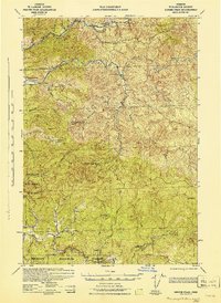 1942 Ginger Peak1942 Print · USGSCoastal Oregon mountain life is captured during the early 1940s as resource management and small-scale ranching shaped the forest drainages. Genealogists and researchers can locate Detrick Ranch, the Sturdevant Sch, and New Deal era labor sites like CCC Camp Trask.2 unique versions available
 - 1948 Map of Vancouver, 1957 Print
 1948 Vancouver1957 Print · USGSPost-war growth transforms the river valleys of the Pacific Northwest as the timber and rail economy thrives. Trace family roots in Tillamook or Oregon City, and locate vanished landmarks like the spit at Bayocean or the Skamania Mine.
 - 1950 Map of Vancouver
 1950 Vancouver1950 Print · USGSCoastal Oregon and the lower Columbia River valley are captured in detail just after the war. Researchers can trace historic rail routes like the Southern Pacific or locate early settlements such as Vernonia, Gaston, and the Grand Ronde Indian Reservation.
 - 1950 Map of Vancouver, 1951 Print
 1950 Vancouver1951 Print · USGSThe Pacific Northwest urban corridor meets the rugged coast in the years following the war, showing the expansion of Portland and Vancouver. Genealogists and historians can trace the reach of the Southern Pacific RR and locate coastal communities like Tillamook, Seaside, and Tolovana Park.
 - 1955 Map of Blaine, 1957 Print
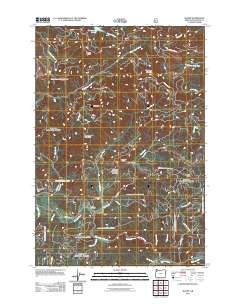
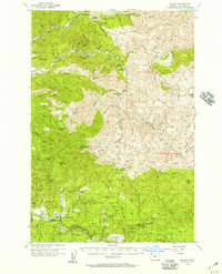 1955 Blaine1957 Print · USGSThe Oregon Coast Range near Blaine is shown in the mid-1950s as a landscape of timber management and forest retreats. Researchers can trace historic roads like the Old Toll Road and locate local landmarks such as the Nestucca Grange Hall and Detrick Ranch.2 unique versions available
 - 1958 Map of Vancouver, 1968 Print
 1958 Vancouver1968 Print · USGSThe Lower Columbia and Willamette valleys thrive in the late sixties as major rail and river hubs. Genealogists and historians can trace the development of Portland, identify the grounds of Camp Withycombe, and locate coastal landmarks from Tillamook Head to Garibaldi.3 unique versions available
 - 1964 Map of Vancouver
 1964 Vancouver1964 Print · USGSThe Pacific Northwest interior and coast are shown here in the 1960s, from the Portland metropolitan hub to the rugged Pacific shoreline. Researchers can trace the legacy of the Grand Ronde Indian Reservation, the early layout of McMinnville, and the maritime approaches near Tillamook Head.
 - 1980 Map of Yamhill River
 1980 Yamhill River1980 Print · USGSThe Oregon Coast Range and the western Willamette Valley meet in this 1980 survey, showing the landscape from the Pacific shore to the valley floor. Genealogists and historians can trace old routes like the Salmon River Highway to find the Grand Ronde Agency, Cloverdale, and Perrydale.3 unique versions available
 - 1984 Map of Blaine
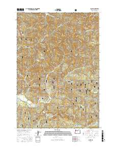
 1984 Blaine1984 Print · USGSThe Oregon Coast Range in the early 1980s was a landscape of deep timber and winding waterways like the Nestucca River. Trace the rural layout of Blaine, locate Detrick Ranch, or study the high ridges of Hardscrabble Mtn and Grindstone Mtn.
 - 2011 Map of Blaine, 2011 Print
 2011 Blaine2011 Print · USGSCovers Blaine, including Tillamook County, United States, and other nearby areas
 - 2017 Map of Blaine, 2017 Print
 2017 Blaine2017 Print · USGSCovers Blaine, including Tillamook County, United States, and other nearby areas
 - 2023 Map of Blaine, 2023 Print
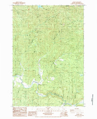
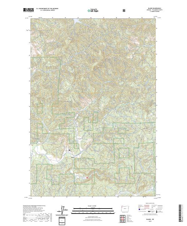 2023 Blaine2023 Print · USGSThe settlement of Blaine and the surrounding Siuslaw National Forest are captured here in the early twenty-first century. Family historians can locate the Blaine Cem and trace the paths of the Nestucca River and Moon Creek.
End of results
Showing maps 1-12 of 12
Top cities near Blaine
Frequently asked questions
- What are the different types of historical maps available for Blaine?
- What is the oldest map of Blaine?
- Where can I purchase historical maps of Blaine for my home or office?
- Where can I download high-res historical maps of Blaine?
- Are there historical topographic maps available for Blaine?
- Is there historical aerial imagery available for Blaine?
- Where are historical maps of Blaine sourced from?