1990s Maps of Umatilla County, Oregon
Explore 60 historic maps of Umatilla County from the 1990s. These maps offer a rare glimpse into what life looked like during the 1990s — showing old roads, neighborhoods, homes, and landmarks that have changed or disappeared over time.
Whether you're researching your family's past, planning a metal detecting trip, or studying how Umatilla County's landscape evolved across the 1990s, these high-resolution maps are a powerful tool for exploring the history of this region.
- Focus on a specific era: All maps on this page are from the 1990s, giving you a focused view of this time period.
- See what’s changed: Compare century-old streets, trails, and buildings to today's modern landscape using overlays and satellite layers.
- Research with precision: Use these maps for genealogy, historical research, land use analysis, or educational projects.
- View, download, or print: Maps are fully viewable online in high resolution, and can be downloaded or printed for your own records.
Start exploring Umatilla County's history through authentic maps from the 1990s. This is your window into the past.
Umatilla County, OR maps
(60)- 1990 Map of Meadow Brook Summit
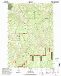
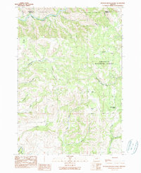 1990 Meadow Brook Summit1990 Print · USGSThe Grant County backcountry is captured here during the late 1980s as the Forest Service managed the timberlands of the Umatilla National Forest. Researchers can trace the network of unimproved roads and trails leading to Elk Grove, Meadow Brook Summit, and the remote Rush Pond.
 - 1990 Map of Ritter
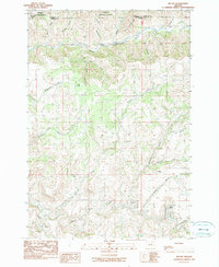 1990 Ritter1990 Print · USGSThe rugged river forks of Grant County are captured in the 1990s, centered on the settlement of Ritter. Researchers can locate the Ritter Cem and trace the complex drainages of Sixmile Creek and Eightmile Creek.
 - 1990 Map of The Cockscomb
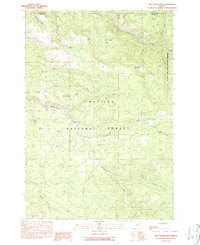 1990 The Cockscomb1990 Print · USGSThe Grant and Umatilla county borderlands remained a pristine wilderness in the early 1990s, centered on the North Fork John Day River. Researchers can trace old high-country water sources and terrain features like The Cockscomb, Hunters Spring, and Turner Meadow.
 - 1990 Map of Dale
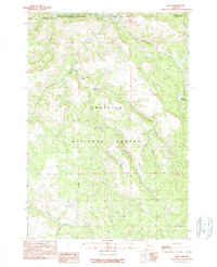 1990 Dale1990 Print · USGSThe North Fork John Day River corridor and the settlement of Dale are captured here in the 1990s as part of the Blue Mountain timberlands. Researchers can trace forest service routes and water sources like Meadow Brooks Falls, Howard Meadows, and Road Camp Spring.
 - 1991 Map of Touchet, 1992 Print
 1991 Touchet1992 Print · USGSThe Walla Walla Valley at the start of the nineties reveals a complex network of irrigation ditches and river crossings. Researchers can trace the water-driven economy of Touchet and Gardena through features like the Aqueduct and the Grain Elevator.
 - 1991 Map of Zangar Junction, 1992 Print
 1991 Zangar Junction1992 Print · USGSThe Walla Walla River valley at the Washington-Oregon border is captured here in the early nineties, showing a landscape of essential rural infrastructure. Trace the early layout of Zangar Junction near its Landing Strip or locate local landmarks like Reese and Cummins Bridge Rd.
 - 1991 Map of Lowden, 1992 Print
 1991 Lowden1992 Print · USGSThe Walla Walla Valley at the start of the 1990s reveals a landscape defined by intensive irrigation and agricultural heritage. Researchers can trace historic water routes like the Burlingame Canal or locate the Frenchtown Monument near Lowden.
 - 1992 Map of Wallula
 1992 Wallula1992 Print · USGSThe Columbia River corridor near the turn of the 1990s shows a landscape of vital rail lines and river industry. Genealogists and historians can trace the foundations of Wallula and Attalia, and locate landmarks like Wallula Cem and Twin Sisters.
 - 1993 Map of Hermiston
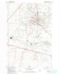 1993 Hermiston1993 Print · USGSHermiston and the surrounding Umatilla River valley are shown in the early nineties as a bustling center of irrigation and rail logistics. Researchers can trace the massive Hinkle Yards, locate the Cem, and find local landmarks like Bucks Corners.
 - 1993 Map of Ordnance
 1993 Ordnance1993 Print · USGSThe high desert of Umatilla County is seen here in the early nineties, centered on the sprawling military infrastructure of the Umatilla Depot Activity. Researchers can trace irrigation networks like the Irrigon Canal and locate the small communities of Ordnance and Westland.
 - 1993 Map of Stanfield SE
 1993 Stanfield SE1993 Print · USGSUmatilla County's desert drainages and historic travel routes are captured in the early nineties, centered on the Despain Gulch basin. Researchers can trace the pathways of Stage Road and find localized settlements at Lenz and Moorehouse.
 - 1993 Map of Umatilla
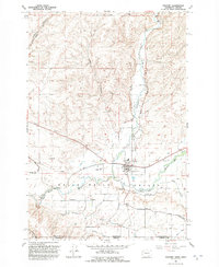
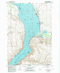
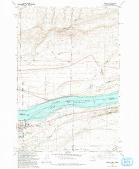
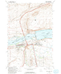 1993 Umatilla1993 Print · USGSThe Columbia River corridor is captured here in the early nineties, showing the massive engineering of the McNary Lock and Dam and the surrounding irrigation network. Trace the development of Power City, McNary, and the Umatilla shoreline alongside landmarks like Sillusi Butte.
 - 1993 Map of Juniper
 1993 Juniper1993 Print · USGSThe Columbia River borderlands appear in the early nineties, showing the managed waters of Lake Wallula. Local researchers can trace the settlement at Juniper, the Sand Station Recreation Area, and backcountry landmarks like Cold Springs Canyon.
 - 1993 Map of Irrigon
 1993 Irrigon1993 Print · USGSIrrigon and the Columbia River frontier are captured here in the early nineties as the region balanced agriculture, conservation, and military land use. Genealogists and local historians can locate Houghton Sch, the Desert Lawn Memorial Cem, and the expansive Umatilla Depot Activity.
 - 1993 Map of Hat Rock
 1993 Hat Rock1993 Print · USGSThe Columbia River shoreline near the Oregon-Washington border is captured here in the early nineties, showing a landscape defined by water management and transit. Researchers can trace the river's path past Hat Rock State Park, the Union Pacific tracks, and the Cold Springs National Wildlife Refuge.
 - 1993 Map of Stanfield
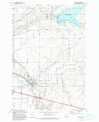 1993 Stanfield1993 Print · USGSStanfield and the Umatilla River valley are captured in the early nineties, showing a landscape defined by an intricate canal system and rail lines. Researchers can trace local heritage through Pleasant View Cem, the Grange Hall, and the winding Union Pacific Railroad.
 - 1995 Map of Blalock Mountain, 1997 Print
 1995 Blalock Mountain1997 Print · USGSThe rugged Blue Mountains of Umatilla County are shown here in the mid-1990s, dominated by river canyons and timbered ridges. Genealogists and hikers can trace remote landmarks like Demaris Cabin, Blue Mountain Camp, and the winding South Fork Walla Walla River.
 - 1995 Map of Bingham Springs, 1998 Print
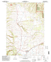
 1995 Bingham Springs1998 Print · USGSIn the 1990s, this portion of the Blue Mountains was a landscape of remote ridges and protected forests. Trace local landmarks like the Bar M Ranch, Bingham Springs, and the Corporation Guard Station along the Umatilla River.
 - 1995 Map of Ukiah, 1998 Print
 1995 Ukiah1998 Print · USGSThe high country of Umatilla County in the mid-1990s is captured here, showing the intersection of forest service lands and small mountain communities. Researchers can trace the layout of Ukiah and Albee or locate the local Cemetery and Landing Strip.
 - 1995 Map of Kooskooskie, 1998 Print
 1995 Kooskooskie1998 Print · USGSThe Washington-Oregon borderlands come into focus in the mid-nineties, showing the intersection of forest management and rural settlement. Researchers can trace the Railroad through Mill Creek Canyon or locate the Kiwanis Camp and Cemetery near Kooskooskie.
 - 1995 Map of Ritter, 1998 Print
 1995 Ritter1998 Print · USGSCentral Oregon in the mid-nineties shows a remote landscape where the Middle Fork John Day River meets local thermal features. Researchers can locate the Ritter Cem, the Ritter Hot Springs resort area, and the rugged Devils Backbone ridge.
 - 1995 Map of Pearson Ridge, 1998 Print
 1995 Pearson Ridge1998 Print · USGSThe Blue Mountains of Umatilla County are shown in the mid-1990s as a landscape of forest management and protected wilderness. You can trace the path of the Woop-De-Doo Trail or locate the historic Pearson Guard Station near Pearson Ridge.
 - 1995 Map of Thimbleberry Mountain, 1998 Print
 1995 Thimbleberry Mountain1998 Print · USGSUmatilla County in the mid-1990s remained a landscape of high timber ridges and essential water sources. Researchers can trace the layout of the Umatilla National Forest, locating historical landmarks like Goodman Lookout and the Skyline Road.
 - 1995 Map of Lehman Springs, 1998 Print
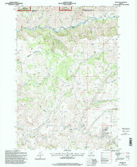
 1995 Lehman Springs1998 Print · USGSThe high forest country of the Blue Mountains comes alive in the mid-1990s as the timber and water resources are carefully documented. Researchers can trace the layout of Lehman Springs, the Frazier Guard Station, and the Bear Willow Interpretive Trail.
 - 1995 Map of Drumhill Ridge, 1998 Print
 1995 Drumhill Ridge1998 Print · USGSThe Oregon high country along the Umatilla and Union county lines comes into focus in the mid-1990s, revealing a landscape of dense national forests. Researchers can trace historic markers and camps including the Summit Guard Station, Keilers Cabin, and the Whitman Route Overlook.
Showing maps 1-25 of 60
Top cities of Umatilla County
- Pendleton historical maps
- Hermiston historical maps
- Milton-Freewater historical maps
- Umatilla historical maps
- Stanfield historical maps
- Pilot Rock historical maps
See more
Frequently asked questions
- What are the different types of historical maps available for Umatilla County?
- What is the oldest map of Umatilla County?
- Where can I purchase historical maps of Umatilla County for my home or office?
- Where can I download high-res historical maps of Umatilla County?
- Are there historical topographic maps available for Umatilla County?
- Is there historical aerial imagery available for Umatilla County?
- Where are historical maps of Umatilla County sourced from?