Old Maps of Duncan, Oregon for Hiking & Exploration
Hike through history with 9 historic maps of Duncan. Explore old trails, ghost towns, and forgotten backroads — perfect for outdoor adventurers and local explorers.
- Rediscover forgotten places: Map out old mining camps, roads, and footpaths that no longer exist on modern maps.
- Layer with modern tools: Combine with LiDAR or satellite views to plan hikes through historical terrain.
- Made for exploration: Popular among hikers, overlanders, and local history lovers.
Use these maps to find adventure and explore the hidden past of Duncan.
Duncan, OR maps
(9)- 1953 Map of Pendleton, 1957 Print
 1953 Pendleton1957 Print · USGSNortheastern Oregon and the Columbia River frontier are captured here in the early fifties, a time of massive federal infrastructure projects. Researchers can trace the historic route of The Old Oregon Trail as it passes near the Umatilla Ordnance Depot and the new McNary Dam.4 unique versions available
 - 1956 Map of Pendleton
 1956 Pendleton1956 Print · USGSNortheastern Oregon’s high plateau and timbered peaks appear here in the mid-fifties, during a time of major military and hydroelectric development. Trace the path of The Old Oregon Trail alongside modern landmarks like McNary Dam and the Umatilla Ordnance Depot.
 - 1964 Map of Duncan, 1966 Print
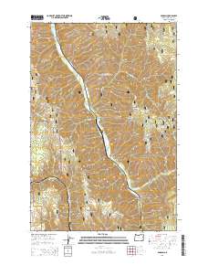
 1964 Duncan1966 Print · USGSUmatilla County's forest interior is captured here in the mid-1960s, where the railroad follows the winding path of Meacham Creek. Genealogists and historians can trace the early rail stops at Duncan and Gibbon or locate the Duncan Guard Station.3 unique versions available
 - 1983 Map of Pendleton, 1984 Print
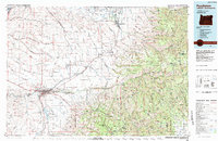 1983 Pendleton1984 Print · USGSPendleton and the Blue Mountain foothills are captured here in the early eighties as a hub of rail, ranching, and forest management. Genealogists and historians can trace local landmarks like Indian Agency Hdqrs, Bingham Springs, and the Union Pacific line.
 - 1995 Map of Duncan, 1998 Print
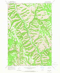
 1995 Duncan1998 Print · USGSThe Blue Mountains of Umatilla County are captured here in the mid-nineties, showing where the Union Pacific railroad tracks hug the banks of Meacham Creek. Genealogists and historians can trace the small mountain settlements of Gibbon and Duncan and follow old 4WD tracks through the Umatilla National Forest.
 - 2011 Map of Duncan, 2011 Print
 2011 Duncan2011 Print · USGSCovers Duncan, including Umatilla County, United States, and other nearby areas
 - 2014 Map of Duncan, 2014 Print
 2014 Duncan2014 Print · USGSCovers Duncan, including Umatilla County, United States, and other nearby areas
 - 2020 Map of Duncan, 2020 Print
 2020 Duncan2020 Print · USGSCovers Duncan, including Umatilla County, United States, and other nearby areas
 - 2023 Map of Duncan, 2023 Print
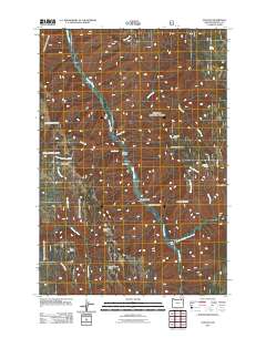
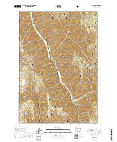
 2023 Duncan2023 Print · USGSUmatilla County's high ridges and creek drainages are documented here in the early twenty-first century. Researchers can trace the timber and water geography through Duncan, Smith Gate, and landmarks like Horse Heaven Ridge and Black Canyon Butte.
End of results
Showing maps 1-9 of 9
Top cities near Duncan
Frequently asked questions
- What are the different types of historical maps available for Duncan?
- What is the oldest map of Duncan?
- Where can I purchase historical maps of Duncan for my home or office?
- Where can I download high-res historical maps of Duncan?
- Are there historical topographic maps available for Duncan?
- Is there historical aerial imagery available for Duncan?
- Where are historical maps of Duncan sourced from?