Old Maps of Troy, Oregon for Genealogy
Trace your family roots with 9 historic maps of Troy. These high-res maps reveal old neighborhoods, homesites, landmarks, and streets — helping you uncover where your ancestors lived and how the area evolved over time.
- Explore historic neighborhoods: Identify where your relatives may have lived in the 1800s or 1900s.
- Compare maps over time: Trace the changes in streets, buildings, and landmarks for multi-generational research.
- Perfect for genealogy & ancestry research: Used by family historians and researchers to map out lineage and migration.
These maps are an incredible resource for exploring your personal connection to Troy's past.
Troy, OR maps
(9)- 1955 Map of Grangeville, 1964 Print
 1955 Grangeville1964 Print · USGSThe high country of the Idaho-Oregon border comes alive in the mid-1950s, showing the deep river canyons and mountain peaks. Trace the Union Pacific RR through the valleys or locate settlements like Grangeville, Joseph, and the shoreline of Wallowa Lake.4 unique versions available
 - 1959 Map of Grangeville
 1959 Grangeville1959 Print · USGSThe high alpine peaks and deep river canyons of the Idaho-Oregon borderlands are captured in the late fifties. Researchers can trace the Union Pacific RR through the valleys to settlements like Enterprise, Union, and Grangeville.2 unique versions available
 - 1967 Map of Troy, 1971 Print
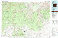
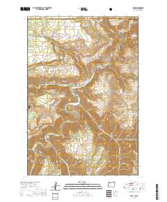
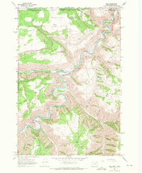 1967 Troy1971 Print · USGSThe Oregon-Washington border region comes to life in the late sixties as the Grande Ronde River carves through the high plateaus. Genealogists and hikers can trace the remote settlement of Troy, the upland community of Bartlett, and the Bartlett Cem tucked away on the flat.2 unique versions available
 - 1982 Map of Wallowa, 1983 Print
 1982 Wallowa1983 Print · USGSNortheast Oregon's rugged canyon country is captured here in the early eighties, showing a landscape defined by the Grande Ronde River and its high plateaus. Researchers can trace the Union Pacific line through Rondowa or locate vanished sites like Maxville and Palmer Junction.2 unique versions available
 - 1995 Map of Troy, 1998 Print
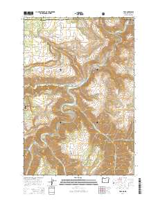
 1995 Troy1998 Print · USGSThe remote border of Oregon and Washington is captured here in the mid-1990s at the meeting of the Grande Ronde River and Wenaha River. Researchers can trace old family roots at Bartlett Cemetery or locate specialized river infrastructure like the Fish Ladder.
 - 2011 Map of Troy, 2011 Print
 2011 Troy2011 Print · USGSCovers Troy, including Asotin County, Wallowa County, and other nearby areas
 - 2014 Map of Troy, 2014 Print
 2014 Troy2014 Print · USGSCovers Troy, including Asotin County, Wallowa County, and other nearby areas
 - 2020 Map of Troy, 2020 Print
 2020 Troy2020 Print · USGSCovers Troy, including Asotin County, Wallowa County, and other nearby areas
 - 2023 Map of Troy, 2023 Print
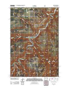
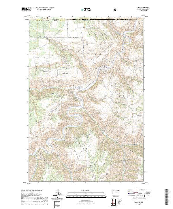 2023 Troy2023 Print · USGSThe Oregon and Washington borderlands come into focus in this contemporary survey of the canyons where the Wenaha River meets the Grande Ronde River. Researchers can trace the high plateau settlements of Bartlett and Grouse Flat, locating sites like Bartlett Cem above the river breaks.
End of results
Showing maps 1-9 of 9
Frequently asked questions
- What are the different types of historical maps available for Troy?
- What is the oldest map of Troy?
- Where can I purchase historical maps of Troy for my home or office?
- Where can I download high-res historical maps of Troy?
- Are there historical topographic maps available for Troy?
- Is there historical aerial imagery available for Troy?
- Where are historical maps of Troy sourced from?