Old Maps of Clarno, Oregon for Academic Research
Study the evolution of Clarno with 12 high-resolution historic maps. Whether you're teaching, researching, or modeling changes in land use, these maps provide essential visual documentation of urban, environmental, and geographic change.
- Analyze long-term change: Track patterns in development, transportation, and natural features.
- Ideal for environmental or urban studies: Support academic projects with primary historical map data.
- Use in the classroom or lab: Educators and researchers rely on these maps to bring historical context to life.
These maps are a powerful tool for teaching, research, and visualizing how Clarno has changed over the decades.
Clarno, OR maps
(12)- 1926 Map of Mitchell
 1926 Mitchell1926 Print · USGSCentral Oregon ranching and geology are documented here in the mid-1920s, showing a landscape defined by the winding John River. Genealogists can locate family holdings like Old Frizzell Ranch and Laird Ranch alongside remote schoolhouses like Gable School.3 unique versions available
 - 1955 Map of Bend, 1964 Print
 1955 Bend1964 Print · USGSCentral Oregon was undergoing significant growth in the mid-1960s as irrigation and infrastructure transformed the high desert. Researchers can trace the path of the Oregon Trunk Line, locate old stops like Gateway, and find landmarks like Lava Butte or the Grange.3 unique versions available
 - 1957 Map of Bend
 1957 Bend1957 Print · USGSCentral Oregon in the mid-fifties is a landscape of transition between the high Cascades and the arid volcanic plateau. Local historians can trace the rail corridors of the Oregon Trunk and locate early settlements like Ashwood, Odin Falls, and Camp Sherman.
 - 1958 Map of Bend
 1958 Bend1958 Print · USGSCentral Oregon in the late fifties was a land of high desert ranching and growing mountain towns. Researchers can trace the rail lines of the Oregon Trunk Railroad, find established settlements like Madras and Sisters, or locate landmarks such as Smith Rock and Lava Butte.
 - 1966 Map of Clarno, 1969 Print
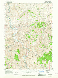 1966 Clarno1969 Print · USGSThe John Day River corridor in the mid-1960s reveals a landscape of remote ranching outposts and geological landmarks. Researchers can trace family history through sites like Tillotson Cem, the Lower Pine Creek Sch, and the Knox Ranch.
 - 1981 Map of Stephenson Mountain, 1997 Print
 1981 Stephenson Mountain1997 Print · USGSThe high-desert ranching and mining heart of North Central Oregon is captured here in the early eighties. Genealogists and historians can trace old settlements and mineral prospects from Shaniko to the Oregon King Mine and the John Day River canyon.
 - 1988 Map of Clarno
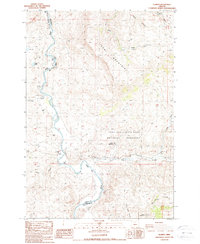 1988 Clarno1988 Print · USGSWheeler County was a landscape of remote canyons and fossil beds in the late eighties. Genealogists and researchers can trace the banks of the John Day River to find landmarks like the Tillotson Cemetery, Clarno, and Camp Hancock.
 - 2011 Map of Clarno, 2011 Print
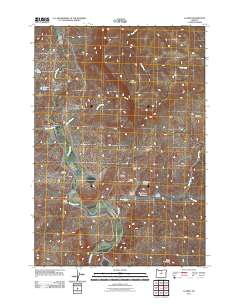 2011 Clarno2011 Print · USGSCovers Clarno, including Wasco County, Wheeler County, and other nearby areas
 - 2014 Map of Clarno, 2014 Print
 2014 Clarno2014 Print · USGSCovers Clarno, including Wasco County, Wheeler County, and other nearby areas
 - 2017 Map of Clarno, 2017 Print
 2017 Clarno2017 Print · USGSCovers Clarno, including Wasco County, Wheeler County, and other nearby areas
 - 2020 Map of Clarno, 2020 Print
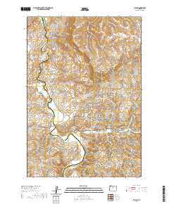 2020 Clarno2020 Print · USGSCovers Clarno, including Wasco County, Wheeler County, and other nearby areas
 - 2023 Map of Clarno, 2023 Print
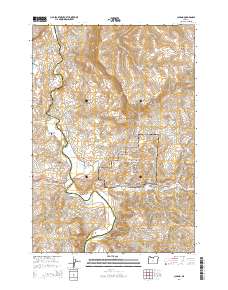
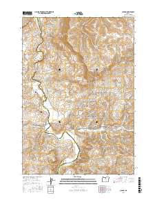
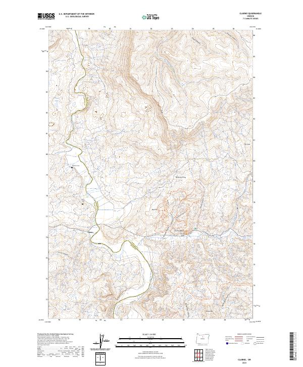 2023 Clarno2023 Print · USGSThe John Day River valley at Clarno reveals a landscape of fossil-rich formations and early pioneer history in the high desert. Researchers and genealogists can trace the Tillotson Cem and Clarno Cem near the John Day Fossil Beds.
End of results
Showing maps 1-12 of 12
Frequently asked questions
- What are the different types of historical maps available for Clarno?
- What is the oldest map of Clarno?
- Where can I purchase historical maps of Clarno for my home or office?
- Where can I download high-res historical maps of Clarno?
- Are there historical topographic maps available for Clarno?
- Is there historical aerial imagery available for Clarno?
- Where are historical maps of Clarno sourced from?