1960s Maps of Wamic, Oregon
Explore 1 historic maps of Wamic from the 1960s. These maps offer a rare glimpse into what life looked like during the 1960s — showing old roads, neighborhoods, homes, and landmarks that have changed or disappeared over time.
Whether you're researching your family's past, planning a metal detecting trip, or studying how Wamic's landscape evolved across the 1960s, these high-resolution maps are a powerful tool for exploring the history of this region.
- Focus on a specific era: All maps on this page are from the 1960s, giving you a focused view of this time period.
- See what’s changed: Compare century-old streets, trails, and buildings to today's modern landscape using overlays and satellite layers.
- Research with precision: Use these maps for genealogy, historical research, land use analysis, or educational projects.
- View, download, or print: Maps are fully viewable online in high resolution, and can be downloaded or printed for your own records.
Start exploring Wamic's history through authentic maps from the 1960s. This is your window into the past.
Wamic, OR maps
(1)- 1962 Map of Wamic, 1964 Print
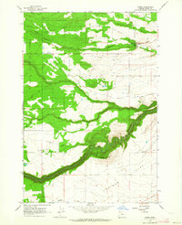 1962 Wamic1964 Print · USGSWamic and its surrounding wheat and juniper lands appear here during the early sixties, as the community stood at the threshold of the Mt Hood National Forest. Genealogists and local historians can locate the Smock Sch, Batty Sch, and Graveyard Butte Cem along the historic Barlow Road.4 unique versions available
End of results
Showing maps 1-1 of 1
Top cities near Wamic
Frequently asked questions
- What are the different types of historical maps available for Wamic?
- What is the oldest map of Wamic?
- Where can I purchase historical maps of Wamic for my home or office?
- Where can I download high-res historical maps of Wamic?
- Are there historical topographic maps available for Wamic?
- Is there historical aerial imagery available for Wamic?
- Where are historical maps of Wamic sourced from?