Old Maps of Tigard, Oregon
Explore 29 old maps of Tigard, spanning from 1914 to today. These high-resolution historic maps reveal how streets, neighborhoods, landmarks, and natural features evolved over time — perfect for genealogy, metal detecting, research, and local history exploration.
What you can do with these maps:
- See how Tigard changed over time: Compare historical maps to modern-day views to trace roads, homesites, rail lines & more.
- View detailed metadata: Each map includes creators, publishers, year, scale, and archive source.
- Overlay maps with satellite & LiDAR: Visualize the past alongside modern tools to explore terrain & human change.
- Trusted historical sources: Maps sourced from the USGS, Library of Congress, and other archives.
- Access maps your way: View online, download high-res files, or order prints for personal or research use.
Start exploring old maps of Tigard to uncover forgotten places, hidden landmarks, and the deep history beneath your feet.
Tigard, OR maps
(29)- 1914 Map of Oregon City
 1914 Oregon City1914 Print · USGSThe Willamette Valley at the start of the twentieth century was a landscape of rapid rail expansion and river-based industry. Researchers can trace early rural life through Wichita School and Lions Mill, or explore the growth of Oswego and Milwaukie.4 unique versions available
 - 1916 Map of Tualatin
 1916 Tualatin1916 Print · USGSThe northern Willamette Valley in the mid-1910s is a landscape of orchards and rail spurs, where river ferries still compete with new electric lines. Trace family roots at Champoeg Monument or explore old school sites like Grabel School and St Pauls School.5 unique versions available
 - 1939 Map of Oregon City, 1958 Print
 1939 Oregon City1958 Print · USGSThe Willamette Valley during the late thirties shows a landscape defined by river industry and competing rail lines. Genealogists and historians can trace family-named sites and rural institutions like the Ten O'clock Church, Linns Mill, and Reed College.
 - 1939 Map of Tualatin, 1958 Print
 1939 Tualatin1958 Print · USGSThe Tualatin Valley and Willamette River corridor are captured here before mid-century growth transformed the region. Genealogists can trace family footprints through dozens of rural landmarks, from Miners Landing and Butteville Sta to Mountainside School.
 - 1940 Map of Tualatin
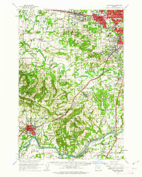
 1940 Tualatin1940 Print · USGSThe Tualatin Valley comes into sharp focus during the late 1930s, showing the early footprints of Beaverton and Tigard amid a vast network of rail lines. Researchers can trace historic family schoolhouses like Witch Hazel School and locate the original path of Boones Ferry Road near Wilsonville.
 - 1941 Map of Oregon City
 1941 Oregon City1941 Print · USGSThe Lower Willamette Valley thrived on a mix of river power and rail transit in the early 1940s. Genealogists can trace family footprints across dozens of local school districts, from Petes Mountain School to Harmony School, and locate landmarks like Willamette Falls and the Ten O'clock Church.
 - 1948 Map of Vancouver, 1957 Print
 1948 Vancouver1957 Print · USGSPost-war growth transforms the river valleys of the Pacific Northwest as the timber and rail economy thrives. Trace family roots in Tillamook or Oregon City, and locate vanished landmarks like the spit at Bayocean or the Skamania Mine.
 - 1950 Map of Vancouver
 1950 Vancouver1950 Print · USGSCoastal Oregon and the lower Columbia River valley are captured in detail just after the war. Researchers can trace historic rail routes like the Southern Pacific or locate early settlements such as Vernonia, Gaston, and the Grand Ronde Indian Reservation.
 - 1950 Map of Vancouver, 1951 Print
 1950 Vancouver1951 Print · USGSThe Pacific Northwest urban corridor meets the rugged coast in the years following the war, showing the expansion of Portland and Vancouver. Genealogists and historians can trace the reach of the Southern Pacific RR and locate coastal communities like Tillamook, Seaside, and Tolovana Park.
 - 1954 Map of Beaverton, 1956 Print
 1954 Beaverton1956 Print · USGSMid-century Washington County reveals a growing suburban network just before its modern boom. Researchers can trace historic family landmarks such as Cooper Mtn Cem, old rail lines like the Oregon Electric, and established schools including Merle Davies Sch.
 - 1954 Map of Oswego, 1957 Print
 1954 Oswego1957 Print · USGSSouthwest Portland and the Willamette valley were undergoing rapid suburban growth during the mid-fifties. Researchers can trace the development of neighborhoods like Hillsdale and Multnomah, or locate family sites near Reed College and Riverview Cemetery.
 - 1958 Map of Vancouver, 1968 Print
 1958 Vancouver1968 Print · USGSThe Lower Columbia and Willamette valleys thrive in the late sixties as major rail and river hubs. Genealogists and historians can trace the development of Portland, identify the grounds of Camp Withycombe, and locate coastal landmarks from Tillamook Head to Garibaldi.3 unique versions available
 - 1961 Map of Beaverton
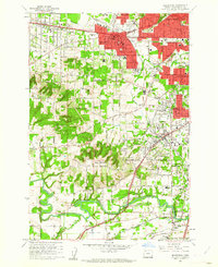 1961 Beaverton1961 Print · USGSBeaverton and Tigard are caught in a moment of post-war suburban expansion just as the rail-centered economy shifts toward the highway. Genealogists can locate family sites at Crescent Grove Cem or trace institutions like St Marys Boys Home and the Bernard Airport.5 unique versions available
 - 1961 Map of Oregon City, 1963 Print
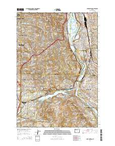
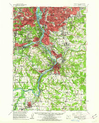 1961 Oregon City1963 Print · USGSThe Willamette River corridor south of Portland is seen here in the early sixties as suburban growth meets long-standing river towns. Genealogists and historians can trace the foundations of Oregon City, Milwaukie, and Canemah, alongside landmarks like Willamette National Cem and Camp Withycombe.
 - 1961 Map of Beaverton, 1963 Print
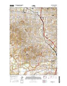
 1961 Beaverton1963 Print · USGSWashington County undergoes a post-war transition in the early sixties as suburban grids meet the farms of the Tualatin Valley. Researchers can trace family roots through numerous country schools like Witch Hazel Sch or find regional landmarks like Dammasch State Hospital and Champoeg State Park.
 - 1961 Map of Lake Oswego, 1971 Print
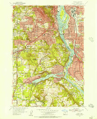
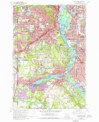 1961 Lake Oswego1971 Print · USGSThe suburbs south of Portland are in full development during the early sixties, centered on the Willamette River and the expanding residential reaches of Lake Oswego. Researchers can trace the grounds of Reed College, locate the Beth Israel Cem, or follow the Southern Pacific rail line through West Portland.5 unique versions available
 - 1964 Map of Vancouver
 1964 Vancouver1964 Print · USGSThe Pacific Northwest interior and coast are shown here in the 1960s, from the Portland metropolitan hub to the rugged Pacific shoreline. Researchers can trace the legacy of the Grand Ronde Indian Reservation, the early layout of McMinnville, and the maritime approaches near Tillamook Head.
 - 1975 Map of Beaverton, 1977 Print
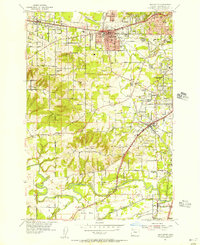
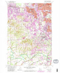
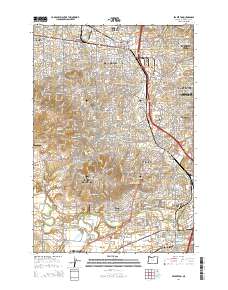
 1975 Beaverton1977 Print · USGSBeaverton and Tigard are caught in a moment of rapid suburban transition during the mid-seventies. Local historians can trace the evolving street grids and land use patterns from West Slope down to the banks of the Tualatin River.
 - 1982 Map of Oregon City, 1983 Print
 1982 Oregon City1983 Print · USGSGreater Portland and the Willamette Valley are shown in the early eighties as the region's urban and rural landscapes converged. Genealogists and historians can trace family-named sites across French Prairie, visit St Paul Ch, or locate the grounds of Dammasch State Hospital.
 - 1984 Map of Beaverton, 1985 Print
 1984 Beaverton1985 Print · USGSThe Tualatin Valley was undergoing a significant suburban transformation during the mid-eighties as growth pushed south from Beaverton. Researchers can trace old property lines and community hubs like St Marys Boys Home, Crescent Grove Cem, and the Oregon Electric rail line.
 - 2011 Map of Beaverton, 2011 Print
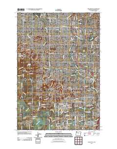 2011 Beaverton2011 Print · USGSCovers Tigard, including Portland, Beaverton, and other nearby areas
 - 2014 Map of Beaverton, 2014 Print
 2014 Beaverton2014 Print · USGSCovers Tigard, including Portland, Beaverton, and other nearby areas
 - 2014 Map of Lake Oswego, 2014 Print
 2014 Lake Oswego2014 Print · USGSCovers Tigard, including Portland, Beaverton, and other nearby areas
 - 2017 Map of Beaverton, 2017 Print
 2017 Beaverton2017 Print · USGSCovers Tigard, including Portland, Beaverton, and other nearby areas
 - 2017 Map of Lake Oswego, 2017 Print
 2017 Lake Oswego2017 Print · USGSCovers Tigard, including Portland, Beaverton, and other nearby areas
Showing maps 1-25 of 29
Top cities near Tigard
- Portland historical maps
- Vancouver historical maps
- Hillsboro historical maps
- Beaverton historical maps
- Lake Oswego historical maps
- Oregon City historical maps
See more
Top neighborhoods of Tigard
- Englewood Park historical maps
- Downtown Tigard historical maps
- Bull Mountain historical maps
- Cook Park historical maps
- Derry Dell historical maps
- Durham Road historical maps
See more
Frequently asked questions
- What are the different types of historical maps available for Tigard?
- What is the oldest map of Tigard?
- Where can I purchase historical maps of Tigard for my home or office?
- Where can I download high-res historical maps of Tigard?
- Are there historical topographic maps available for Tigard?
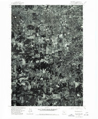
- Is there historical aerial imagery available for Tigard?
- Where are historical maps of Tigard sourced from?