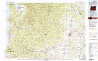
Old Maps of Dundee, Oregon
Explore 24 old maps of Dundee, spanning from 1916 to today. These high-resolution historic maps reveal how streets, neighborhoods, landmarks, and natural features evolved over time — perfect for genealogy, metal detecting, research, and local history exploration.
What you can do with these maps:
- See how Dundee changed over time: Compare historical maps to modern-day views to trace roads, homesites, rail lines & more.
- View detailed metadata: Each map includes creators, publishers, year, scale, and archive source.
- Overlay maps with satellite & LiDAR: Visualize the past alongside modern tools to explore terrain & human change.
- Trusted historical sources: Maps sourced from the USGS, Library of Congress, and other archives.
- Access maps your way: View online, download high-res files, or order prints for personal or research use.
Start exploring old maps of Dundee to uncover forgotten places, hidden landmarks, and the deep history beneath your feet.
Dundee, OR maps
(24)- 1916 Map of Tualatin
 1916 Tualatin1916 Print · USGSThe northern Willamette Valley in the mid-1910s is a landscape of orchards and rail spurs, where river ferries still compete with new electric lines. Trace family roots at Champoeg Monument or explore old school sites like Grabel School and St Pauls School.5 unique versions available
 - 1939 Map of Tualatin, 1958 Print
 1939 Tualatin1958 Print · USGSThe Tualatin Valley and Willamette River corridor are captured here before mid-century growth transformed the region. Genealogists can trace family footprints through dozens of rural landmarks, from Miners Landing and Butteville Sta to Mountainside School.
 - 1940 Map of Tualatin
 1940 Tualatin1940 Print · USGSThe Tualatin Valley comes into sharp focus during the late 1930s, showing the early footprints of Beaverton and Tigard amid a vast network of rail lines. Researchers can trace historic family schoolhouses like Witch Hazel School and locate the original path of Boones Ferry Road near Wilsonville.
 - 1941 Map of Yamhill, 1963 Print
 1941 Yamhill1963 Print · USGSThe northern Willamette Valley and Tualatin hills come alive in this wartime-era survey of the Yamhill and Washington county border. Genealogists and historians can trace defunct school districts like White Cloud Sch, the sprawling Stimson Lumber Camp, and the tracks of the Southern Pacific.2 unique versions available
 - 1942 Map of Yamhill
 1942 Yamhill1942 Print · USGSThe timber and rail corridors of the Tualatin Valley come alive in this wartime portrait of Yamhill and Washington Counties. Genealogists and researchers can trace rural school districts like Firdale Sch and Pioneer Sch or locate the Stimson Lumber Camp and Laurelwood Academy.
 - 1948 Map of Vancouver, 1957 Print
 1948 Vancouver1957 Print · USGSPost-war growth transforms the river valleys of the Pacific Northwest as the timber and rail economy thrives. Trace family roots in Tillamook or Oregon City, and locate vanished landmarks like the spit at Bayocean or the Skamania Mine.
 - 1950 Map of Vancouver
 1950 Vancouver1950 Print · USGSCoastal Oregon and the lower Columbia River valley are captured in detail just after the war. Researchers can trace historic rail routes like the Southern Pacific or locate early settlements such as Vernonia, Gaston, and the Grand Ronde Indian Reservation.
 - 1950 Map of Vancouver, 1951 Print
 1950 Vancouver1951 Print · USGSThe Pacific Northwest urban corridor meets the rugged coast in the years following the war, showing the expansion of Portland and Vancouver. Genealogists and historians can trace the reach of the Southern Pacific RR and locate coastal communities like Tillamook, Seaside, and Tolovana Park.
 - 1954 Map of Newberg, 1957 Print
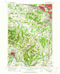
 1954 Newberg1957 Print · USGSNewberg and the northern Willamette Valley are captured in the mid-1950s as a landscape of river-bend orchards and mountain-foothill farms. You can locate family-named sites like Gibbs Cemetery, trace the Southern Pacific tracks through Rex, and explore the grounds of Champoeg State Park.
 - 1956 Map of Dundee, 1957 Print
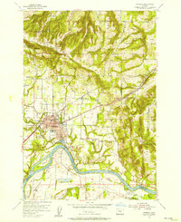
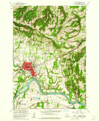
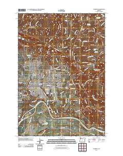
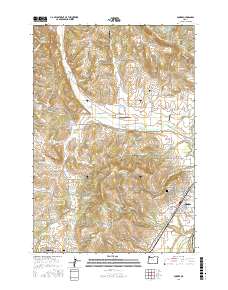
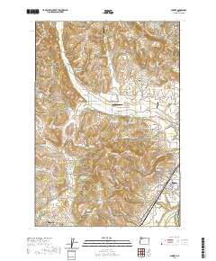
 1956 Dundee1957 Print · USGSDundee and the surrounding agricultural valleys are captured here in the mid-fifties as the local railroad and school networks shaped the community. Genealogists and researchers can trace local landmarks like the Noble Cemetery, the Ribbon Ridge School, and the Trappist Abbey of Our Lady of Guadalupe.3 unique versions available
 - 1958 Map of Vancouver, 1968 Print
 1958 Vancouver1968 Print · USGSThe Lower Columbia and Willamette valleys thrive in the late sixties as major rail and river hubs. Genealogists and historians can trace the development of Portland, identify the grounds of Camp Withycombe, and locate coastal landmarks from Tillamook Head to Garibaldi.3 unique versions available
 - 1961 Map of Newberg
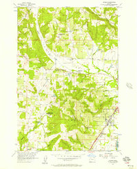
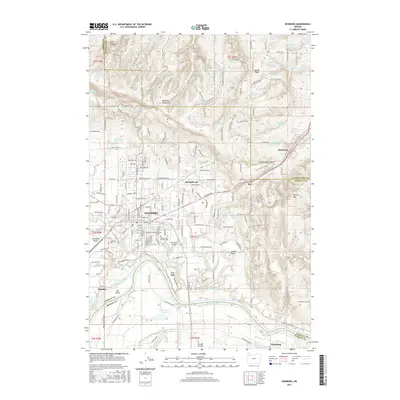
 1961 Newberg1961 Print · USGSNewberg and the Willamette Valley are captured in the early sixties as agricultural roots met mid-century growth. Genealogists and historians can trace Ash Island, the Gearns Ferry (Site), and several pioneer-era cemeteries including Gibbs Cem.4 unique versions available
 - 1961 Map of Beaverton, 1963 Print
 1961 Beaverton1963 Print · USGSWashington County undergoes a post-war transition in the early sixties as suburban grids meet the farms of the Tualatin Valley. Researchers can trace family roots through numerous country schools like Witch Hazel Sch or find regional landmarks like Dammasch State Hospital and Champoeg State Park.
 - 1964 Map of Vancouver
 1964 Vancouver1964 Print · USGSThe Pacific Northwest interior and coast are shown here in the 1960s, from the Portland metropolitan hub to the rugged Pacific shoreline. Researchers can trace the legacy of the Grand Ronde Indian Reservation, the early layout of McMinnville, and the maritime approaches near Tillamook Head.
 - 1980 Map of Yamhill River
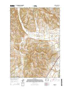
 1980 Yamhill River1980 Print · USGSThe Oregon Coast Range and the western Willamette Valley meet in this 1980 survey, showing the landscape from the Pacific shore to the valley floor. Genealogists and historians can trace old routes like the Salmon River Highway to find the Grand Ronde Agency, Cloverdale, and Perrydale.3 unique versions available
 - 1982 Map of Oregon City, 1983 Print
 1982 Oregon City1983 Print · USGSGreater Portland and the Willamette Valley are shown in the early eighties as the region's urban and rural landscapes converged. Genealogists and historians can trace family-named sites across French Prairie, visit St Paul Ch, or locate the grounds of Dammasch State Hospital.
 - 2011 Map of Newberg, 2011 Print
 2011 Newberg2011 Print · USGSCovers Dundee, including Newberg, Sherwood, and other nearby areas
 - 2011 Map of Dundee, 2011 Print
 2011 Dundee2011 Print · USGSCovers Dundee, including Lafayette, Marion County, and other nearby areas
 - 2014 Map of Dundee, 2014 Print
 2014 Dundee2014 Print · USGSCovers Dundee, including Lafayette, Marion County, and other nearby areas
 - 2017 Map of Dundee, 2017 Print
 2017 Dundee2017 Print · USGSCovers Dundee, including Lafayette, Marion County, and other nearby areas
 - 2017 Map of Newberg, 2017 Print
 2017 Newberg2017 Print · USGSCovers Dundee, including Newberg, Sherwood, and other nearby areas
 - 2020 Map of Dundee, 2020 Print
 2020 Dundee2020 Print · USGSCovers Dundee, including Lafayette, Marion County, and other nearby areas
 - 2023 Map of Newberg, 2023 Print
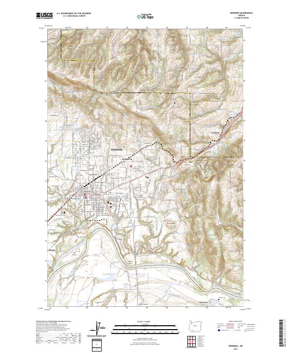 2023 Newberg2023 Print · USGSNewberg and the Chehalem Valley are captured here in the early 2020s, showing a landscape defined by the Willamette River and the Chehalem Mountains. Researchers can locate historic burial sites like Gibbs Cem, the grounds of George Fox University, and the site of Gearins Ferry.
 - 2023 Map of Dundee, 2023 Print
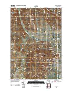
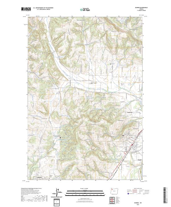 2023 Dundee2023 Print · USGSDundee and the surrounding Chehalem Valley are captured in the 2020s, showing a landscape defined by its famous red hills and small-town roots. Researchers can trace local lineage through the Dundee Pioneer Cem and Lafayette Pioneer Cem or locate the historic Our Lady of Guadalupe Trappist Abbey Cem.
End of results
Showing maps 1-24 of 24
Top cities near Dundee
- Portland historical maps
- Hillsboro historical maps
- Beaverton historical maps
- Tigard historical maps
- McMinnville historical maps
- Tualatin historical maps
See more
Frequently asked questions
- What are the different types of historical maps available for Dundee?
- What is the oldest map of Dundee?
- Where can I purchase historical maps of Dundee for my home or office?
- Where can I download high-res historical maps of Dundee?
- Are there historical topographic maps available for Dundee?
- Is there historical aerial imagery available for Dundee?
- Where are historical maps of Dundee sourced from?