Old Maps of Richmond, Oregon for Hiking & Exploration
Hike through history with 9 historic maps of Richmond. Explore old trails, ghost towns, and forgotten backroads — perfect for outdoor adventurers and local explorers.
- Rediscover forgotten places: Map out old mining camps, roads, and footpaths that no longer exist on modern maps.
- Layer with modern tools: Combine with LiDAR or satellite views to plan hikes through historical terrain.
- Made for exploration: Popular among hikers, overlanders, and local history lovers.
Use these maps to find adventure and explore the hidden past of Richmond.
Richmond, OR maps
(9)- 1953 Map of Richmond, 1955 Print
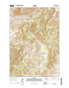
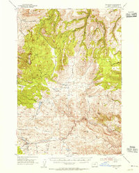 1953 Richmond1955 Print · USGSWheeler County ranching and upland territory are documented here during the early fifties. Local historians and researchers can trace family lands near Richmond, Waterman, and the Sixshooter Ranch, or locate small-scale landmarks like Bearway Meadow.2 unique versions available
 - 1955 Map of Canyon City, 1966 Print
 1955 Canyon City1966 Print · USGSCentral Oregon's high desert and timber country are captured here in the mid-fifties, showing the rugged ranching and logging landscape. Trace the path of the Sumpter Valley Ry or locate remote settlements like Izee, Whitney, and Ritter.4 unique versions available
 - 1959 Map of Canyon City
 1959 Canyon City1959 Print · USGSEastern Oregon in the late fifties was a landscape of high timber and remote river valleys shaped by the cattle and mining trades. Genealogists and historians can trace the paths of the Sumpter Valley RR and find early settlements like Antone, Richmond, and Dayville.2 unique versions available
 - 1980 Map of Monument, 1997 Print
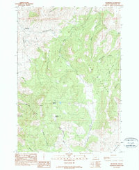
 1980 Monument1997 Print · USGSCentral Oregon’s river-cut high country comes into focus in the early 1980s, documenting a landscape of remote ranching and timber work. Genealogists and researchers can trace local landmarks like Ritter, the Cohoe Mine, and the high reaches of Sourdough Ridge.
 - 1990 Map of Richmond
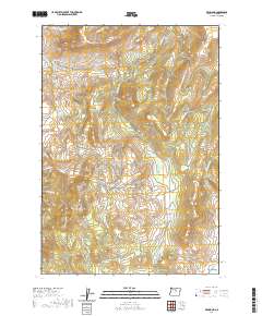
 1990 Richmond1990 Print · USGSRichmond and the surrounding Wheeler County high country are captured here during the late twentieth century. Researchers can trace land features like Floating Prairie, the steep slopes of Butler Mountain, and the drainages of Sixshooter Creek and Dippin Rig Cr.
 - 2011 Map of Richmond, 2011 Print
 2011 Richmond2011 Print · USGSCovers Richmond, including Wheeler County, United States, and other nearby areas
 - 2014 Map of Richmond, 2014 Print
 2014 Richmond2014 Print · USGSCovers Richmond, including Wheeler County, United States, and other nearby areas
 - 2020 Map of Richmond, 2020 Print
 2020 Richmond2020 Print · USGSCovers Richmond, including Wheeler County, United States, and other nearby areas
 - 2023 Map of Richmond, 2023 Print
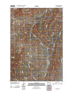
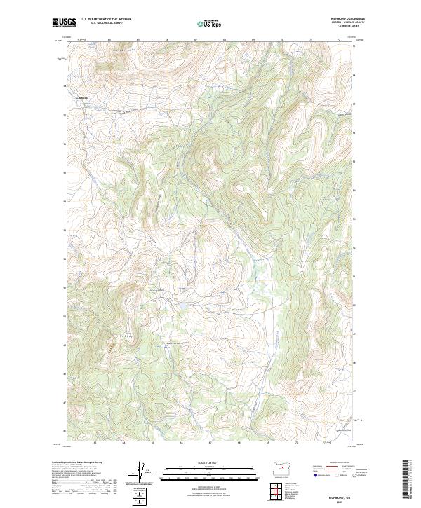 2023 Richmond2023 Print · USGSWheeler County high country comes into focus in this recent survey, showing the land as it remains defined by early ranching landmarks. Researchers can trace the layout of Richmond or locate family-named features like Mahogany Ridge, Sheet Iron Jack Meadow, and Butler Mtn.
End of results
Showing maps 1-9 of 9
Top cities near Richmond
Frequently asked questions
- What are the different types of historical maps available for Richmond?
- What is the oldest map of Richmond?
- Where can I purchase historical maps of Richmond for my home or office?
- Where can I download high-res historical maps of Richmond?
- Are there historical topographic maps available for Richmond?
- Is there historical aerial imagery available for Richmond?
- Where are historical maps of Richmond sourced from?