
1953 Map of Richmond
USGS Topo · Published 1955About this map
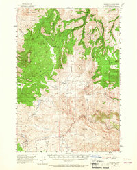
Richmond and Waterman anchor this mid-century view of Wheeler County, where the landscape is defined by a dense network of seasonal drainages and high meadows. The ranching and upland character of the era is evident in features like the Sixshooter Ranch and the expansive Bearway Meadow. The geography is shaped by prominent heights such as Butter Mountain and Juniper Butte, while the drainage systems of Indian Creek and Mountain Creek carve through the terrain. A notable level of detail is given to small, essential water sources like Dippie Spring and Mud Spring, which were vital for livestock and homesteading in this part of Oregon. Transportation is represented by a network of unimproved roads and a Landing Strip near Fopiano Hollow Creek, illustrating the remote connectivity of these rural communities just after the war.
Find a feature on this map
33 named features on this map. Tap any name to fly to it.
Don’t see what you’re looking for? This feature index may not catch every label — zoom into the map to look around manually.
Map Details
Editions of this 1953 Richmond Map
2 editions found
Other maps of this area

1926 · Mitchell
USGS Topo · 1:125,000

1932 · Dayville
USGS Topo · 1:125,000

1936 · Dayville
USGS Topo · 1:125,000

1953 · Kimberly
USGS Topo · 1:62,500

1953 · Picture
USGS Topo · 1:62,500

1953 · Spray
USGS Topo · 1:62,500

1955 · Bend
USGS Topo · 1:250,000

1955 · Canyon City
USGS Topo · 1:250,000

1957 · Bend
USGS Topo · 1:250,000

1958 · Bend
USGS Topo · 1:250,000