
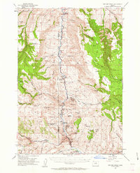
1953 Map of Picture
USGS Topo · Published 1955About this map
The John Day River carves a deep path through Grant and Wheeler counties, revealing the dramatic geology of the Picture Gorge and the expansive John Day Fossil Beds State Park. This mid-century survey captures a ranching landscape defined by isolated homesteads and seasonal camps, such as the Cant Ranch, Humphrey Ranch, and Mascall Ranch. The presence of the Erickson Mill (Aband) near Sunflower Flat suggests the small-scale timber operations that once punctuated these high basins. The map is particularly useful for locating named cabins and springs, including the Old Armunger Cabin and Old Kennedy Cabin, which provide evidence of earlier settlement patterns in the rugged basins of Big Basin and Butler Basin. These features, along with landmarks like Sheep Rock and Turtle Cove, illustrate the intersection of pioneer habitation and the preserved natural history of the region.
Find a feature on this map
78 named features on this map. Tap any name to fly to it.
Don’t see what you’re looking for? This feature index may not catch every label — zoom into the map to look around manually.
Map Details
Editions of this 1953 Picture Map
3 editions found
Other maps of this area

1932 · Dayville
USGS Topo · 1:125,000

1936 · Dayville
USGS Topo · 1:125,000

1940 · Aldrich Mtn.
USGS Topo · 1:62,500

1943 · Aldrich Mtn.
USGS Topo · 1:62,500

1951 · Courtrock
USGS Topo · 1:62,500

1951 · Monument
USGS Topo · 1:62,500

1953 · Richmond
USGS Topo · 1:62,500

1953 · Kimberly
USGS Topo · 1:62,500

1953 · Spray
USGS Topo · 1:62,500

1955 · Canyon City
USGS Topo · 1:250,000