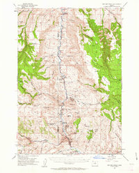
1953 Map of Picture
USGS Topo · Published 1963About this map
The John Day River carves a deep path through the high desert of Central Oregon, defining the geological character of the Wheeler and Grant county line. This mid-century survey reveals a landscape where ranching life and scientific preservation coexist. The map highlights the early footprints of the John Day Fossil Beds State Park and the Picture Gorge Fossil Beds State Park, protecting world-renowned paleontological sites like Goose Rock and Sheep Rock.
Find a feature on this map
67 named features on this map. Tap any name to fly to it.
Don’t see what you’re looking for? This feature index may not catch every label — zoom into the map to look around manually.
Map Details
Editions of this 1953 Picture Map
3 editions found
Other maps of this area

1932 · Dayville
USGS Topo · 1:125,000

1936 · Dayville
USGS Topo · 1:125,000

1940 · Aldrich Mtn.
USGS Topo · 1:62,500

1943 · Aldrich Mtn.
USGS Topo · 1:62,500

1951 · Courtrock
USGS Topo · 1:62,500

1951 · Monument
USGS Topo · 1:62,500

1953 · Richmond
USGS Topo · 1:62,500

1953 · Kimberly
USGS Topo · 1:62,500

1953 · Picture
USGS Topo · 1:62,500

1953 · Spray
USGS Topo · 1:62,500