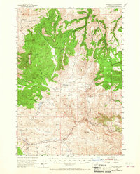
1953 Map of Richmond
USGS Topo · Published 1967About this map
Richmond sits at the northern edge of this Wheeler County landscape, which transitions from the high elevations of Butler Mountain and Steamboat Mountain down into a complex system of creek drainages and meadows. The area's mid-century ranching and agrarian character is evident in the presence of the Sixshooter Ranch and several designated meadows like Blann Meadow and Bearway Meadow. The geography is defined by deeply cut drainages such as Indian Hollow Creek and Hardscrabble Creek, which create a rugged terrain punctuated by high flats like Waterman Flat.
Find a feature on this map
68 named features on this map. Tap any name to fly to it.
Don’t see what you’re looking for? This feature index may not catch every label — zoom into the map to look around manually.
Map Details
Editions of this 1953 Richmond Map
2 editions found
Other maps of this area

1926 · Mitchell
USGS Topo · 1:125,000

1932 · Dayville
USGS Topo · 1:125,000

1936 · Dayville
USGS Topo · 1:125,000

1953 · Richmond
USGS Topo · 1:62,500

1953 · Kimberly
USGS Topo · 1:62,500

1953 · Picture
USGS Topo · 1:62,500

1953 · Spray
USGS Topo · 1:62,500

1955 · Bend
USGS Topo · 1:250,000

1955 · Canyon City
USGS Topo · 1:250,000

1957 · Bend
USGS Topo · 1:250,000