1990s Maps of Sedgwick, Cumberland Township
Explore 2 historic maps of Sedgwick from the 1990s. These maps offer a rare glimpse into what life looked like during the 1990s — showing old roads, neighborhoods, homes, and landmarks that have changed or disappeared over time.
Whether you're researching your family's past, planning a metal detecting trip, or studying how Sedgwick's landscape evolved across the 1990s, these high-resolution maps are a powerful tool for exploring the history of this region.
- Focus on a specific era: All maps on this page are from the 1990s, giving you a focused view of this time period.
- See what’s changed: Compare century-old streets, trails, and buildings to today's modern landscape using overlays and satellite layers.
- Research with precision: Use these maps for genealogy, historical research, land use analysis, or educational projects.
- View, download, or print: Maps are fully viewable online in high resolution, and can be downloaded or printed for your own records.
Start exploring Sedgwick's history through authentic maps from the 1990s. This is your window into the past.
Sedgwick, Cumberland Township maps
(2)- 1990 Map of Gettysburg, 1995 Print
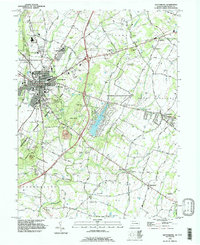 1990 Gettysburg1995 Print · USGSGettysburg and its surrounding townships appear here in the 1990s, Balancing its legacy as a memorial site with modern growth. Historians can trace landmark sites like Devils Den and Spanglers Spring alongside the Gettysburg Railroad and Hoffman Orphanage.
 - 1994 Map of Gettysburg, 1998 Print
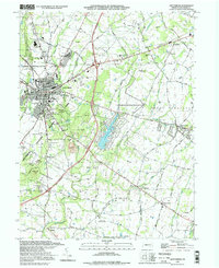 1994 Gettysburg1998 Print · USGSGettysburg and its surrounding townships appear here in the mid-nineties, balancing a preserved Civil War landscape with a growing modern community. Researchers can trace historic landmarks from Devils Den and Culps Hill to the Hoffman Orphanage and the Gettysburg Railroad.
End of results
Showing maps 1-2 of 2
Top cities near Sedgwick
- Westminster historical maps
- Gettysburg historical maps
- Taneytown historical maps
- Thurmont historical maps
- Littlestown historical maps
- Carroll Valley historical maps
See more
Frequently asked questions
- What are the different types of historical maps available for Sedgwick?
- What is the oldest map of Sedgwick?
- Where can I purchase historical maps of Sedgwick for my home or office?
- Where can I download high-res historical maps of Sedgwick?
- Are there historical topographic maps available for Sedgwick?
- Is there historical aerial imagery available for Sedgwick?
- Where are historical maps of Sedgwick sourced from?