Old Maps of Allentown, Pittsburgh for Genealogy
Trace your family roots with 37 historic maps of Allentown. These high-res maps reveal old neighborhoods, homesites, landmarks, and streets — helping you uncover where your ancestors lived and how the area evolved over time.
- Explore historic neighborhoods: Identify where your relatives may have lived in the 1800s or 1900s.
- Compare maps over time: Trace the changes in streets, buildings, and landmarks for multi-generational research.
- Perfect for genealogy & ancestry research: Used by family historians and researchers to map out lineage and migration.
These maps are an incredible resource for exploring your personal connection to Allentown's past.
Allentown, Pittsburgh maps
(37)- 1904 Map of Mc Keesport
 1904 Mc Keesport1904 Print · USGSAllegheny County at the height of its industrial era reveals a landscape of massive rail yards and riverfront steel towns. Genealogists can trace family roots through dense neighborhoods in Homestead, Wilkinsburg, and Braddock or locate ancestral plots in Homewood Cem.2 unique versions available
 - 1904 Map of Carnegie, 1954 Print
 1904 Carnegie1954 Print · USGSAllegheny County's industrial heartland is captured here at the start of the twentieth century as rail lines and mines reshaped the landscape. Researchers can trace early settlements and social hubs like Cliff Mine, the County Home, and the Union Church.
 - 1906 Map of Carnegie
 1906 Carnegie1906 Print · USGSThe industrial valleys of Western Pennsylvania come alive in the early 1900s, showing the early infrastructure of the Ohio River and its tributaries. Local historians can trace family roots at Union Church or explore the early coal economy at Cliff Mine and Walkers Mills.7 unique versions available
 - 1907 Map of Pittsburg
 1907 Pittsburg1907 Print · USGSSteel-industry heartlands and river-valley rail corridors define the Pittsburgh region in the early nineteen-hundreds. Trace the complex rail networks of the Union RR and Pennsylvania RR through industrial hubs like Homestead and Wilmerding.10 unique versions available
 - 1908 Map of Carnegie, 1910 Print
 1908 Carnegie1910 Print · USGSSouthwest of the Pittsburgh river forks in the early 1900s, a complex web of railroads and industrial hollows began to link the rural coal and mill towns. Trace the paths of the Wabash and Side Belt lines past landmarks like Cliff Mine, Guy Mills, and Treveskyn Cuddy PO.
 - 1948 Map of Pittsburgh West, 1954 Print
 1948 Pittsburgh West1954 Print · USGSPittsburgh’s western riverfronts and boroughs are captured in the mid-forties during a peak era of rail and industrial activity. Genealogists can locate family landmarks like Highwood Cemetery or the Western State Penitentiary and trace the Chartiers Creek rail lines.
 - 1951 Map of Pittsburgh West
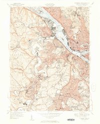 1951 Pittsburgh West1951 Print · USGSThe industrial heart of Allegheny County is captured at mid-century as neighborhoods expanded across the hills west of the rivers. Researchers can trace the rail lines through McKees Rocks, find ancestors at Highwood Cemetery, or locate old landmarks like the Allegheny Observatory.3 unique versions available
 - 1951 Map of Pittsburg East
 1951 Pittsburg East1951 Print · USGSThe eastern reaches of Pittsburgh and its river valleys are shown here in the early postwar era. Researchers can trace the footprints of iconic landmarks like Forbes Field and the University of Pittsburgh or locate family plots in Allegheny Cemetery.3 unique versions available
 - 1951 Map of Canton
 1951 Canton1951 Print · USGSThe industrial heartland of Ohio and Pennsylvania reached its mid-century peak during this era of heavy rail and river transit. Genealogists and historians can trace the development of steel towns like Aliquippa and Weirton alongside the Ohio River and major lines of the Pennsylvania RR.
 - 1953 Map of Pittsburgh
 1953 Pittsburgh1953 Print · USGSWestern Pennsylvania's industrial landscape at the start of the fifties shows the steel and rail corridors between Pittsburgh and Altoona. Trace family roots in river towns like Tarentum or follow the Pennsylvania Turnpike across Laurel Hill.
 - 1953 Map of Canton
 1953 Canton1953 Print · USGSThe industrial heartland of Ohio and Pennsylvania is captured at its mid-century peak in this detailed regional survey. Genealogists and historians can trace the vast rail networks of the Pennsylvania RR and find local landmarks like Nimisila Reservoir and Tappan Reservoir.
 - 1954 Map of Pittsburgh
 1954 Pittsburgh1954 Print · USGSWestern Pennsylvania in the early fifties remains a powerhouse of heavy industry and vital transit corridors. Genealogists and historians can trace the rail-and-river network connecting Pittsburgh, Johnstown, and Altoona via the Pennsylvania RR and the Lincoln Highway.2 unique versions available
 - 1956 Map of Pittsburgh East, 1959 Print
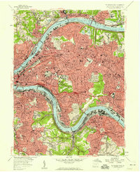 1956 Pittsburgh East1959 Print · USGSMid-century Pittsburgh and its eastern boroughs appear here during a peak era of industrial and academic expansion. Trace the rail-integrated neighborhoods from Lawrenceville to Wilkinsburg, including the historic Allegheny Cemetery and Frick Park.
 - 1956 Map of Pittsburgh West, 1959 Print
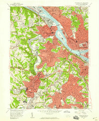 1956 Pittsburgh West1959 Print · USGSWestern Pittsburgh and its industrial riverfronts are captured here during the mid-fifties era of bridge building and suburban expansion. Genealogists and researchers can locate neighborhood landmarks like Chartiers Cem, the Western State Penitentiary, and the Allegheny Observatory.
 - 1957 Map of Canton, 1971 Print
 1957 Canton1971 Print · USGSThe industrial heartland of eastern Ohio and western Pennsylvania comes alive in this mid-century survey of the Ohio River Valley. Trace the heritage of rail and river commerce through Pittsburgh, the massive steel towns along the Ohio River, and major junctions on the Pennsylvania RR.3 unique versions available
 - 1958 Map of Pittsburgh
 1958 Pittsburgh1958 Print · USGSWestern Pennsylvania in the late fifties shows an industrial heartland defined by the confluence of the Allegheny River and Monongahela River. Researchers can trace the sprawling rail networks of the Pennsylvania RR and find established towns like Butler, Latrobe, and Windber.5 unique versions available
 - 1959 Map of Pittsburgh
 1959 Pittsburgh1959 Print · USGSWestern Pennsylvania in the late fifties is captured here at the height of its industrial era. Genealogists and historians can trace the riverfront growth of Pittsburgh, the rail works at Altoona, and the mountain gaps of Laurel Hill.
 - 1960 Map of Pittsburgh West, 1961 Print
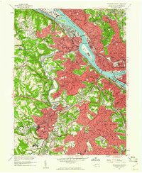 1960 Pittsburgh West1961 Print · USGSThe industrial heart of Allegheny County is shown here in the early 1960s, documenting the dense riverfront and hilly residential boroughs. Researchers can trace the massive Western State Penitentiary, find family roots in Uniondale Cemetery, or locate the old Woodville State Hospital.4 unique versions available
 - 1960 Map of Pittsburgh East, 1961 Print
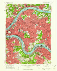 1960 Pittsburgh East1961 Print · USGSPostwar Pittsburgh and its eastern boroughs are captured here at their industrial height, bounded by the great river bends. Genealogists and local historians can trace legacy parish boundaries through St Marys Cem, Peabody High Sch, and St Aloysius Ch.4 unique versions available
 - 1962 Map of Canton
 1962 Canton1962 Print · USGSThe industrial heartland of Eastern Ohio and Western Pennsylvania thrives in the early sixties as steel mills and rail lines dominate the river valleys. Genealogists and historians can trace local landmarks like McKinley National Memorial, Malone College, and industrial sites such as Republic Steel Corp.2 unique versions available
 - 1964 Map of Pittsburgh
 1964 Pittsburgh1964 Print · USGSWestern Pennsylvania in the late fifties and early sixties shows a landscape of powerful river industries and expanding highways. Genealogists and historians can trace the rail corridors of the Pennsylvania RR through industrial hubs like Johnstown, Altoona, and Nanty Glo.
 - 1986 Map of Pittsburgh West
 1986 Pittsburgh West1986 Print · USGSThe Tri-State region's coal and rail corridors are captured in the mid-eighties as industry and aviation expanded. Trace the legacy of extraction at Nelms Mine No 1, locate Short Creek PO, or follow the Chessie System tracks along the Ohio River.3 unique versions available
 - 1986 Map of Pittsburgh East
 1986 Pittsburgh East1986 Print · USGSWestern Pennsylvania in the mid-eighties shows a landscape defined by industrial rivers and rising mountain ridges. Trace the dense rail networks of CONRAIL and the Pittsburgh and Lake Erie RR connecting historic centers like Monessen, Jeannette, and Connellsville.3 unique versions available
 - 1993 Map of Pittsburgh West, 1994 Print
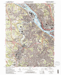 1993 Pittsburgh West1994 Print · USGSThe confluence of the Three Rivers defines this western Pennsylvania landscape in the early 1990s. Genealogists and local historians can trace parish cemeteries like Polish Cem, institutional landmarks such as St Pauls Orphanage, and the heavy industrial corridor along the Ohio River.2 unique versions available
 - 1993 Map of Pittsburgh East, 1994 Print
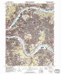 1993 Pittsburgh East1994 Print · USGSThe industrial and academic heart of western Pennsylvania is captured here in the early nineties, showing Pittsburgh as its neighborhoods and riverfronts continued to evolve. Researchers can locate family sites near Allegheny Cemetery, trace the campus footprints of Carnegie Mellon University, or find local landmarks like the Civic Arena.2 unique versions available
Showing maps 1-25 of 37
Frequently asked questions
- What are the different types of historical maps available for Allentown?
- What is the oldest map of Allentown?
- Where can I purchase historical maps of Allentown for my home or office?
- Where can I download high-res historical maps of Allentown?
- Are there historical topographic maps available for Allentown?
- Is there historical aerial imagery available for Allentown?
- Where are historical maps of Allentown sourced from?