1900s (20th Century) Maps of Spring Hill-City View, Pittsburgh
Explore 27 historic maps of Spring Hill-City View from the 1900s (20th Century). These maps offer a rare glimpse into what life looked like during the 1900s — showing old roads, neighborhoods, homes, and landmarks that have changed or disappeared over time.
Whether you're researching your family's past, planning a metal detecting trip, or studying how Spring Hill-City View's landscape evolved across the 1900s, these high-resolution maps are a powerful tool for exploring the history of this region.
- Focus on a specific era: All maps on this page are from the 1900s, giving you a focused view of this time period.
- See what’s changed: Compare century-old streets, trails, and buildings to today's modern landscape using overlays and satellite layers.
- Research with precision: Use these maps for genealogy, historical research, land use analysis, or educational projects.
- View, download, or print: Maps are fully viewable online in high resolution, and can be downloaded or printed for your own records.
Start exploring Spring Hill-City View's history through authentic maps from the 1900s. This is your window into the past.
Spring Hill-City View, Pittsburgh maps
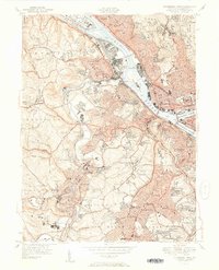
(27)- 1904 Map of Mc Keesport
 1904 Mc Keesport1904 Print · USGSCovers Spring Hill-City View, including Pittsburgh, Penn Hills, and other nearby areas2 unique versions available
 - 1904 Map of Carnegie, 1954 Print
 1904 Carnegie1954 Print · USGSCovers Spring Hill-City View, including Pittsburgh, Bethel Park, and other nearby areas
 - 1906 Map of Carnegie
 1906 Carnegie1906 Print · USGSCovers Spring Hill-City View, including Pittsburgh, Bethel Park, and other nearby areas7 unique versions available
 - 1907 Map of Pittsburg
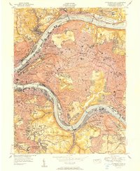
 1907 Pittsburg1907 Print · USGSCovers Spring Hill-City View, including Pittsburgh, Penn Hills, and other nearby areas10 unique versions available
 - 1908 Map of Carnegie, 1910 Print
 1908 Carnegie1910 Print · USGSCovers Spring Hill-City View, including Pittsburgh, Bethel Park, and other nearby areas
 - 1948 Map of Pittsburgh West, 1954 Print
 1948 Pittsburgh West1954 Print · USGSCovers Spring Hill-City View, including Pittsburgh, Ross Township, and other nearby areas
 - 1951 Map of Pittsburgh West
 1951 Pittsburgh West1951 Print · USGSCovers Spring Hill-City View, including Pittsburgh, Ross Township, and other nearby areas3 unique versions available
 - 1951 Map of Pittsburg East
 1951 Pittsburg East1951 Print · USGSCovers Spring Hill-City View, including Pittsburgh, Penn Hills, and other nearby areas3 unique versions available
 - 1951 Map of Canton
 1951 Canton1951 Print · USGSCovers Spring Hill-City View, including Pittsburgh, Akron, and other nearby areas
 - 1953 Map of Pittsburgh
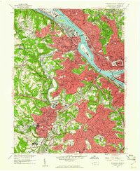
 1953 Pittsburgh1953 Print · USGSCovers Spring Hill-City View, including Pittsburgh, Penn Hills, and other nearby areas
 - 1953 Map of Canton
 1953 Canton1953 Print · USGSCovers Spring Hill-City View, including Pittsburgh, Akron, and other nearby areas
 - 1954 Map of Pittsburgh
 1954 Pittsburgh1954 Print · USGSCovers Spring Hill-City View, including Pittsburgh, Penn Hills, and other nearby areas2 unique versions available
 - 1956 Map of Pittsburgh East, 1959 Print
 1956 Pittsburgh East1959 Print · USGSCovers Spring Hill-City View, including Pittsburgh, Penn Hills, and other nearby areas
 - 1956 Map of Pittsburgh West, 1959 Print
 1956 Pittsburgh West1959 Print · USGSCovers Spring Hill-City View, including Pittsburgh, Ross Township, and other nearby areas
 - 1957 Map of Canton, 1971 Print
 1957 Canton1971 Print · USGSCovers Spring Hill-City View, including Pittsburgh, Akron, and other nearby areas3 unique versions available
 - 1958 Map of Pittsburgh
 1958 Pittsburgh1958 Print · USGSCovers Spring Hill-City View, including Pittsburgh, Penn Hills, and other nearby areas5 unique versions available
 - 1959 Map of Pittsburgh
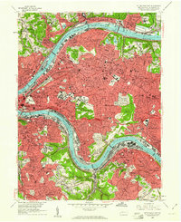
 1959 Pittsburgh1959 Print · USGSCovers Spring Hill-City View, including Pittsburgh, Penn Hills, and other nearby areas
 - 1960 Map of Pittsburgh West, 1961 Print
 1960 Pittsburgh West1961 Print · USGSCovers Spring Hill-City View, including Pittsburgh, Ross Township, and other nearby areas4 unique versions available
 - 1960 Map of Pittsburgh East, 1961 Print
 1960 Pittsburgh East1961 Print · USGSCovers Spring Hill-City View, including Pittsburgh, Penn Hills, and other nearby areas4 unique versions available
 - 1962 Map of Canton
 1962 Canton1962 Print · USGSCovers Spring Hill-City View, including Pittsburgh, Akron, and other nearby areas2 unique versions available
 - 1964 Map of Pittsburgh
 1964 Pittsburgh1964 Print · USGSCovers Spring Hill-City View, including Pittsburgh, Penn Hills, and other nearby areas
 - 1986 Map of Pittsburgh West
 1986 Pittsburgh West1986 Print · USGSCovers Spring Hill-City View, including Pittsburgh, Bethel Park, and other nearby areas3 unique versions available
 - 1986 Map of Pittsburgh East
 1986 Pittsburgh East1986 Print · USGSCovers Spring Hill-City View, including Pittsburgh, Penn Hills, and other nearby areas3 unique versions available
 - 1993 Map of Pittsburgh West, 1994 Print
 1993 Pittsburgh West1994 Print · USGSCovers Spring Hill-City View, including Pittsburgh, Ross Township, and other nearby areas2 unique versions available
 - 1993 Map of Pittsburgh East, 1994 Print
 1993 Pittsburgh East1994 Print · USGSCovers Spring Hill-City View, including Pittsburgh, Penn Hills, and other nearby areas2 unique versions available
Showing maps 1-25 of 27
Frequently asked questions
- What are the different types of historical maps available for Spring Hill-City View?
- What is the oldest map of Spring Hill-City View?
- Where can I purchase historical maps of Spring Hill-City View for my home or office?
- Where can I download high-res historical maps of Spring Hill-City View?
- Are there historical topographic maps available for Spring Hill-City View?
- Is there historical aerial imagery available for Spring Hill-City View?
- Where are historical maps of Spring Hill-City View sourced from?