1900-1909 Maps of Ross Township, Pennsylvania
Explore 8 historic maps of Ross Township from 1900-1909. These maps offer a rare glimpse into what life looked like during the 1900s — showing old roads, neighborhoods, homes, and landmarks that have changed or disappeared over time.
Whether you're researching your family's past, planning a metal detecting trip, or studying how Ross Township's landscape evolved across the 1900s, these high-resolution maps are a powerful tool for exploring the history of this region.
- Focus on a specific era: All maps on this page are from the 1900s, giving you a focused view of this time period.
- See what’s changed: Compare century-old streets, trails, and buildings to today's modern landscape using overlays and satellite layers.
- Research with precision: Use these maps for genealogy, historical research, land use analysis, or educational projects.
- View, download, or print: Maps are fully viewable online in high resolution, and can be downloaded or printed for your own records.
Start exploring Ross Township's history through authentic maps from the 1900s. This is your window into the past.
Ross Township, PA maps
(8)- 1904 Map of Mc Keesport
 1904 Mc Keesport1904 Print · USGSAllegheny County at the height of its industrial era reveals a landscape of massive rail yards and riverfront steel towns. Genealogists can trace family roots through dense neighborhoods in Homestead, Wilkinsburg, and Braddock or locate ancestral plots in Homewood Cem.2 unique versions available
 - 1904 Map of Carnegie, 1954 Print
 1904 Carnegie1954 Print · USGSAllegheny County's industrial heartland is captured here at the start of the twentieth century as rail lines and mines reshaped the landscape. Researchers can trace early settlements and social hubs like Cliff Mine, the County Home, and the Union Church.
 - 1906 Map of Carnegie
 1906 Carnegie1906 Print · USGSThe industrial valleys of Western Pennsylvania come alive in the early 1900s, showing the early infrastructure of the Ohio River and its tributaries. Local historians can trace family roots at Union Church or explore the early coal economy at Cliff Mine and Walkers Mills.7 unique versions available
 - 1906 Map of Sewickley, 1960 Print
 1906 Sewickley1960 Print · USGSWestern Pennsylvania’s river-and-rail corridor is captured here at the start of the century, showing the industrial development along the Ohio River. Researchers can trace early infrastructure like Dam No 4 or locate landmarks such as the Camp Meeting Grounds and Parks Quarries.
 - 1907 Map of Pittsburg
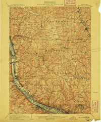
 1907 Pittsburg1907 Print · USGSSteel-industry heartlands and river-valley rail corridors define the Pittsburgh region in the early nineteen-hundreds. Trace the complex rail networks of the Union RR and Pennsylvania RR through industrial hubs like Homestead and Wilmerding.10 unique versions available
 - 1908 Map of Sewickley
 1908 Sewickley1908 Print · USGSThe industrial corridor of the Ohio River valley is captured here in the early twentieth century, showing a landscape defined by steam-era transport and valley settlements. Researchers can trace the riverfront rail networks of the Pennsylvania System and locate historic landmarks like Aliquippa Park and the Campmeeting Grounds.7 unique versions available
 - 1908 Map of Carnegie, 1910 Print
 1908 Carnegie1910 Print · USGSSouthwest of the Pittsburgh river forks in the early 1900s, a complex web of railroads and industrial hollows began to link the rural coal and mill towns. Trace the paths of the Wabash and Side Belt lines past landmarks like Cliff Mine, Guy Mills, and Treveskyn Cuddy PO.
 - 1908 Map of New Kensington, 1956 Print
 1908 New Kensington1956 Print · USGSThe Allegheny River valley and its surrounding townships are captured here at the start of the twentieth century. Researchers can trace early railroad stops at Allison Park Sta, find rural landmarks like Sandy Hill School, and locate the Fulton Ferry crossing.
End of results
Showing maps 1-8 of 8
Top cities near Ross Township
- Pittsburgh historical maps
- Penn Hills historical maps
- Bethel Park historical maps
- Mount Lebanon historical maps
- McCandless historical maps
- Monroeville historical maps
See more
Top neighborhoods of Ross Township
- Highcliff historical maps
- Keown Station historical maps
- Perrysville historical maps
- Laurel Gardens historical maps
- Berkeley Hills historical maps
- Evergreen historical maps
Frequently asked questions
- What are the different types of historical maps available for Ross Township?
- What is the oldest map of Ross Township?
- Where can I purchase historical maps of Ross Township for my home or office?
- Where can I download high-res historical maps of Ross Township?
- Are there historical topographic maps available for Ross Township?
- Is there historical aerial imagery available for Ross Township?
- Where are historical maps of Ross Township sourced from?