Old Maps of Whitehall, Allegheny County for Metal Detecting
Plan your next treasure hunt with 33 historic maps of Whitehall. Find old homesites, ghost towns, trails, and gathering spots that may be lost to time — perfect for identifying promising metal detecting locations.
- Locate forgotten sites: Uncover places like long-lost settlements, abandoned rail lines, or gathering spots.
- Plan better hunts: Use map overlays combined with LiDAR or satellite views to narrow in on historically rich areas.
- Made for detectorists: Thousands of hobbyists use these maps to discover relics, coins, and hidden history.
Use these historic maps to boost your research and find new opportunities beneath the surface of Whitehall.
Whitehall, Allegheny County maps
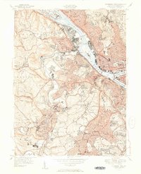
(33)- 1904 Map of Mc Keesport
 1904 Mc Keesport1904 Print · USGSCovers Whitehall, including Pittsburgh, Penn Hills, and other nearby areas2 unique versions available
 - 1904 Map of Carnegie, 1954 Print
 1904 Carnegie1954 Print · USGSCovers Whitehall, including Pittsburgh, Bethel Park, and other nearby areas
 - 1906 Map of Carnegie
 1906 Carnegie1906 Print · USGSCovers Whitehall, including Pittsburgh, Bethel Park, and other nearby areas7 unique versions available
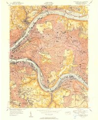
 - 1907 Map of Pittsburg
 1907 Pittsburg1907 Print · USGSCovers Whitehall, including Pittsburgh, Penn Hills, and other nearby areas10 unique versions available
 - 1908 Map of Carnegie, 1910 Print
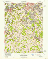
 1908 Carnegie1910 Print · USGSCovers Whitehall, including Pittsburgh, Bethel Park, and other nearby areas
 - 1948 Map of Pittsburgh West, 1954 Print
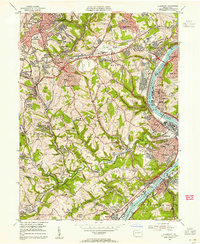
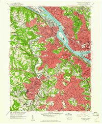
 1948 Pittsburgh West1954 Print · USGSCovers Whitehall, including Pittsburgh, Ross Township, and other nearby areas
 - 1951 Map of Pittsburgh West
 1951 Pittsburgh West1951 Print · USGSCovers Whitehall, including Pittsburgh, Ross Township, and other nearby areas3 unique versions available
 - 1951 Map of Pittsburg East
 1951 Pittsburg East1951 Print · USGSCovers Whitehall, including Pittsburgh, Penn Hills, and other nearby areas3 unique versions available
 - 1951 Map of Canton
 1951 Canton1951 Print · USGSCovers Whitehall, including Pittsburgh, Akron, and other nearby areas
 - 1953 Map of Pittsburgh
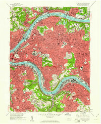
 1953 Pittsburgh1953 Print · USGSCovers Whitehall, including Pittsburgh, Penn Hills, and other nearby areas
 - 1953 Map of Canton
 1953 Canton1953 Print · USGSCovers Whitehall, including Pittsburgh, Akron, and other nearby areas
 - 1953 Map of Bridgeville, 1955 Print
 1953 Bridgeville1955 Print · USGSCovers Whitehall, including Pittsburgh, Bethel Park, and other nearby areas
 - 1953 Map of Glassport, 1955 Print
 1953 Glassport1955 Print · USGSCovers Whitehall, including Pittsburgh, Bethel Park, and other nearby areas
 - 1954 Map of Pittsburgh
 1954 Pittsburgh1954 Print · USGSCovers Whitehall, including Pittsburgh, Penn Hills, and other nearby areas2 unique versions available
 - 1956 Map of Pittsburgh East, 1959 Print
 1956 Pittsburgh East1959 Print · USGSCovers Whitehall, including Pittsburgh, Penn Hills, and other nearby areas
 - 1956 Map of Pittsburgh West, 1959 Print
 1956 Pittsburgh West1959 Print · USGSCovers Whitehall, including Pittsburgh, Ross Township, and other nearby areas
 - 1957 Map of Canton, 1971 Print
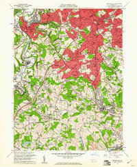
 1957 Canton1971 Print · USGSCovers Whitehall, including Pittsburgh, Akron, and other nearby areas3 unique versions available
 - 1958 Map of Pittsburgh
 1958 Pittsburgh1958 Print · USGSCovers Whitehall, including Pittsburgh, Penn Hills, and other nearby areas5 unique versions available
 - 1959 Map of Pittsburgh
 1959 Pittsburgh1959 Print · USGSCovers Whitehall, including Pittsburgh, Penn Hills, and other nearby areas
 - 1960 Map of Pittsburgh West, 1961 Print
 1960 Pittsburgh West1961 Print · USGSCovers Whitehall, including Pittsburgh, Ross Township, and other nearby areas4 unique versions available
 - 1960 Map of Bridgeville, 1961 Print
 1960 Bridgeville1961 Print · USGSCovers Whitehall, including Pittsburgh, Bethel Park, and other nearby areas6 unique versions available
 - 1960 Map of Glassport, 1961 Print
 1960 Glassport1961 Print · USGSCovers Whitehall, including Pittsburgh, Bethel Park, and other nearby areas4 unique versions available
 - 1960 Map of Pittsburgh East, 1961 Print
 1960 Pittsburgh East1961 Print · USGSCovers Whitehall, including Pittsburgh, Penn Hills, and other nearby areas4 unique versions available
 - 1962 Map of Canton
 1962 Canton1962 Print · USGSCovers Whitehall, including Pittsburgh, Akron, and other nearby areas2 unique versions available
 - 1964 Map of Pittsburgh
 1964 Pittsburgh1964 Print · USGSCovers Whitehall, including Pittsburgh, Penn Hills, and other nearby areas
Showing maps 1-25 of 33
Frequently asked questions
- What are the different types of historical maps available for Whitehall?
- What is the oldest map of Whitehall?
- Where can I purchase historical maps of Whitehall for my home or office?
- Where can I download high-res historical maps of Whitehall?
- Are there historical topographic maps available for Whitehall?
- Is there historical aerial imagery available for Whitehall?
- Where are historical maps of Whitehall sourced from?