Old Maps of South Bethlehem, Armstrong County for Hiking & Exploration
Hike through history with 17 historic maps of South Bethlehem. Explore old trails, ghost towns, and forgotten backroads — perfect for outdoor adventurers and local explorers.
- Rediscover forgotten places: Map out old mining camps, roads, and footpaths that no longer exist on modern maps.
- Layer with modern tools: Combine with LiDAR or satellite views to plan hikes through historical terrain.
- Made for exploration: Popular among hikers, overlanders, and local history lovers.
Use these maps to find adventure and explore the hidden past of South Bethlehem.
South Bethlehem, Armstrong County maps
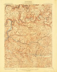
(17)- 1901 Map of Rural Valley, 1957 Print
 1901 Rural Valley1957 Print · USGSCovers South Bethlehem, including Mahoning, Rural Valley, and other nearby areas2 unique versions available
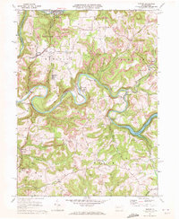
 - 1903 Map of Rural Valley
 1903 Rural Valley1903 Print · USGSCovers South Bethlehem, including Mahoning, Rural Valley, and other nearby areas6 unique versions available
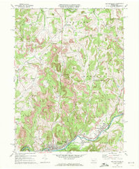
 - 1906 Map of Clarion
 1906 Clarion1906 Print · USGSCovers South Bethlehem, including Clarion, Limestone Township, and other nearby areas2 unique versions available
 - 1907 Map of Clarion
 1907 Clarion1907 Print · USGSCovers South Bethlehem, including Clarion, Limestone Township, and other nearby areas5 unique versions available
 - 1953 Map of Pittsburgh
 1953 Pittsburgh1953 Print · USGSCovers South Bethlehem, including Pittsburgh, Penn Hills, and other nearby areas
 - 1954 Map of Pittsburgh
 1954 Pittsburgh1954 Print · USGSCovers South Bethlehem, including Pittsburgh, Penn Hills, and other nearby areas2 unique versions available
 - 1957 Map of Warren, 1964 Print
 1957 Warren1964 Print · USGSCovers South Bethlehem, including Saint Marys, Sandy Township, and other nearby areas4 unique versions available
 - 1958 Map of Pittsburgh
 1958 Pittsburgh1958 Print · USGSCovers South Bethlehem, including Pittsburgh, Penn Hills, and other nearby areas5 unique versions available
 - 1958 Map of Warren
 1958 Warren1958 Print · USGSCovers South Bethlehem, including Saint Marys, Sandy Township, and other nearby areas
 - 1959 Map of Warren
 1959 Warren1959 Print · USGSCovers South Bethlehem, including Saint Marys, Sandy Township, and other nearby areas2 unique versions available
 - 1959 Map of Pittsburgh
 1959 Pittsburgh1959 Print · USGSCovers South Bethlehem, including Pittsburgh, Penn Hills, and other nearby areas
 - 1964 Map of Pittsburgh
 1964 Pittsburgh1964 Print · USGSCovers South Bethlehem, including Pittsburgh, Penn Hills, and other nearby areas
 - 1969 Map of Distant, 1972 Print
 1969 Distant1972 Print · USGSCovers South Bethlehem, including McCrea Furnace, Wayne Township, and other nearby areas3 unique versions available
 - 1969 Map of New Bethlehem, 1972 Print
 1969 New Bethlehem1972 Print · USGSCovers South Bethlehem, including Limestone Township, New Bethlehem, and other nearby areas2 unique versions available
 - 1971 Map of Warren
 1971 Warren1971 Print · USGSCovers South Bethlehem, including Saint Marys, Sandy Township, and other nearby areas
 - 1983 Map of Indiana
 1983 Indiana1983 Print · USGSCovers South Bethlehem, including Penn Hills, Ross Township, and other nearby areas
 - 1983 Map of Oil City, 1984 Print
 1983 Oil City1984 Print · USGSCovers South Bethlehem, including Oil City, Cranberry Township, and other nearby areas
End of results
Showing maps 1-17 of 17
Frequently asked questions
- What are the different types of historical maps available for South Bethlehem?
- What is the oldest map of South Bethlehem?
- Where can I purchase historical maps of South Bethlehem for my home or office?
- Where can I download high-res historical maps of South Bethlehem?
- Are there historical topographic maps available for South Bethlehem?
- Is there historical aerial imagery available for South Bethlehem?
- Where are historical maps of South Bethlehem sourced from?