1900s (20th Century) Maps of West Franklin Township, Pennsylvania
Explore 16 historic maps of West Franklin Township from the 1900s (20th Century). These maps offer a rare glimpse into what life looked like during the 1900s — showing old roads, neighborhoods, homes, and landmarks that have changed or disappeared over time.
Whether you're researching your family's past, planning a metal detecting trip, or studying how West Franklin Township's landscape evolved across the 1900s, these high-resolution maps are a powerful tool for exploring the history of this region.
- Focus on a specific era: All maps on this page are from the 1900s, giving you a focused view of this time period.
- See what’s changed: Compare century-old streets, trails, and buildings to today's modern landscape using overlays and satellite layers.
- Research with precision: Use these maps for genealogy, historical research, land use analysis, or educational projects.
- View, download, or print: Maps are fully viewable online in high resolution, and can be downloaded or printed for your own records.
Start exploring West Franklin Township's history through authentic maps from the 1900s. This is your window into the past.
West Franklin Township, PA maps
(16)- 1900 Map of Kittanning, 1963 Print
 1900 Kittanning1963 Print · USGSThe Allegheny River valley was a bustling corridor of rail and river industry at the turn of the century. Genealogists and researchers can trace family landmarks and early industrial sites like Redbank Furnace, Laceys Store, and Buffalo Mills.
 - 1902 Map of Kittanning
 1902 Kittanning1902 Print · USGSThe Allegheny River corridor at the start of the twentieth century shows a region shaped by heavy rail and early industry. Trace family roots and old commercial sites like Redbank Furnace, East Brady, and the milling hub at Worthington.6 unique versions available
 - 1953 Map of Pittsburgh
 1953 Pittsburgh1953 Print · USGSWestern Pennsylvania's industrial landscape at the start of the fifties shows the steel and rail corridors between Pittsburgh and Altoona. Trace family roots in river towns like Tarentum or follow the Pennsylvania Turnpike across Laurel Hill.
 - 1954 Map of Pittsburgh
 1954 Pittsburgh1954 Print · USGSWestern Pennsylvania in the early fifties remains a powerhouse of heavy industry and vital transit corridors. Genealogists and historians can trace the rail-and-river network connecting Pittsburgh, Johnstown, and Altoona via the Pennsylvania RR and the Lincoln Highway.2 unique versions available
 - 1958 Map of Pittsburgh
 1958 Pittsburgh1958 Print · USGSWestern Pennsylvania in the late fifties shows an industrial heartland defined by the confluence of the Allegheny River and Monongahela River. Researchers can trace the sprawling rail networks of the Pennsylvania RR and find established towns like Butler, Latrobe, and Windber.5 unique versions available
 - 1958 Map of Worthington, 1959 Print
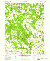 1958 Worthington1959 Print · USGSThe Armstrong and Butler county line in the late 1950s shows a landscape of industrial transition and rural community. Genealogists and researchers can locate historic brick kilns, rural congregations at McKee Chapel, and the milling history at Buffalo Mills.4 unique versions available
 - 1958 Map of Kittanning, 1959 Print
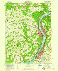 1958 Kittanning1959 Print · USGSArmstrong County’s industrial river valley thrives in the late fifties, dominated by the manufacturing hubs and rail networks of the Allegheny. Researchers can trace family history through sites like Salem Ch, the Appleby Manor Ch, and the neighborhoods of McGrann and Tarrtown.4 unique versions available
 - 1959 Map of Pittsburgh
 1959 Pittsburgh1959 Print · USGSWestern Pennsylvania in the late fifties is captured here at the height of its industrial era. Genealogists and historians can trace the riverfront growth of Pittsburgh, the rail works at Altoona, and the mountain gaps of Laurel Hill.
 - 1963 Map of East Brady, 1964 Print
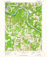 1963 East Brady1964 Print · USGSThe Allegheny River corridor in the early sixties was a hub of rail transport and strip mining across the Clarion and Armstrong county lines. Local historians can trace the foundations of East Brady and Philipston, or locate rural landmarks like St Eusebius Ch and Lock and Dam No 9.2 unique versions available
 - 1964 Map of Pittsburgh
 1964 Pittsburgh1964 Print · USGSWestern Pennsylvania in the late fifties and early sixties shows a landscape of powerful river industries and expanding highways. Genealogists and historians can trace the rail corridors of the Pennsylvania RR through industrial hubs like Johnstown, Altoona, and Nanty Glo.
 - 1964 Map of Chicora, 1965 Print
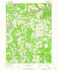 1964 Chicora1965 Print · USGSAcross Butler and Armstrong counties in the mid-sixties, this area reveals a landscape shaped by mining and rail. Genealogists can trace family names and landmarks like White Oak Cem, Kepples Corners, and the old Home for the Aged.3 unique versions available
 - 1983 Map of Indiana
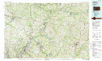 1983 Indiana1983 Print · USGSWestern Pennsylvania in the early eighties shows a landscape of industrial river towns and expanding university campuses. Genealogists can trace family roots through Lucernemines and Spring Church, or locate ancestors in Oakland Cemetery.
 - 1993 Map of East Brady
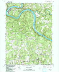 1993 East Brady1993 Print · USGSThe Allegheny River corridor in the early nineties reveals a landscape shaped by river transport and deep-vein mining. Researchers can trace family roots at St Eusebius Cem, locate the Sugarcreek Sch, or explore riverside hamlets like Wattersonville and Philipston.
 - 1993 Map of Worthington
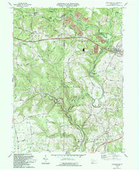 1993 Worthington1993 Print · USGSArmstrong and Butler counties are captured here in the early nineties as rural communities and light industry meet. Genealogists can trace family names at Slate Lick, Fenelton, and St Johns Ch or follow the historic Buffalo Mills along the creek.
 - 1993 Map of Kittanning
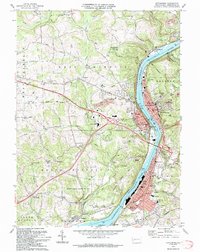 1993 Kittanning1993 Print · USGSArmstrong County in the 1990s was a landscape shaped by the Allegheny River and a legacy of industry. Genealogists and historians can trace family roots through numerous sites like Lawnheaven Cem, Wick City, and the St Pauls Monastery.
 - 1998 Map of Kittanning, 2000 Print
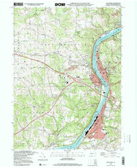 1998 Kittanning2000 Print · USGSArmstrong County’s riverfront industrial corridor is captured here at the end of the century, showing the tight-knit settlements along the Allegheny. Researchers can trace local roots through St Pauls Monastery, Dog Town, and Holy Trinity Cem.
End of results
Showing maps 1-16 of 16
Top cities near West Franklin Township
- Harrison Township historical maps
- Kittanning historical maps
- Ford City historical maps
- Clinton Township historical maps
- North Buffalo Township historical maps
- Leechburg historical maps
See more
Top neighborhoods of West Franklin Township
- Craigsville historical maps
- Laird Crossing historical maps
- Shadyside Village historical maps
- Nichola historical maps
Frequently asked questions
- What are the different types of historical maps available for West Franklin Township?
- What is the oldest map of West Franklin Township?
- Where can I purchase historical maps of West Franklin Township for my home or office?
- Where can I download high-res historical maps of West Franklin Township?
- Are there historical topographic maps available for West Franklin Township?
- Is there historical aerial imagery available for West Franklin Township?
- Where are historical maps of West Franklin Township sourced from?