Old Maps of Independence Township, Pennsylvania for Hiking & Exploration
Hike through history with 15 historic maps of Independence Township. Explore old trails, ghost towns, and forgotten backroads — perfect for outdoor adventurers and local explorers.
- Rediscover forgotten places: Map out old mining camps, roads, and footpaths that no longer exist on modern maps.
- Layer with modern tools: Combine with LiDAR or satellite views to plan hikes through historical terrain.
- Made for exploration: Popular among hikers, overlanders, and local history lovers.
Use these maps to find adventure and explore the hidden past of Independence Township.
Independence Township, PA maps
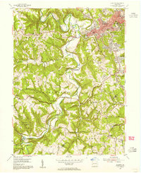
(15)- 1901 Map of Beaver, 1958 Print
 1901 Beaver1958 Print · USGSThe industrial river valleys of Beaver County at the dawn of the twentieth century are captured here in meticulous detail. Researchers can trace the development of Beaver Falls and Rochester or locate riverside landmarks like Baker's Landing and Dam No. 6.
 - 1904 Map of Beaver
 1904 Beaver1904 Print · USGSBeaver County at the opening of the twentieth century shows a landscape defined by the bustling industrial corridors of the Ohio River. Genealogists can trace family roots through riverfront settlements like Monaca, Shippingport, and Freedom, or locate early transport hubs such as Cooks Ferry.6 unique versions available
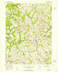
 - 1904 Map of Burgettstown, 1958 Print
 1904 Burgettstown1958 Print · USGSWashington County and its neighbors are documented at the turn of the century as the coal and rail industries began reshaping the landscape. Researchers can trace early family sites and infrastructure from Pattersons Mill to the Francis Mine and the North Star Tyre P O.
 - 1906 Map of Burgettstown
 1906 Burgettstown1906 Print · USGSWestern Pennsylvania’s coal and rail landscape comes into focus at the dawn of the twentieth century. Researchers can trace historic family landmarks and industrial sites like Francis Mine, Pattersons Mill, and the North Star Tyre P O.5 unique versions available
 - 1951 Map of Canton
 1951 Canton1951 Print · USGSThe industrial heartland of Ohio and Pennsylvania reached its mid-century peak during this era of heavy rail and river transit. Genealogists and historians can trace the development of steel towns like Aliquippa and Weirton alongside the Ohio River and major lines of the Pennsylvania RR.
 - 1953 Map of Canton
 1953 Canton1953 Print · USGSThe industrial heartland of Ohio and Pennsylvania is captured at its mid-century peak in this detailed regional survey. Genealogists and historians can trace the vast rail networks of the Pennsylvania RR and find local landmarks like Nimisila Reservoir and Tappan Reservoir.
 - 1954 Map of Aliquippa, 1955 Print
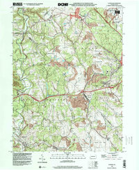
 1954 Aliquippa1955 Print · USGSBeaver County’s industrial valleys and rural uplands meet in the mid-fifties, showing the growth of Aliquippa alongside established farming communities. Genealogists can trace family names through the John Anderson Memorial Cem, New Bethlehem Ch, and the rural crossroads of Gringo.6 unique versions available
 - 1954 Map of Clinton, 1955 Print
 1954 Clinton1955 Print · USGSThe mining hills west of Pittsburgh come to life in the mid-1950s, showing a landscape defined by the Montour RR and early coal extraction. Genealogists and historians can trace the foundations of Santiago (Tyre PO), Murdocksville, and old country landmarks like Hebron Ch.7 unique versions available
 - 1957 Map of Canton, 1971 Print
 1957 Canton1971 Print · USGSThe industrial heartland of eastern Ohio and western Pennsylvania comes alive in this mid-century survey of the Ohio River Valley. Trace the heritage of rail and river commerce through Pittsburgh, the massive steel towns along the Ohio River, and major junctions on the Pennsylvania RR.3 unique versions available
 - 1962 Map of Canton
 1962 Canton1962 Print · USGSThe industrial heartland of Eastern Ohio and Western Pennsylvania thrives in the early sixties as steel mills and rail lines dominate the river valleys. Genealogists and historians can trace local landmarks like McKinley National Memorial, Malone College, and industrial sites such as Republic Steel Corp.2 unique versions available
 - 1986 Map of Pittsburgh West
 1986 Pittsburgh West1986 Print · USGSThe Tri-State region's coal and rail corridors are captured in the mid-eighties as industry and aviation expanded. Trace the legacy of extraction at Nelms Mine No 1, locate Short Creek PO, or follow the Chessie System tracks along the Ohio River.3 unique versions available
 - 1986 Map of East Liverpool
 1986 East Liverpool1986 Print · USGSThe tri-state border region in the 1980s reveals a landscape shaped by the Ohio River and a massive rail network. Researchers can trace the industrial footprint of East Liverpool and Midland or locate inland landmarks like Pine Lake and Strip Mines.2 unique versions available
 - 1998 Map of Clinton, 2000 Print
 1998 Clinton2000 Print · USGSWestern Pennsylvania at the end of the century reveals a landscape shaped by heavy industry and aviation. Researchers can trace family sites near Hebron Ch, explore the footprint of Imperial, or study the impact of Reclaimed Strip Mines and the Greater Pittsburgh International Airport.
 - 2023 Map of Aliquippa, 2023 Print
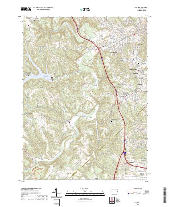 2023 Aliquippa2023 Print · USGSThis part of Beaver County shows the suburban and rural landscape south of the Ohio River in recent years. Genealogists can trace family names at the Saint Elijah Serbian Cem or follow the waters of Raccoon Creek past McAlisters Crossroads.
 - 2023 Map of Clinton, 2023 Print
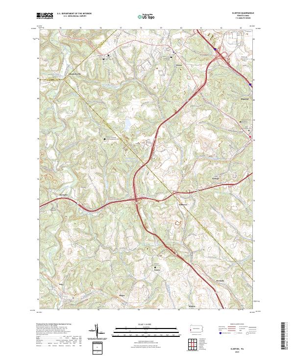 2023 Clinton2023 Print · USGSAllegheny and Washington Counties meet in this modern survey of western Pennsylvania's rolling hills and airport outskirts. Researchers can locate family sites like the James and Cecilia Henderson Family Cem and the historic Steubenville Pike.
End of results
Showing maps 1-15 of 15
Top cities near Independence Township
- Cranberry Township historical maps
- Moon Township historical maps
- Weirton historical maps
- Upper St. Clair historical maps
- East Liverpool historical maps
- Center Township historical maps
See more
Top neighborhoods of Independence Township
Frequently asked questions
- What are the different types of historical maps available for Independence Township?
- What is the oldest map of Independence Township?
- Where can I purchase historical maps of Independence Township for my home or office?
- Where can I download high-res historical maps of Independence Township?
- Are there historical topographic maps available for Independence Township?
- Is there historical aerial imagery available for Independence Township?
- Where are historical maps of Independence Township sourced from?