1960s Maps of Monroe Township, Pennsylvania
Explore 8 historic maps of Monroe Township from the 1960s. These maps offer a rare glimpse into what life looked like during the 1960s — showing old roads, neighborhoods, homes, and landmarks that have changed or disappeared over time.
Whether you're researching your family's past, planning a metal detecting trip, or studying how Monroe Township's landscape evolved across the 1960s, these high-resolution maps are a powerful tool for exploring the history of this region.
- Focus on a specific era: All maps on this page are from the 1960s, giving you a focused view of this time period.
- See what’s changed: Compare century-old streets, trails, and buildings to today's modern landscape using overlays and satellite layers.
- Research with precision: Use these maps for genealogy, historical research, land use analysis, or educational projects.
- View, download, or print: Maps are fully viewable online in high resolution, and can be downloaded or printed for your own records.
Start exploring Monroe Township's history through authentic maps from the 1960s. This is your window into the past.
Monroe Township, PA maps
(8)- 1961 Map of Cumberland
 1961 Cumberland1961 Print · USGSThe tri-state highlands of Maryland, West Virginia, and Pennsylvania are shown in the mid-twentieth century as a complex landscape of ridges and river valleys. Researchers can trace the winding Potomac River and find old rail-and-river towns like Cumberland, Keyser, and Morgantown.
 - 1962 Map of Cumberland
 1962 Cumberland1962 Print · USGSThe central Appalachians meet at the height of the mid-century industrial era, showing the rugged topography between Morgantown and Winchester. Genealogists can trace family lands near Fort Necessity or along the vital Baltimore & Ohio RR corridors.
 - 1967 Map of Clearville, 1970 Print
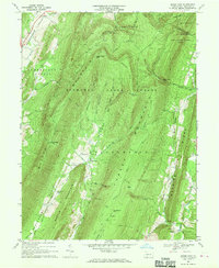
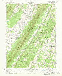 1967 Clearville1970 Print · USGSBedford County's ridge-and-valley landscape is captured here in the late 1960s, showing a region defined by high timbered ridges and narrow agricultural hollows. Researchers can locate family landmarks like St Marks Ch, the village of Clearville, and the Mann Monroe Sch.4 unique versions available
 - 1967 Map of Mench, 1970 Print
 1967 Mench1970 Print · USGSBedford County in the late sixties reveals a landscape of high ridges and deep creek valleys centered around Mench and Mattie. Researchers can trace rural life through numerous landmarks like Jackson Mills, several Covered Bridge crossings, and Wesley Chapel.3 unique versions available
 - 1967 Map of Rainsburg, 1970 Print
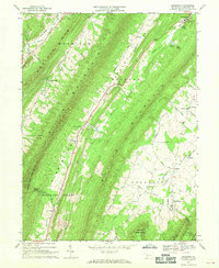 1967 Rainsburg1970 Print · USGSThe ridge-and-valley landscape of Bedford County is captured here in the late sixties, showing a rural society shaped by its mountain gaps. Researchers can locate family landmarks like Cove Ch, the County Home, and the remote settlement of Burning Bush.4 unique versions available
 - 1967 Map of Amaranth, 1970 Print
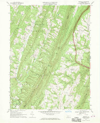 1967 Amaranth1970 Print · USGSThe ridge-and-valley country of the Fulton and Bedford county line is captured here in the late sixties. Genealogists and local historians can trace family roots through numerous rural landmarks like Sheeves Chapel, Wards Ch, and the high mountain pass at McKees Gap.4 unique versions available
 - 1967 Map of Beans Cove, 1970 Print
 1967 Beans Cove1970 Print · USGSBedford County’s high ridges and isolated valleys are captured here in the late sixties, showing the remote settlement of Beans Cove. Genealogists and historians can locate the Seven Dolors Ch, the Covered Bridge at Hewitt, and numerous family-named landmarks like Twigg Hollow.4 unique versions available
 - 1968 Map of Chaneysville, 1970 Print
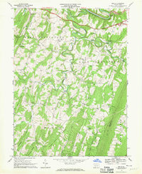
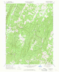 1968 Chaneysville1970 Print · USGSBedford County's ridgeline communities are captured here in the late sixties, showing the enduring rural layout of the southern Pennsylvania mountains. Genealogists and historians can locate family landmarks like Zion Ch, the settlement at Chaneysville, and the remote Inglesmith crossroads.4 unique versions available
End of results
Showing maps 1-8 of 8
Top cities near Monroe Township
- Bedford historical maps
- Napier Township historical maps
- Everett historical maps
- Hancock historical maps
- Manns Choice historical maps
- Flintstone historical maps
See more
Top neighborhoods of Monroe Township
- Emerson historical maps
- Robinsonville historical maps
- Clearville historical maps
- Five Forks historical maps
Frequently asked questions
- What are the different types of historical maps available for Monroe Township?
- What is the oldest map of Monroe Township?
- Where can I purchase historical maps of Monroe Township for my home or office?
- Where can I download high-res historical maps of Monroe Township?
- Are there historical topographic maps available for Monroe Township?
- Is there historical aerial imagery available for Monroe Township?
- Where are historical maps of Monroe Township sourced from?