Old Maps of Monroe Township, Pennsylvania for Academic Research
Study the evolution of Monroe Township with 27 high-resolution historic maps. Whether you're teaching, researching, or modeling changes in land use, these maps provide essential visual documentation of urban, environmental, and geographic change.
- Analyze long-term change: Track patterns in development, transportation, and natural features.
- Ideal for environmental or urban studies: Support academic projects with primary historical map data.
- Use in the classroom or lab: Educators and researchers rely on these maps to bring historical context to life.
These maps are a powerful tool for teaching, research, and visualizing how Monroe Township has changed over the decades.
Monroe Township, PA maps
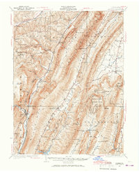
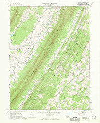
(27)- 1927 Map of Clearville
 1927 Clearville1927 Print · USGSBedford and Fulton counties appear here in the late twenties, showing a landscape of high ridges and isolated mountain valleys. Genealogists can trace family roots through numerous rural landmarks like Hendershot Cemetery, Ottown Sch, and the village of Clearville.
 - 1927 Map of Hyndman, 1967 Print
 1927 Hyndman1967 Print · USGSThe ridges and valleys of Bedford County appear here at a moment when rural life centered on dozens of mountain schools and the Baltimore and Ohio railroad. Genealogists can trace family footprints at Diehl Cem or locate the sites of St James Ch and the Bedford Valley PO.
 - 1931 Map of Clearville
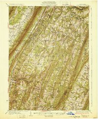 1931 Clearville1931 Print · USGSBedford County at the start of the 1930s shows a landscape of deep ridges and busy valley farms. Genealogists can trace family names through landmarks like Jackson Mills, Chaneysville, and schools such as Barkman Sch or Bittle Sch.3 unique versions available
 - 1931 Map of Hyndman
 1931 Hyndman1931 Print · USGSHyndman and the surrounding ridges of Bedford County are captured in the late twenties, showing a landscape of tight mountain gaps and railroad hubs. Researchers can trace family-named schoolhouses like Pender Sch, the old Bedford Valley PO, and the Horseshoe Trail.3 unique versions available
 - 1944 Map of Hyndman
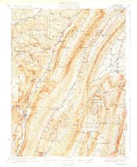
 1944 Hyndman1944 Print · USGSBedford County in the mid-1940s is defined by its strategic mountain gaps and the busy rail corridors of Hyndman and Buffalo Mills. Researchers can trace the early Pennsylvania Turnpike or locate vanished landmarks like Bedford Valley P O and James Ch.
 - 1944 Map of Clearville, 1945 Print
 1944 Clearville1945 Print · USGSBedford and Fulton Counties are captured here in the mid-1940s, showing a landscape of steep ridges and tight-knit valley settlements. Researchers can locate numerous vanished rural landmarks, from Silver Mills and Mills Store to the Hendershot Cem and Indian Spring Sch.
 - 1948 Map of Cumberland
 1948 Cumberland1948 Print · USGSMid-century Appalachia and the Shenandoah Valley are shown in detail, documenting the industrial and transportation hubs of the tri-state area. Genealogists can trace family roots through settlements like Double Tollgate and Bunker Hill or along the Baltimore & Ohio RR.3 unique versions available
 - 1952 Map of Cumberland
 1952 Cumberland1952 Print · USGSThe Potomac Highlands and the Shenandoah Valley are revealed in this early 1950s survey of the Appalachian interior. Researchers can trace the river-and-rail corridors connecting Cumberland, Winchester, and the recreational waters of Deep Creek Lake.
 - 1956 Map of Cumberland, 1966 Print
 1956 Cumberland1966 Print · USGSThe tri-state Highlands in the mid-1950s show a landscape shaped by coal, timber, and the massive presence of the Baltimore & Ohio RR. Researchers can trace the industrial corridor from Cumberland through the Allegheny Mountains to mountain retreats like Deep Creek Lake.6 unique versions available
 - 1957 Map of Cumberland
 1957 Cumberland1957 Print · USGSThe Potomac River valley and the ridges of the Allegheny Front define this mid-century landscape at the intersection of Maryland, West Virginia, and Pennsylvania. Trace the steam-era rail lines of the Baltimore and Ohio RR or locate rural landmarks like St Stephens Church and Stony River Dam.
 - 1961 Map of Cumberland
 1961 Cumberland1961 Print · USGSThe tri-state highlands of Maryland, West Virginia, and Pennsylvania are shown in the mid-twentieth century as a complex landscape of ridges and river valleys. Researchers can trace the winding Potomac River and find old rail-and-river towns like Cumberland, Keyser, and Morgantown.
 - 1962 Map of Cumberland
 1962 Cumberland1962 Print · USGSThe central Appalachians meet at the height of the mid-century industrial era, showing the rugged topography between Morgantown and Winchester. Genealogists can trace family lands near Fort Necessity or along the vital Baltimore & Ohio RR corridors.
 - 1967 Map of Clearville, 1970 Print
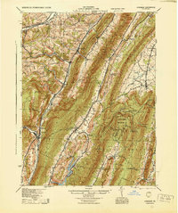
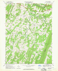
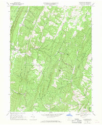
 1967 Clearville1970 Print · USGSBedford County's ridge-and-valley landscape is captured here in the late 1960s, showing a region defined by high timbered ridges and narrow agricultural hollows. Researchers can locate family landmarks like St Marks Ch, the village of Clearville, and the Mann Monroe Sch.4 unique versions available
 - 1967 Map of Mench, 1970 Print
 1967 Mench1970 Print · USGSBedford County in the late sixties reveals a landscape of high ridges and deep creek valleys centered around Mench and Mattie. Researchers can trace rural life through numerous landmarks like Jackson Mills, several Covered Bridge crossings, and Wesley Chapel.3 unique versions available
 - 1967 Map of Rainsburg, 1970 Print
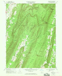
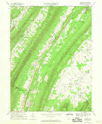 1967 Rainsburg1970 Print · USGSThe ridge-and-valley landscape of Bedford County is captured here in the late sixties, showing a rural society shaped by its mountain gaps. Researchers can locate family landmarks like Cove Ch, the County Home, and the remote settlement of Burning Bush.4 unique versions available
 - 1967 Map of Amaranth, 1970 Print
 1967 Amaranth1970 Print · USGSThe ridge-and-valley country of the Fulton and Bedford county line is captured here in the late sixties. Genealogists and local historians can trace family roots through numerous rural landmarks like Sheeves Chapel, Wards Ch, and the high mountain pass at McKees Gap.4 unique versions available
 - 1967 Map of Beans Cove, 1970 Print
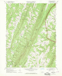
 1967 Beans Cove1970 Print · USGSBedford County’s high ridges and isolated valleys are captured here in the late sixties, showing the remote settlement of Beans Cove. Genealogists and historians can locate the Seven Dolors Ch, the Covered Bridge at Hewitt, and numerous family-named landmarks like Twigg Hollow.4 unique versions available
 - 1968 Map of Chaneysville, 1970 Print
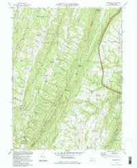
 1968 Chaneysville1970 Print · USGSBedford County's ridgeline communities are captured here in the late sixties, showing the enduring rural layout of the southern Pennsylvania mountains. Genealogists and historians can locate family landmarks like Zion Ch, the settlement at Chaneysville, and the remote Inglesmith crossroads.4 unique versions available
 - 1981 Map of Cumberland, 1982 Print
 1981 Cumberland1982 Print · USGSThe tri-state region of Maryland, Pennsylvania, and West Virginia is captured here in the early eighties as a landscape of industrial history and ridgeline geography. Researchers can trace the heritage of the C & O Canal and the B & O RR through mountain gaps and coal towns like Eckhart Mines and Frostburg.2 unique versions available
 - 1994 Map of Amaranth, 1997 Print
 1994 Amaranth1997 Print · USGSThe ridge-and-valley country of the Pennsylvania borderlands remained a mosaic of state forests and small hamlets in the 1990s. Genealogists can locate family landmarks like Silver Mills and Lashley, or trace ancestral ties to Bethel Ch and Jerusalem Ch.
 - 1994 Map of Mench, 1997 Print
 1994 Mench1997 Print · USGSBedford and Fulton County at the close of the twentieth century show a landscape of deep ridges and rural crossroads. Genealogists can trace family roots through numerous sites like Wesley Chapel, Mattie, and the old structures at Jackson Mills.
 - 2023 Map of Chaneysville, 2023 Print
 2023 Chaneysville2023 Print · USGSBedford County's southern ridges and valleys are mapped here in the modern era, showing the enduring rural layout near the Maryland line. Researchers can locate numerous family burial sites and old country parishes, including Mount Zion Christian Cem and Zion Lutheran Church Cem.
 - 2023 Map of Beans Cove, 2023 Print
 2023 Beans Cove2023 Print · USGSThe rural valleys of Bedford County near the Maryland border remain a landscape of small farmsteads and narrow gaps. Genealogists can trace early residents through several burial sites, including Perdew Cem, Prosperity Cem, and the Seven Dolors Catholic Cem.
 - 2023 Map of Clearville, 2023 Print
 2023 Clearville2023 Print · USGSBedford County's ridges and valleys are shown here in modern detail, preserving the locations of generations-old farmsteads and rural crossroads. Researchers can trace family history through sites like the Wilson Weimer Family Cem, Cornell Graveyard, and the settlement at Ott Town.
 - 2023 Map of Rainsburg, 2023 Print
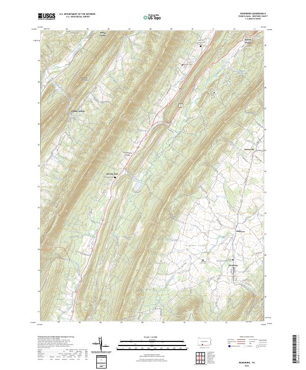 2023 Rainsburg2023 Print · USGSBedford County's ridge-and-valley landscape near Rainsburg is captured here in the early twenty-first century, showing a pattern of settlement and burial grounds. Researchers can trace family history at the Major John Cessna Burial Site, Sweet Root Cem, or the Memorial Lutheran Church.
Showing maps 1-25 of 27
Top cities near Monroe Township
- Bedford historical maps
- Napier Township historical maps
- Everett historical maps
- Hancock historical maps
- Manns Choice historical maps
- Flintstone historical maps
See more
Top neighborhoods of Monroe Township
- Emerson historical maps
- Robinsonville historical maps
- Clearville historical maps
- Five Forks historical maps
Frequently asked questions
- What are the different types of historical maps available for Monroe Township?
- What is the oldest map of Monroe Township?
- Where can I purchase historical maps of Monroe Township for my home or office?
- Where can I download high-res historical maps of Monroe Township?
- Are there historical topographic maps available for Monroe Township?
- Is there historical aerial imagery available for Monroe Township?
- Where are historical maps of Monroe Township sourced from?