1970s Maps of West Saint Clair Township, Pennsylvania
Explore 6 historic maps of West Saint Clair Township from the 1970s. These maps offer a rare glimpse into what life looked like during the 1970s — showing old roads, neighborhoods, homes, and landmarks that have changed or disappeared over time.
Whether you're researching your family's past, planning a metal detecting trip, or studying how West Saint Clair Township's landscape evolved across the 1970s, these high-resolution maps are a powerful tool for exploring the history of this region.
- Focus on a specific era: All maps on this page are from the 1970s, giving you a focused view of this time period.
- See what’s changed: Compare century-old streets, trails, and buildings to today's modern landscape using overlays and satellite layers.
- Research with precision: Use these maps for genealogy, historical research, land use analysis, or educational projects.
- View, download, or print: Maps are fully viewable online in high resolution, and can be downloaded or printed for your own records.
Start exploring West Saint Clair Township's history through authentic maps from the 1970s. This is your window into the past.
West Saint Clair Township, PA maps
(6)- 1971 Map of Schellsburg, 1972 Print
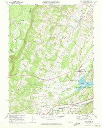 1971 Schellsburg1972 Print · USGSBedford County at the start of the seventies reveals a landscape of protected game lands and emerging state recreation areas. Genealogists and hikers can trace old homesteads near New Paris, remote churches like Pleasant View Ch, and the shoreline of Shawnee Lake.3 unique versions available
 - 1971 Map of Alum Bank, 1973 Print
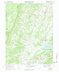
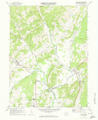 1971 Alum Bank1973 Print · USGSBedford County in the early 1970s shows a landscape of ridge-and-valley settlements connected by the Penn Central railroad. Genealogists and historians can locate family-named sites, rural churches like Horne Ch, and landmarks like the Fish Hatchery or Alum Bank.3 unique versions available
 - 1971 Map of Bedford, 1973 Print
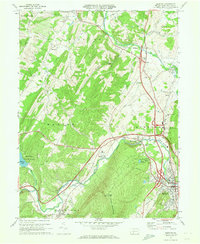 1971 Bedford1973 Print · USGSBedford County during the early seventies is a landscape defined by the Raystown Branch valley and the bustling Pennsylvania Turnpike. Researchers can trace family roots through St Pauls Cem, the Covered Bridge at Napier, and old crossroads like Wolfsburg and Cessna.3 unique versions available
 - 1971 Map of Ogletown, 1973 Print
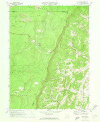 1971 Ogletown1973 Print · USGSBedford and Somerset Counties are documented here in the early 1970s, showing a landscape defined by state forestry and mountain ridges. Researchers can locate remote settlements like Ogletown and Ryot, alongside local landmarks such as Calvary Ch and Pine Lake.4 unique versions available
 - 1977 Map of Schellsburg, 1979 Print
 1977 Schellsburg1979 Print · USGSBedford County during the late seventies shows a rural landscape defined by the winding Raystown Branch Juniata River and the recreation area at Shawnee Lake. Genealogists can locate family roots in New Paris, Helixville, or Schellsburg, while tracing local landmarks like the New Paris Central Sch and two historic Covered Bridge crossings.
 - 1977 Map of Ogletown, 1979 Print
 1977 Ogletown1979 Print · USGSBedford County's rural landscape is captured in this late-seventies aerial survey of the forest and farm country. Genealogists and historians can trace property lines and land use near settlements like Ogletown and Ryot or along the slopes of Shade Mountain.
End of results
Showing maps 1-6 of 6
Top cities near West Saint Clair Township
- Windber historical maps
- Stonycreek Township historical maps
- Bedford historical maps
- Portage historical maps
- Napier Township historical maps
- King historical maps
See more
Top neighborhoods of West Saint Clair Township
Frequently asked questions
- What are the different types of historical maps available for West Saint Clair Township?
- What is the oldest map of West Saint Clair Township?
- Where can I purchase historical maps of West Saint Clair Township for my home or office?
- Where can I download high-res historical maps of West Saint Clair Township?
- Are there historical topographic maps available for West Saint Clair Township?
- Is there historical aerial imagery available for West Saint Clair Township?
- Where are historical maps of West Saint Clair Township sourced from?