Old Maps of Amity Township, Pennsylvania for Academic Research
Study the evolution of Amity Township with 39 high-resolution historic maps. Whether you're teaching, researching, or modeling changes in land use, these maps provide essential visual documentation of urban, environmental, and geographic change.
- Analyze long-term change: Track patterns in development, transportation, and natural features.
- Ideal for environmental or urban studies: Support academic projects with primary historical map data.
- Use in the classroom or lab: Educators and researchers rely on these maps to bring historical context to life.
These maps are a powerful tool for teaching, research, and visualizing how Amity Township has changed over the decades.
Amity Township, PA maps
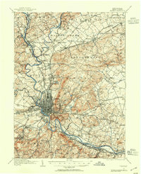
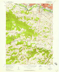
(39)- 1894 Map of Reading
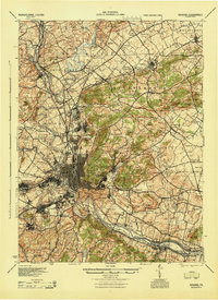
 1894 Reading1894 Print · USGSIn the 1890s, the industrial core of Berks County was defined by its coal-and-iron rail networks and the winding Schuylkill River. Genealogists and historians can trace late-nineteenth-century life in Reading and surrounding villages like Shoemakersville or find local landmarks such as Spies Church.5 unique versions available
 - 1902 Map of Boyertown
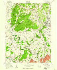
 1902 Boyertown1902 Print · USGSSoutheast Pennsylvania at the dawn of the century reveals an intricate landscape of iron-era settlements and early rail networks. Genealogists and historians can trace the foundations of Boyertown, locate rural landmarks like Landis Store, or follow the path of the Schuylkill Canal.9 unique versions available
 - 1906 Map of Phoenixville
 1906 Phoenixville1906 Print · USGSThe industrial corridor along the Schuylkill River thrives in the early 1900s as rail networks expand through Chester and Montgomery counties. Genealogists and historians can trace old community centers like Seven Stars, Limerick, and the Paoli Monument.8 unique versions available
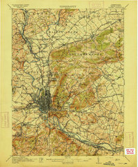
 - 1913 Map of Reading, 1954 Print
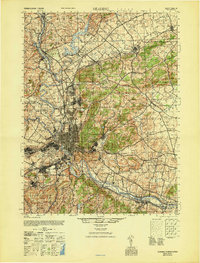
 1913 Reading1954 Print · USGSThe Schuylkill valley near the turn of the century shows a landscape transitioning between its colonial iron roots and a modern rail-driven economy. Genealogists and historians can trace family locations near the Friends Meetinghouse, Van Reeds Mill, or the many district schoolhouses like Neff School.
 - 1915 Map of Reading
 1915 Reading1915 Print · USGSBerks County at the height of its industrial and rail era shows a landscape where iron furnaces and canals meet growing boroughs. Trace the paths of the Schuylkill Canal, locate old sites like Oley Furnace, or find family landmarks like Gernant Church and Epler School.6 unique versions available
 - 1943 Map of Boyertown
 1943 Boyertown1943 Print · USGSBerks and Montgomery counties are shown at a wartime peak of rail and river industry, centered on the growing boroughs of Boyertown and Pottstown. Genealogists and historians can trace the mid-century layout of Pine Forge, the historic Schuylkill Canal, and local landmarks like Half Way House.
 - 1943 Map of Phoenixville
 1943 Phoenixville1943 Print · USGSSoutheastern Pennsylvania during the early war years shows a landscape defined by the winding Schuylkill River and heavy rail traffic. Genealogists and historians can trace the early Pennsylvania Turnpike and explore historic locales like Fricks Lock and Nantmeal Village.
 - 1944 Map of Reading
 1944 Reading1944 Print · USGSReading and its surrounding Berks County townships appear here during the height of the mid-century industrial era. Genealogists and historians can trace family locations through dozens of named schools like Shirk Sch and Cedar top Sch, or locate ancestral sites at Oley Furnace and Charles Evans Cem.
 - 1944 Map of Newark, 1971 Print
 1944 Newark1971 Print · USGSThe industrial corridor from Philadelphia to New York was in a period of massive transition during the mid-forties. Genealogists and researchers can trace the rail lines of the Lehigh Valley RR, locate military installations like Picatinny Arsenal, and explore the early sprawl near Levittown.5 unique versions available
 - 1946 Map of Reading
 1946 Reading1946 Print · USGSBerks County's industrial and agricultural heartland is documented here just after the war, centered on the bustling hub of Reading. Genealogists and historians can trace family-named landmarks like Hecktown Sch, Friends Meeting House, and Van Reeds Mill.
 - 1947 Map of Birdsboro, 1967 Print
 1947 Birdsboro1967 Print · USGSBerks County’s industrial and colonial history converge along the Schuylkill River in the late 1940s. Genealogists and historians can trace family sites like the Daniel Boone Homestead and the Exeter Friends Meeting House.4 unique versions available
 - 1949 Map of Newark
 1949 Newark1949 Print · USGSThe industrial corridor between Philadelphia and New York comes alive in this post-war survey. Genealogists and historians can trace the massive rail networks of the Reading Railroad and locate major installations like Fort Dix or Picatinny Arsenal.2 unique versions available
 - 1950 Map of Birdsboro
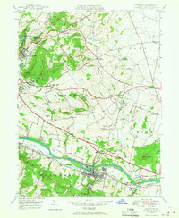
 1950 Birdsboro1950 Print · USGSBerks County's industrial and agricultural heartland is captured here just after the war, centered on the Birdsboro rail hub. Trace family history through landmarks like the Daniel Boone Homestead, Exeter Friends Meeting House, and Stony Creek Mills.
 - 1956 Map of Newark
 1956 Newark1956 Print · USGSThe industrial heart of the Mid-Atlantic is captured here at the dawn of the highway era, tracing the dense corridors between Newark and Philadelphia. Genealogists and local historians can map the rail networks of the Reading RR or locate mid-century military life at Fort Dix Military Reservation.2 unique versions available
 - 1956 Map of Pottstown, 1957 Print
 1956 Pottstown1957 Print · USGSMid-century Pottstown and the rural townships of Chester and Montgomery counties were still deeply connected by the Reading and Pennsylvania railroads. Genealogists and local historians can trace the foundations of Nantmeal Village, the old crossroads at Titlows Corner, and historic sites like St Peters Ch.5 unique versions available
 - 1957 Map of Newark
 1957 Newark1957 Print · USGSThe industrial and military heart of the Mid-Atlantic is mapped during its post-war suburban boom. Genealogists and historians can trace the intricate rail corridors of the Reading Railroad and locate key landmarks from Princeton University to Fort Hancock.
 - 1957 Map of Boyertown, 1958 Print
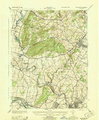
 1957 Boyertown1958 Print · USGSSoutheastern Berks County is shown here in the late fifties, where the industrial valley of the Schuylkill meets the ridges of Earl and Colebrookdale. Genealogists can locate family landmarks like Hahawas Sachem Cem, the Shanesville Chapel, and the vanished site of Woodchoppertown.6 unique versions available
 - 1960 Map of Newark
 1960 Newark1960 Print · USGSThe industrial heart of the Mid-Atlantic is shown at mid-century, stretching from the dense urban centers of Newark and Philadelphia to the Blue Mountain ridges. Researchers can trace historic rail lines, coastal defenses at Fort Hancock, and the riverfront growth of Trenton and Easton.3 unique versions available
 - 1964 Map of Newark
 1964 Newark1964 Print · USGSGreater New Jersey and eastern Pennsylvania appear at the peak of their industrial and rail-centered development in the mid-sixties. Genealogists and historians can trace the paths of the Pennsylvania RR, identify mid-century landmarks like CAMP KILMER, or follow the Schuylkill River through READING.2 unique versions available
 - 1984 Map of Reading, 1986 Print
 1984 Reading1986 Print · USGSSoutheastern Pennsylvania in the mid-eighties shows a landscape of established industrial hubs and rapid suburban expansion. Trace local history through landmarks like Valley Forge National Historical Park, the Willow Grove Naval Air Station, and Kutztown University.2 unique versions available
 - 1995 Map of Boyertown, 1996 Print
 1995 Boyertown1996 Print · USGSThe Berks and Montgomery county line in the mid-1990s shows a landscape of historic industrial river towns and rural upland ridges. Genealogists and local historians can trace family-named landmarks and old hamlets like Pine Forge, Woodchoppertown, and Douglassville.
 - 1997 Map of Boyertown, 2000 Print
 1997 Boyertown2000 Print · USGSThe Berks and Montgomery county line comes alive in the late nineties, documenting a region of deep-rooted settlements and evolving industry. Genealogists can trace family landmarks like Shanesville Ch, find long-standing cemeteries such as Union Cem, and follow the Colebrookdale Branch rail line.
 - 1999 Map of Birdsboro, 2001 Print
 1999 Birdsboro2001 Print · USGSBerks County at the turn of the millennium shows a deep layering of colonial history and industrial transit along the Schuylkill River. Genealogists and historians can trace family-named landmarks like the Daniel Boone Homestead, de Benneville House, and Stonetown.
 - 1999 Map of Pottstown, 2001 Print
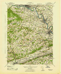
 1999 Pottstown2001 Print · USGSAs the millennium approached, the Schuylkill River valley maintained a dense network of rural villages and industrial centers across Chester and Montgomery counties. Researchers can trace historic family landmarks and local institutions like St Peters Ch, Coventryville, and the grounds of the Hill Sch.
 - 2010 Map of Boyertown, 2010 Print
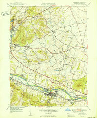
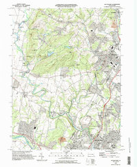
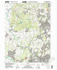
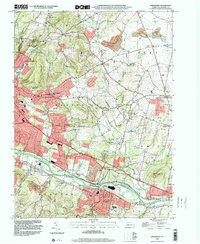
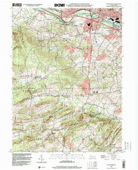
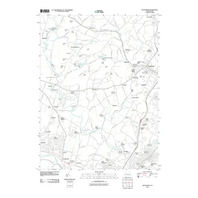 2010 Boyertown2010 Print · USGSCovers Amity Township, including Pottstown, Colebrookdale, and other nearby areas
Showing maps 1-25 of 39
Top cities near Amity Township
- Reading historical maps
- Pottstown historical maps
- Muhlenberg Park historical maps
- Limerick Township historical maps
- Phoenixville historical maps
- Wyomissing historical maps
See more
Top neighborhoods of Amity Township
- Amityville historical maps
- Earlville historical maps
- Yellow House historical maps
- Browns Mill historical maps
- Weavertown historical maps
- Douglassville historical maps
See more
Frequently asked questions
- What are the different types of historical maps available for Amity Township?
- What is the oldest map of Amity Township?
- Where can I purchase historical maps of Amity Township for my home or office?
- Where can I download high-res historical maps of Amity Township?
- Are there historical topographic maps available for Amity Township?
- Is there historical aerial imagery available for Amity Township?
- Where are historical maps of Amity Township sourced from?