2020s Maps of Overton Township, Pennsylvania
Explore 5 historic maps of Overton Township from the 2020s. These maps offer a rare glimpse into what life looked like during the 2020s — showing old roads, neighborhoods, homes, and landmarks that have changed or disappeared over time.
Whether you're researching your family's past, planning a metal detecting trip, or studying how Overton Township's landscape evolved across the 2020s, these high-resolution maps are a powerful tool for exploring the history of this region.
- Focus on a specific era: All maps on this page are from the 2020s, giving you a focused view of this time period.
- See what’s changed: Compare century-old streets, trails, and buildings to today's modern landscape using overlays and satellite layers.
- Research with precision: Use these maps for genealogy, historical research, land use analysis, or educational projects.
- View, download, or print: Maps are fully viewable online in high resolution, and can be downloaded or printed for your own records.
Start exploring Overton Township's history through authentic maps from the 2020s. This is your window into the past.
Overton Township, PA maps
(5)- 2023 Map of Leroy, 2023 Print
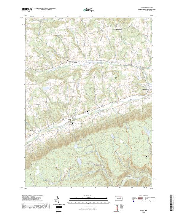 2023 Leroy2023 Print · USGSBradford County’s southern highlands and Towanda Creek valley are shown here in modern detail. Genealogists can locate family sites like the Mott Family Cem and Holcomb Cem, or trace the old industrial footprints at Carbon and Laquin.
 - 2023 Map of Powell, 2023 Print
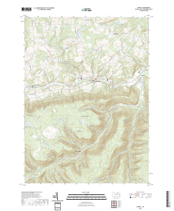 2023 Powell2023 Print · USGSBradford County’s highlands and creek valleys are captured in this recent survey of rural Pennsylvania. Genealogists and local historians can trace family plots like Willey Family Cem and Powell Cem or follow the path of Schrader Creek.
 - 2023 Map of Shunk, 2023 Print
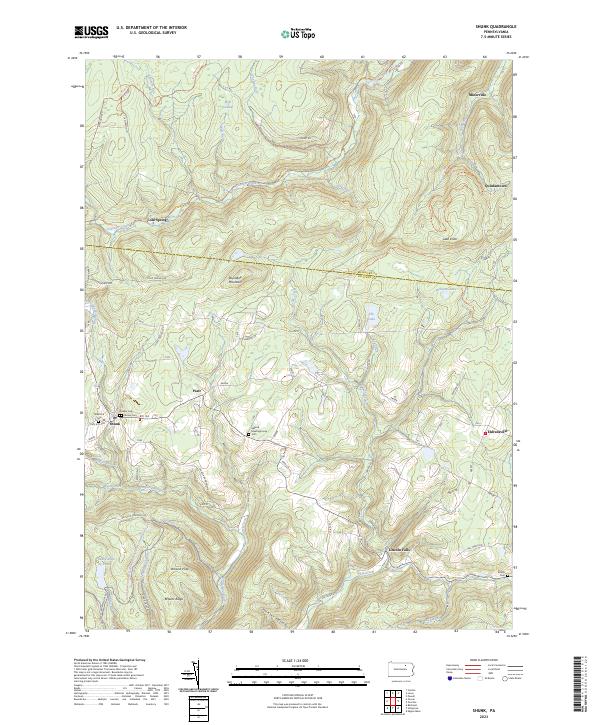 2023 Shunk2023 Print · USGSSullivan and Bradford Counties are shown in the early 2020s, featuring a network of mountain hamlets and old forest trails. Researchers can locate early burial grounds like Quaker Cem, find the Elkland Meetinghouse, and trace local landmarks such as Buttermilk Falls.
 - 2023 Map of Dushore, 2023 Print
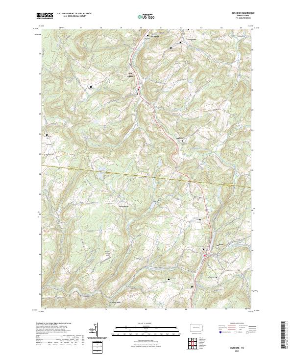 2023 Dushore2023 Print · USGSSullivan and Bradford counties appear in this modern survey of the uplands surrounding the Dushore borough. Genealogists can locate family burial grounds like the Heverly Family Cem and trace the paths of Little Loyalsock Creek through Cherry Mills.
 - 2023 Map of Overton, 2023 Print
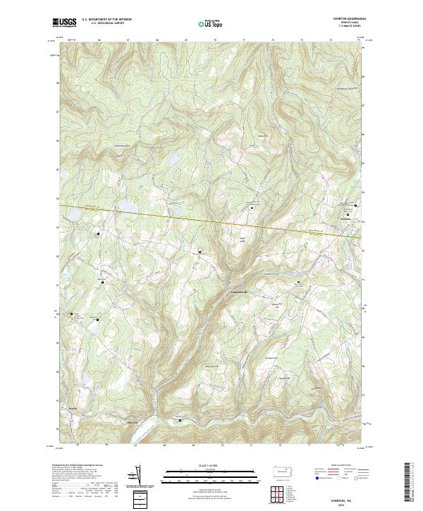 2023 Overton2023 Print · USGSThe Sullivan and Bradford county border region is shown here in the modern era, featuring upland mountain settlements and numerous family cemeteries. Locate local landmarks like Overton, Estella, and the Saint Francis Xavier Cem.
End of results
Showing maps 1-5 of 5
Top cities near Overton Township
- Towanda historical maps
- Wysox Township historical maps
- Troy historical maps
- Sheshequin Township historical maps
- Ulster Township historical maps
- Wilmot Township historical maps
See more
Top neighborhoods of Overton Township
Frequently asked questions
- What are the different types of historical maps available for Overton Township?
- What is the oldest map of Overton Township?
- Where can I purchase historical maps of Overton Township for my home or office?
- Where can I download high-res historical maps of Overton Township?
- Are there historical topographic maps available for Overton Township?
- Is there historical aerial imagery available for Overton Township?
- Where are historical maps of Overton Township sourced from?