1930s Maps of South Creek Township, Pennsylvania
Explore 3 historic maps of South Creek Township from the 1930s. These maps offer a rare glimpse into what life looked like during the 1930s — showing old roads, neighborhoods, homes, and landmarks that have changed or disappeared over time.
Whether you're researching your family's past, planning a metal detecting trip, or studying how South Creek Township's landscape evolved across the 1930s, these high-resolution maps are a powerful tool for exploring the history of this region.
- Focus on a specific era: All maps on this page are from the 1930s, giving you a focused view of this time period.
- See what’s changed: Compare century-old streets, trails, and buildings to today's modern landscape using overlays and satellite layers.
- Research with precision: Use these maps for genealogy, historical research, land use analysis, or educational projects.
- View, download, or print: Maps are fully viewable online in high resolution, and can be downloaded or printed for your own records.
Start exploring South Creek Township's history through authentic maps from the 1930s. This is your window into the past.
South Creek Township, PA maps
(3)- 1931 Map of Troy
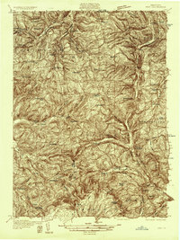 1931 Troy1931 Print · USGSBradford County’s northern valleys and high ridges appear here in the early 1930s, showing a landscape of small hamlets and cross-country rail lines. Genealogists can locate family landmarks such as Besley Cem, Mitchells Mill, and early schools like Doty Hill Sch.2 unique versions available
 - 1938 Map of Troy
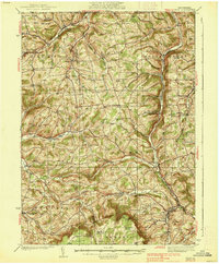 1938 Troy1938 Print · USGSNorthern Bradford and Tioga Counties are captured here in the late 1930s, showing a landscape of upland farms and railroad hamlets. Genealogists can trace family footprints at Roseville Rutland PO, the Armenia Ch, or the Besley Cem.3 unique versions available
 - 1939 Map of Sayre, 1966 Print
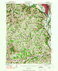 1939 Sayre1966 Print · USGSBradford County’s river valleys and upland farms are captured here just before the war, when the Lehigh Valley Railroad powered the bustling junction at Sayre. Researchers can trace old family sites at Ayers Crossroads, local landmarks like Luthers Mills, and several rural schools including Harkness Sch.
End of results
Showing maps 1-3 of 3
Top cities near South Creek Township
- Elmira historical maps
- Horseheads historical maps
- Southport historical maps
- Big Flats historical maps
- Elmira historical maps
- Southport historical maps
See more
Top neighborhoods of South Creek Township
Frequently asked questions
- What are the different types of historical maps available for South Creek Township?
- What is the oldest map of South Creek Township?
- Where can I purchase historical maps of South Creek Township for my home or office?
- Where can I download high-res historical maps of South Creek Township?
- Are there historical topographic maps available for South Creek Township?
- Is there historical aerial imagery available for South Creek Township?
- Where are historical maps of South Creek Township sourced from?