2020s Maps of Towanda Township, Pennsylvania
Explore 4 historic maps of Towanda Township from the 2020s. These maps offer a rare glimpse into what life looked like during the 2020s — showing old roads, neighborhoods, homes, and landmarks that have changed or disappeared over time.
Whether you're researching your family's past, planning a metal detecting trip, or studying how Towanda Township's landscape evolved across the 2020s, these high-resolution maps are a powerful tool for exploring the history of this region.
- Focus on a specific era: All maps on this page are from the 2020s, giving you a focused view of this time period.
- See what’s changed: Compare century-old streets, trails, and buildings to today's modern landscape using overlays and satellite layers.
- Research with precision: Use these maps for genealogy, historical research, land use analysis, or educational projects.
- View, download, or print: Maps are fully viewable online in high resolution, and can be downloaded or printed for your own records.
Start exploring Towanda Township's history through authentic maps from the 2020s. This is your window into the past.
Towanda Township, PA maps
(4)- 2023 Map of Towanda, 2023 Print
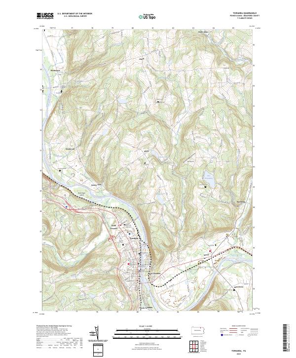 2023 Towanda2023 Print · USGSThe Susquehanna River corridor in Bradford County shows a mature landscape of river towns and upland hamlets in the early twenty-first century. Researchers can trace family history through numerous burial grounds like Wysox Cem or locate the Bradford County Courthouse in the heart of Towanda.
 - 2023 Map of Monroeton, 2023 Print
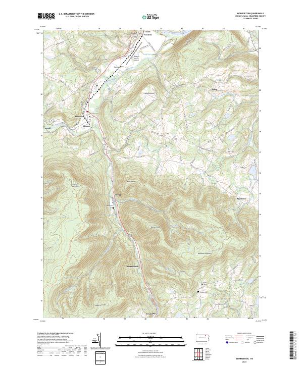 2023 Monroeton2023 Print · USGSThe Towanda Creek valley and surrounding Pennsylvania highlands are captured here in recent years, showing the area's rural character and mountain terrain. Genealogists can locate several burial sites including Kellogg Cem and Scrivens Hollow Cem near the banks of South Branch Towanda Creek.
 - 2023 Map of Powell, 2023 Print
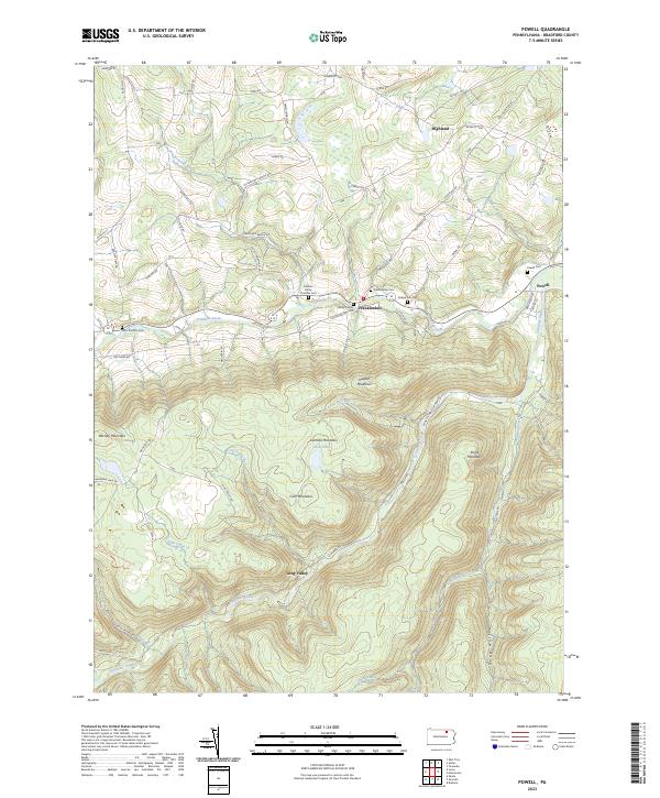 2023 Powell2023 Print · USGSBradford County’s highlands and creek valleys are captured in this recent survey of rural Pennsylvania. Genealogists and local historians can trace family plots like Willey Family Cem and Powell Cem or follow the path of Schrader Creek.
 - 2023 Map of Ulster, 2023 Print
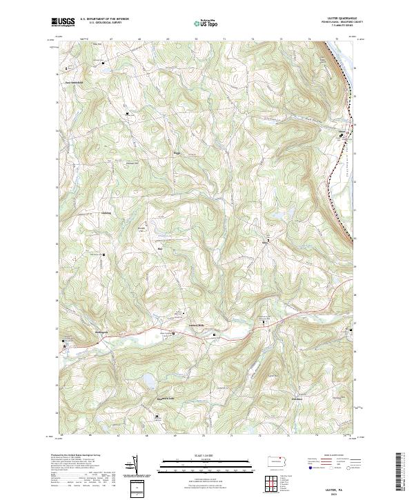 2023 Ulster2023 Print · USGSBradford County's river valleys and upland farms are captured here in the early twenty-first century. Genealogists can locate numerous family and historic burial sites, from the Mitchell Cem to the unique Pail Factory Cem and Gustin Cem.
End of results
Showing maps 1-4 of 4
Top cities near Towanda Township
- Sayre historical maps
- Athens historical maps
- Towanda historical maps
- Wysox Township historical maps
- Sheshequin Township historical maps
- Litchfield Township historical maps
See more
Top neighborhoods of Towanda Township
Frequently asked questions
- What are the different types of historical maps available for Towanda Township?
- What is the oldest map of Towanda Township?
- Where can I purchase historical maps of Towanda Township for my home or office?
- Where can I download high-res historical maps of Towanda Township?
- Are there historical topographic maps available for Towanda Township?
- Is there historical aerial imagery available for Towanda Township?
- Where are historical maps of Towanda Township sourced from?