Old Maps of Middletown Township, Pennsylvania for Metal Detecting
Plan your next treasure hunt with 33 historic maps of Middletown Township. Find old homesites, ghost towns, trails, and gathering spots that may be lost to time — perfect for identifying promising metal detecting locations.
- Locate forgotten sites: Uncover places like long-lost settlements, abandoned rail lines, or gathering spots.
- Plan better hunts: Use map overlays combined with LiDAR or satellite views to narrow in on historically rich areas.
- Made for detectorists: Thousands of hobbyists use these maps to discover relics, coins, and hidden history.
Use these historic maps to boost your research and find new opportunities beneath the surface of Middletown Township.
Middletown Township, PA maps
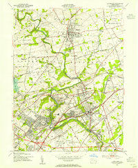
(33)- 1890 Map of Burlington
 1890 Burlington1890 Print · USGSThe Delaware River corridor was a thriving network of canal commerce and rail lines in the late nineteenth century. Genealogists and historians can trace family-named landings and early settlements like Dunks Ferry, Hulmeville, and the State Lunatic Asylum near Trenton.
 - 1893 Map of Burlington
 1893 Burlington1893 Print · USGSThe Delaware River valley thrived as a corridor of rail and river commerce in the late nineteenth century. Genealogists and historians can trace defunct transport hubs like Dunks Ferry, explore the grounds of the State Lunatic Asylum, and locate old stops along the Philadelphia and Newtown Railroad.3 unique versions available
 - 1904 Map of Burlington, 1958 Print
 1904 Burlington1958 Print · USGSThe Delaware River corridor thrives during the early twentieth century as a hub of rail, canal, and river commerce. Genealogists and local historians can trace family roots through riverside landings like Borton Landing or follow the legacy of institutions such as the George School and the State Lunatic Asylum.
 - 1906 Map of Burlington
 1906 Burlington1906 Print · USGSThe Delaware River corridor was a bustling hub of rail and water transport in the early 1900s. Genealogists and local historians can trace the development of riverside wharves like Andalusia Wharf and institutional landmarks such as the State Lunatic Asylum.6 unique versions available
 - 1907 Map of Trenton
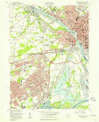
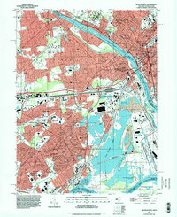
 1907 Trenton1907 Print · USGSThe Delaware River valley hums with turn-of-the-century industry and transport as river canals and railroads converge between New Jersey and Pennsylvania. Genealogists and local historians can trace the footprint of the George School, find early post offices like Holland PO, or locate old mill sites such as Blackwells Mills.4 unique versions available
 - 1942 Map of Burlington
 1942 Burlington1942 Print · USGSThe Delaware River valley thrived at the start of the 1940s as a hub of heavy rail and river commerce. Genealogists and local historians can trace family-named sites and old transit points like Dunks Ferry, Borton Landing, and Neshaminy Falls.
 - 1944 Map of Langhorne, 1947 Print
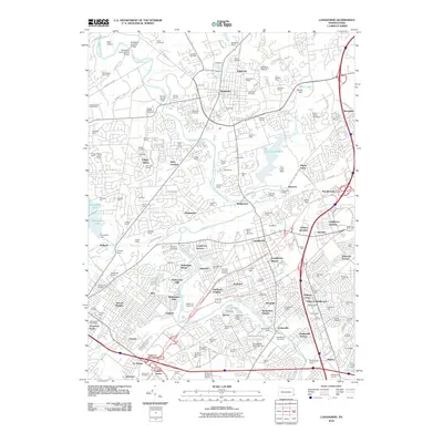
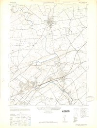 1944 Langhorne1947 Print · USGSBucks County's suburban and industrial landscape comes into focus during the mid-1940s, showing a transition from rural farmland to settled boroughs. Genealogists can trace family connections through sites like George School, St Andrews Ch, and the many rail stops along the Reading Company line.
 - 1944 Map of Trenton West, 1950 Print
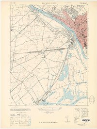 1944 Trenton West1950 Print · USGSThe Delaware River corridor near Trenton and Morrisville is captured here at the height of its mid-century rail and industrial era. Genealogists and historians can trace old property boundaries and landmarks from Fallsington to the landmark Wm Trent House 1719.
 - 1944 Map of Newark, 1971 Print
 1944 Newark1971 Print · USGSThe industrial corridor from Philadelphia to New York was in a period of massive transition during the mid-forties. Genealogists and researchers can trace the rail lines of the Lehigh Valley RR, locate military installations like Picatinny Arsenal, and explore the early sprawl near Levittown.5 unique versions available
 - 1947 Map of Trenton West
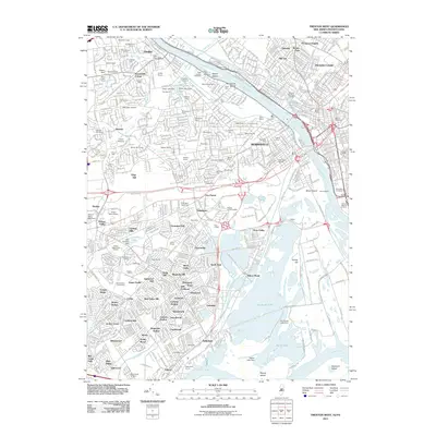
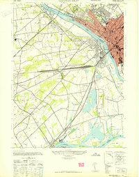 1947 Trenton West1947 Print · USGSThe Delaware River corridor near Trenton and Morrisville was a hive of rail and river activity just after the war. Genealogists and local historians can trace the foundations of Fallsington, locate the Wm Trent House 1719, and follow the Reading Company line through Woodside.
 - 1947 Map of Langhorne
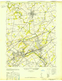 1947 Langhorne1947 Print · USGSBucks County's suburban and industrial evolution is captured here in the years following the war. Researchers can trace the path of the Trenton Cut-Off, locate historic institutions like George School, or find the Silver Star Airport near Glenlake.
 - 1949 Map of Newark
 1949 Newark1949 Print · USGSThe industrial corridor between Philadelphia and New York comes alive in this post-war survey. Genealogists and historians can trace the massive rail networks of the Reading Railroad and locate major installations like Fort Dix or Picatinny Arsenal.2 unique versions available
 - 1953 Map of Langhorne, 1955 Print
 1953 Langhorne1955 Print · USGSBucks County in the early fifties shows a landscape of growing boroughs and historic crossroads. Genealogists and local researchers can trace family plots at Roosevelt Cem, locate the Silver Star Airport, or follow the rail stops at Neshaminy Falls and Janney.2 unique versions available
 - 1955 Map of Trenton West, 1957 Print
 1955 Trenton West1957 Print · USGSThe Delaware Valley transformed during the mid-fifties as planned communities like Levittown and Fairless Hills rose beside the river. Researchers can trace early suburban development through family-centric neighborhoods like Oaktree Hollow and landmarks like Rider College or the 3 M Airport.5 unique versions available
 - 1956 Map of Newark
 1956 Newark1956 Print · USGSThe industrial heart of the Mid-Atlantic is captured here at the dawn of the highway era, tracing the dense corridors between Newark and Philadelphia. Genealogists and local historians can map the rail networks of the Reading RR or locate mid-century military life at Fort Dix Military Reservation.2 unique versions available
 - 1957 Map of Newark
 1957 Newark1957 Print · USGSThe industrial and military heart of the Mid-Atlantic is mapped during its post-war suburban boom. Genealogists and historians can trace the intricate rail corridors of the Reading Railroad and locate key landmarks from Princeton University to Fort Hancock.
 - 1960 Map of Newark
 1960 Newark1960 Print · USGSThe industrial heart of the Mid-Atlantic is shown at mid-century, stretching from the dense urban centers of Newark and Philadelphia to the Blue Mountain ridges. Researchers can trace historic rail lines, coastal defenses at Fort Hancock, and the riverfront growth of Trenton and Easton.3 unique versions available
 - 1964 Map of Newark
 1964 Newark1964 Print · USGSGreater New Jersey and eastern Pennsylvania appear at the peak of their industrial and rail-centered development in the mid-sixties. Genealogists and historians can trace the paths of the Pennsylvania RR, identify mid-century landmarks like CAMP KILMER, or follow the Schuylkill River through READING.2 unique versions available
 - 1966 Map of Langhorne, 1968 Print
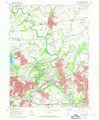 1966 Langhorne1968 Print · USGSLower Bucks County is captured in a moment of massive mid-century growth as suburban developments like Levittown expand toward older boroughs. Genealogists and racing fans can trace the grounds of the Langhorne Speedway, the historic Middletown Meetinghouse, and numerous family burial sites like Feaster Cem.2 unique versions available
 - 1982 Map of Trenton, 1983 Print
 1982 Trenton1983 Print · USGSCentral New Jersey and the Delaware River valley are captured in the early eighties during a time of major highway expansion and suburban maturation. Researchers can trace the grounds of Princeton University, the historic Monmouth Battlefield, and the sprawling Fort Dix.
 - 1986 Map of Trenton, 1987 Print
 1986 Trenton1987 Print · USGSCentral New Jersey and the Delaware River valley are shown here during the mid-eighties, a period of dense suburban growth and military activity. Researchers can trace the sprawling grounds of the Fort Dix Military Reservation and the historic corridors of the Delaware & Raritan Canal State Park.
 - 1993 Map of Langhorne, 1998 Print
 1993 Langhorne1998 Print · USGSBucks County's suburban expansion is fully visible in the 1990s as modern highways weave through historic boroughs and campus grounds. Genealogists can locate family sites at King David Cemetery or Greenwood Cem while tracing the growth of Langhorne and Levittown.
 - 1995 Map of Trenton West, 1998 Print
 1995 Trenton West1998 Print · USGSThe Delaware River corridor between Trenton and Levittown is captured here in the mid-nineties, showing decades of suburban and industrial evolution. Trace local family history through Riverview Cemetery, St Andrews Ch, and the many schools like William Penn High Sch.
 - 2010 Map of Langhorne, 2010 Print
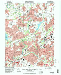
 2010 Langhorne2010 Print · USGSCovers Middletown Township, including Philadelphia, Bensalem Township, and other nearby areas
 - 2011 Map of Trenton West, 2011 Print
 2011 Trenton West2011 Print · USGSCovers Middletown Township, including Hamilton Township, Trenton, and other nearby areas
Showing maps 1-25 of 33
Top cities near Middletown Township
- Philadelphia historical maps
- Hamilton Township historical maps
- Trenton historical maps
- Camden historical maps
- Cherry Hill Township historical maps
- Bensalem Township historical maps
See more
Top neighborhoods of Middletown Township
- Quincy Hollow historical maps
- Fairless Junction historical maps
- Forsythia Gate historical maps
- Glenlake historical maps
- Highland Park historical maps
- Idlewood historical maps
See more
Frequently asked questions
- What are the different types of historical maps available for Middletown Township?
- What is the oldest map of Middletown Township?
- Where can I purchase historical maps of Middletown Township for my home or office?
- Where can I download high-res historical maps of Middletown Township?
- Are there historical topographic maps available for Middletown Township?
- Is there historical aerial imagery available for Middletown Township?
- Where are historical maps of Middletown Township sourced from?