Old Maps of West Rockhill, Pennsylvania for Hiking & Exploration
Hike through history with 48 historic maps of West Rockhill. Explore old trails, ghost towns, and forgotten backroads — perfect for outdoor adventurers and local explorers.
- Rediscover forgotten places: Map out old mining camps, roads, and footpaths that no longer exist on modern maps.
- Layer with modern tools: Combine with LiDAR or satellite views to plan hikes through historical terrain.
- Made for exploration: Popular among hikers, overlanders, and local history lovers.
Use these maps to find adventure and explore the hidden past of West Rockhill.
West Rockhill, PA maps
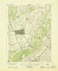
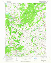
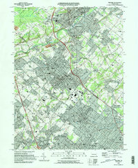
(48)- 1888 Map of Quakertown, 1963 Print
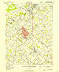
 1888 Quakertown1963 Print · USGSBucks and Montgomery counties are shown in high detail during the railroad era, when rural life centered on mill streams and village junctions. Genealogists can trace family roots through settlements like Richlandtown, Dillingersville, and the transit hub at Rocky Ridge Sta.
 - 1890 Map of Quakertown
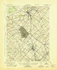
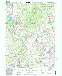
 1890 Quakertown1890 Print · USGSUpper Bucks and Montgomery counties are shown in the 1880s as a thriving corridor of rail towns and rural villages. Researchers can trace the original routes of the Perkasie and Sellersville settlements or locate family homesteads near Trumbauersville and Tylers Port.
 - 1894 Map of Quakertown
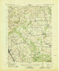
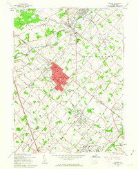
 1894 Quakertown1894 Print · USGSSoutheast Pennsylvania at the close of the nineteenth century reveals a flourishing landscape of rail-linked villages and fertile creek valleys. Genealogists can trace family roots through dozens of named settlements like Trumbauersville, Zion Hill, and Applebachsville.9 unique versions available
 - 1942 Map of Norristown
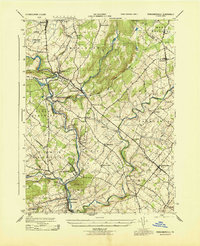
 1942 Norristown1942 Print · USGSSoutheastern Pennsylvania at the onset of World War II shows a landscape of busy industrial river towns and expanding rail suburbs. Genealogists and historians can trace the early transit networks connecting Norristown, Doylestown, and the riverfront at New Hope.
 - 1943 Map of Quakertown
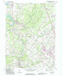
 1943 Quakertown1943 Print · USGSUpper Bucks County during the mid-1940s reveals a network of tight-knit villages and productive valley farms centered on the industrial borough of Quakertown. Genealogists and researchers can trace family lines through the streets of Perkasie, the small hamlets of Applebachsville and Shelly, or the crossroads at Loux Corner.
 - 1943 Map of Telford
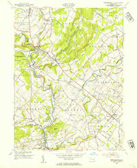
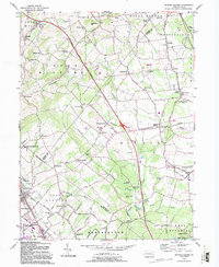
 1943 Telford1943 Print · USGSBucks and Montgomery Counties are captured here during the mid-century, defined by the busy rail corridor connecting Souderton and Perkasie. Researchers can trace old township boundaries and find long-standing community sites like St Peters Ch, Line Lexington, and Menlo Park.
 - 1943 Map of Milford Square
 1943 Milford Square1943 Print · USGSSoutheastern Pennsylvania's tri-county borderlands come to life in this mid-century survey. Genealogists can trace family roots through historic hamlets like Mumbauersville, Geryville, and the transit corridor of the Fogelsville Branch rail line.2 unique versions available
 - 1943 Map of Perkiomenville
 1943 Perkiomenville1943 Print · USGSThe Perkiomen Valley was a landscape of winding creeks and rail-stop villages during the early 1940s. Genealogists and local historians can trace family roots through settlements like Perkiomenville, Schwenksville, and Shirks Corner along the READING railroad line.
 - 1944 Map of Newark, 1971 Print
 1944 Newark1971 Print · USGSThe industrial corridor from Philadelphia to New York was in a period of massive transition during the mid-forties. Genealogists and researchers can trace the rail lines of the Lehigh Valley RR, locate military installations like Picatinny Arsenal, and explore the early sprawl near Levittown.5 unique versions available
 - 1949 Map of Newark
 1949 Newark1949 Print · USGSThe industrial corridor between Philadelphia and New York comes alive in this post-war survey. Genealogists and historians can trace the massive rail networks of the Reading Railroad and locate major installations like Fort Dix or Picatinny Arsenal.2 unique versions available
 - 1953 Map of Telford, 1954 Print
 1953 Telford1954 Print · USGSThe North Penn region comes alive in this mid-century survey, capturing the industrial heart of Souderton and Telford along the Reading railroad. Genealogists can trace family names at Jerusalem Union Ch, Franconia Sch, and the Perkasie Cem.
 - 1953 Map of Perkiomenville, 1954 Print
 1953 Perkiomenville1954 Print · USGSCentral Montgomery County thrived as a landscape of rural villages and creekside industry in the early fifties. Genealogists and historians can trace family locations through sites like Old Goshenhoppen Ch, McLeans Station, and Harleysville.2 unique versions available
 - 1956 Map of Newark
 1956 Newark1956 Print · USGSThe industrial heart of the Mid-Atlantic is captured here at the dawn of the highway era, tracing the dense corridors between Newark and Philadelphia. Genealogists and local historians can map the rail networks of the Reading RR or locate mid-century military life at Fort Dix Military Reservation.2 unique versions available
 - 1957 Map of Newark
 1957 Newark1957 Print · USGSThe industrial and military heart of the Mid-Atlantic is mapped during its post-war suburban boom. Genealogists and historians can trace the intricate rail corridors of the Reading Railroad and locate key landmarks from Princeton University to Fort Hancock.
 - 1957 Map of Quakertown, 1958 Print
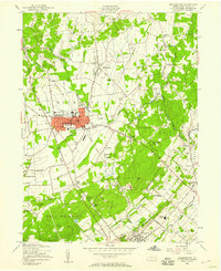 1957 Quakertown1958 Print · USGSBucks County at the dawn of the space age shows a landscape of growing boroughs and quiet rural townships. Genealogists and local historians can trace family-named roads and sites from Applebachsville to Perkasie, including St Pauls Ch and Tohickon Cem.7 unique versions available
 - 1957 Map of Milford Square, 1959 Print
 1957 Milford Square1959 Print · USGSUpper Bucks and Montgomery counties are captured in the late fifties as the new turnpike began to reshape rural life. Researchers can find numerous country churches and local schools, from Great Swamp Ch to the Weikel Sch and Trumbon Valley Sch.4 unique versions available
 - 1960 Map of Newark
 1960 Newark1960 Print · USGSThe industrial heart of the Mid-Atlantic is shown at mid-century, stretching from the dense urban centers of Newark and Philadelphia to the Blue Mountain ridges. Researchers can trace historic rail lines, coastal defenses at Fort Hancock, and the riverfront growth of Trenton and Easton.3 unique versions available
 - 1960 Map of Perkiomenville, 1963 Print
 1960 Perkiomenville1963 Print · USGSNorthern Montgomery County is shown here in the early sixties as a landscape of crossroads hamlets and winding creeks. You can trace family history at Old Goshenhoppen Ch, Tylersport, and the Salford-Upper Salford Township Sch.5 unique versions available
 - 1960 Map of Telford, 1963 Print
 1960 Telford1963 Print · USGSThe boroughs of Souderton and Telford anchor this 1960s study of the Bucks and Montgomery county line at the height of its rail-era layout. Genealogists can trace family roots through historic sites like Schwenkfelder Ch, St Michaels Cem, and the Reading rail corridor.5 unique versions available
 - 1964 Map of Newark
 1964 Newark1964 Print · USGSGreater New Jersey and eastern Pennsylvania appear at the peak of their industrial and rail-centered development in the mid-sixties. Genealogists and historians can trace the paths of the Pennsylvania RR, identify mid-century landmarks like CAMP KILMER, or follow the Schuylkill River through READING.2 unique versions available
 - 1984 Map of Reading, 1986 Print
 1984 Reading1986 Print · USGSSoutheastern Pennsylvania in the mid-eighties shows a landscape of established industrial hubs and rapid suburban expansion. Trace local history through landmarks like Valley Forge National Historical Park, the Willow Grove Naval Air Station, and Kutztown University.2 unique versions available
 - 1992 Map of Perkiomenville, 1995 Print
 1992 Perkiomenville1995 Print · USGSMontgomery County in the early nineties retains its deep rural character even as suburban growth nears the Northeast Extension. Genealogists can trace family names through the Old Goshenhoppen Ch and burial sites like Harley Cem or Delps Cem.
 - 1992 Map of Milford Square, 1995 Print
 1992 Milford Square1995 Print · USGSUpper Bucks and Lehigh Counties appear in detail during the late twentieth century, showing a landscape of historic crossroads and farmsteads. Trace local genealogy and land use at Geryville, Dillingerville, and the Krassdale-Schwenksfelder cemetery.2 unique versions available
 - 1995 Map of Telford, 1996 Print
 1995 Telford1996 Print · USGSThe boroughs of Telford and Souderton appear at a peak of late-century development along the Bucks and Montgomery county line. Genealogists and local historians can trace family-named sites and institutions like Lukins Cem, St Maria Goretti Sch, and the Schwenkfelder Ch.
 - 1997 Map of Perkiomenville, 1999 Print
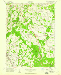
 1997 Perkiomenville1999 Print · USGSNorthwestern Montgomery County in the late 1990s preserved a landscape of old crossroads hamlets and creek-side industry. Genealogists can trace family sites at Old Goshenhoppen Ch, the Tabor Cem, and the rural station at McLeans Sta.
Showing maps 1-25 of 48
Top cities near West Rockhill
- Allentown historical maps
- Bethlehem historical maps
- Abington Township historical maps
- Warminster Township historical maps
- Horsham Township historical maps
- Warrington Township historical maps
See more
Top neighborhoods of West Rockhill
- Almont historical maps
- Derstines historical maps
- Schlichter historical maps
- Argus historical maps
- Highland Park historical maps
- Rich Hill historical maps
See more
Frequently asked questions
- What are the different types of historical maps available for West Rockhill?
- What is the oldest map of West Rockhill?
- Where can I purchase historical maps of West Rockhill for my home or office?
- Where can I download high-res historical maps of West Rockhill?
- Are there historical topographic maps available for West Rockhill?
- Is there historical aerial imagery available for West Rockhill?
- Where are historical maps of West Rockhill sourced from?