1940s Maps of Carbon County, Pennsylvania
Explore 13 historic maps of Carbon County from the 1940s. These maps offer a rare glimpse into what life looked like during the 1940s — showing old roads, neighborhoods, homes, and landmarks that have changed or disappeared over time.
Whether you're researching your family's past, planning a metal detecting trip, or studying how Carbon County's landscape evolved across the 1940s, these high-resolution maps are a powerful tool for exploring the history of this region.
- Focus on a specific era: All maps on this page are from the 1940s, giving you a focused view of this time period.
- See what’s changed: Compare century-old streets, trails, and buildings to today's modern landscape using overlays and satellite layers.
- Research with precision: Use these maps for genealogy, historical research, land use analysis, or educational projects.
- View, download, or print: Maps are fully viewable online in high resolution, and can be downloaded or printed for your own records.
Start exploring Carbon County's history through authentic maps from the 1940s. This is your window into the past.
Carbon County, PA maps
(13)- 1942 Map of Allentown West
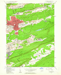
 1942 Allentown West1942 Print · USGSLehigh County during the early war years displays a landscape of industrial river towns and agrarian crossroads. Researchers can locate dozens of country schools like Snyder Sch, historic landmarks like Cedar Crest College, and the sprawling Trexler Game Preserve.3 unique versions available
 - 1943 Map of Scranton
 1943 Scranton1943 Print · USGSNortheastern Pennsylvania’s coal and rail corridor comes to life in the 1940s, showcasing the dense urban industrial centers of the Wyoming Valley. Genealogists can locate family landmarks like the Fayette School and Locust Ridge School or trace the early paths of the DL & W and Erie railroads.
 - 1943 Map of Mauch Chunk
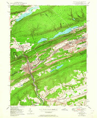
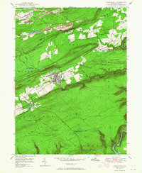
 1943 Mauch Chunk1943 Print · USGSThe Lehigh River corridor is captured here during the mid-forties, showing the vital rail and industry centers of Carbon County. Genealogists and researchers can trace dozens of rural schoolhouses and family-named landmarks like the Larrytown Poor Farm, St Pauls Ch, and Three O'clock Spring.
 - 1943 Map of Wind Gap
 1943 Wind Gap1943 Print · USGSThe Pennsylvania countryside near the Monroe and Northampton county line is captured here during the wartime era. Researchers can trace the path of the Lehigh and New England railroad through the Wind Gap pass or locate local landmarks like St Joseph Sch and Ross Common.
 - 1943 Map of Stoddartsville
 1943 Stoddartsville1943 Print · USGSThe Pocono Plateau at the height of the Second World War shows a landscape defined by river valleys and developing recreation preserves. Genealogists and local historians can trace rural schoolhouses and small settlements like Stoddartsville, Albrightsville, and the Fishery Sch.
 - 1943 Map of Bethlehem
 1943 Bethlehem1943 Print · USGSNorthampton and Lehigh counties hummed with industry and river commerce during the early war years. Researchers can trace the path of the Lehigh Valley RR, locate family-named landmarks like Chief Tatamy, and find rural schools such as Mexico School and Poplar Valley Sch.
 - 1944 Map of Newark, 1971 Print
 1944 Newark1971 Print · USGSThe industrial corridor from Philadelphia to New York was in a period of massive transition during the mid-forties. Genealogists and researchers can trace the rail lines of the Lehigh Valley RR, locate military installations like Picatinny Arsenal, and explore the early sprawl near Levittown.5 unique versions available
 - 1947 Map of Hazleton, 1962 Print
 1947 Hazleton1962 Print · USGSThe Pennsylvania coal fields and the industrial hubs of Luzerne County are captured here just after the war. Researchers can trace the rail-and-mine landscape of Ashmore Yards, Lattimer Mines, and the borough of McAdoo.5 unique versions available
 - 1947 Map of Tamaqua, 1964 Print
 1947 Tamaqua1964 Print · USGSThe Panther Valley coal region is captured here at a mid-century peak of industrial activity. Researchers can trace the extensive rail networks at Arlington Yards or locate local landmarks like Odd Fellows Cem and Owl Creek Sch.5 unique versions available
 - 1947 Map of White Haven, 1966 Print
 1947 White Haven1966 Print · USGSThe Lehigh River valley in the late 1940s is a landscape defined by industry and rail, where coal mining and transportation intersect. Genealogists can trace family roots through settlements like White Haven and Tannery, or locate local landmarks like Ripple Sch and St Patrick Cem.4 unique versions available
 - 1948 Map of Nesquehoning, 1958 Print
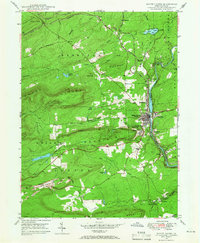
 1948 Nesquehoning1958 Print · USGSMid-century Carbon County reveals a landscape shaped by anthracite mining and valley farming just after the war. Local historians can trace the rail networks at Nesquehoning Junction or locate vanished rural landmarks like Hoppers Mill and East Penn Airport.7 unique versions available
 - 1948 Map of Weatherly, 1965 Print
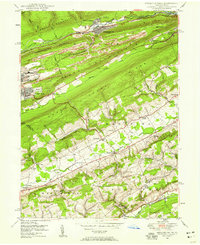
 1948 Weatherly1965 Print · USGSDeep in the anthracite region after the war, this map shows the mining and rail networks of Carbon and Luzerne counties. Trace the coal heritage of Eckley and Weatherly, or locate local landmarks like St Joseph Ch and Larrytown Sch.6 unique versions available
 - 1949 Map of Newark
 1949 Newark1949 Print · USGSThe industrial corridor between Philadelphia and New York comes alive in this post-war survey. Genealogists and historians can trace the massive rail networks of the Reading Railroad and locate major installations like Fort Dix or Picatinny Arsenal.2 unique versions available
End of results
Showing maps 1-13 of 13
Top cities of Carbon County
- Palmerton historical maps
- Lehighton historical maps
- Jim Thorpe historical maps
- Lansford historical maps
- Nesquehoning historical maps
- Summit Hill historical maps
See more
Frequently asked questions
- What are the different types of historical maps available for Carbon County?
- What is the oldest map of Carbon County?
- Where can I purchase historical maps of Carbon County for my home or office?
- Where can I download high-res historical maps of Carbon County?
- Are there historical topographic maps available for Carbon County?
- Is there historical aerial imagery available for Carbon County?
- Where are historical maps of Carbon County sourced from?