1900s (20th Century) Maps of Warwick Township, Pennsylvania
Explore 17 historic maps of Warwick Township from the 1900s (20th Century). These maps offer a rare glimpse into what life looked like during the 1900s — showing old roads, neighborhoods, homes, and landmarks that have changed or disappeared over time.
Whether you're researching your family's past, planning a metal detecting trip, or studying how Warwick Township's landscape evolved across the 1900s, these high-resolution maps are a powerful tool for exploring the history of this region.
- Focus on a specific era: All maps on this page are from the 1900s, giving you a focused view of this time period.
- See what’s changed: Compare century-old streets, trails, and buildings to today's modern landscape using overlays and satellite layers.
- Research with precision: Use these maps for genealogy, historical research, land use analysis, or educational projects.
- View, download, or print: Maps are fully viewable online in high resolution, and can be downloaded or printed for your own records.
Start exploring Warwick Township's history through authentic maps from the 1900s. This is your window into the past.
Warwick Township, PA maps
(17)- 1905 Map of Honey Brook, 1962 Print
 1905 Honey Brook1962 Print · USGSSoutheastern Pennsylvania at the start of the twentieth century shows a landscape shaped by iron furnaces and a dense rail network. Genealogists can trace family footprints at Joanna Furnace, Hummels Store, and numerous rural sites like Silver Hill School.
 - 1906 Map of Phoenixville
 1906 Phoenixville1906 Print · USGSThe industrial corridor along the Schuylkill River thrives in the early 1900s as rail networks expand through Chester and Montgomery counties. Genealogists and historians can trace old community centers like Seven Stars, Limerick, and the Paoli Monument.8 unique versions available
 - 1907 Map of Honeybrook
 1907 Honeybrook1907 Print · USGSSoutheast Pennsylvania at the start of the twentieth century shows a landscape defined by small hamlets and early rail lines. Genealogists can trace family names and local hubs from Honeybrook and Churchtown to rural landmarks like Spoketown School and Harmony Church.7 unique versions available
 - 1941 Map of Honeybrook
 1941 Honeybrook1941 Print · USGSSoutheastern Pennsylvania at the onset of the Second World War shows a landscape of established farm communities and the newly cut path of the Pennsylvania Turnpike. Researchers can locate numerous local landmarks such as Silver Hill School, Stone Church, and the rail stops along the Reading Lines.
 - 1943 Map of Phoenixville
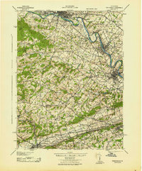 1943 Phoenixville1943 Print · USGSSoutheastern Pennsylvania during the early war years shows a landscape defined by the winding Schuylkill River and heavy rail traffic. Genealogists and historians can trace the early Pennsylvania Turnpike and explore historic locales like Fricks Lock and Nantmeal Village.
 - 1944 Map of Newark, 1971 Print
 1944 Newark1971 Print · USGSThe industrial corridor from Philadelphia to New York was in a period of massive transition during the mid-forties. Genealogists and researchers can trace the rail lines of the Lehigh Valley RR, locate military installations like Picatinny Arsenal, and explore the early sprawl near Levittown.5 unique versions available
 - 1949 Map of Newark
 1949 Newark1949 Print · USGSThe industrial corridor between Philadelphia and New York comes alive in this post-war survey. Genealogists and historians can trace the massive rail networks of the Reading Railroad and locate major installations like Fort Dix or Picatinny Arsenal.2 unique versions available
 - 1954 Map of Elverson, 1970 Print
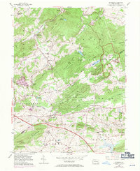 1954 Elverson1970 Print · USGSBerks and Chester counties are captured here in the mid-fifties, showing the intersection of colonial history and modern transit. Trace old family sites near Geigertown, Joanna Heights, and churches like Bethesda Ch or Ebenezer Ch.
 - 1956 Map of Newark
 1956 Newark1956 Print · USGSThe industrial heart of the Mid-Atlantic is captured here at the dawn of the highway era, tracing the dense corridors between Newark and Philadelphia. Genealogists and local historians can map the rail networks of the Reading RR or locate mid-century military life at Fort Dix Military Reservation.2 unique versions available
 - 1956 Map of Pottstown, 1957 Print
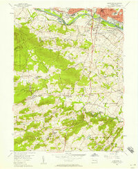 1956 Pottstown1957 Print · USGSMid-century Pottstown and the rural townships of Chester and Montgomery counties were still deeply connected by the Reading and Pennsylvania railroads. Genealogists and local historians can trace the foundations of Nantmeal Village, the old crossroads at Titlows Corner, and historic sites like St Peters Ch.5 unique versions available
 - 1956 Map of Elverson, 1957 Print
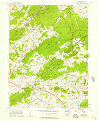 1956 Elverson1957 Print · USGSThe Berks and Chester County borderlands come into focus in the mid-fifties, balancing industrial rail history with emerging state parklands. Researchers can trace family roots at Springfield Cem, locate Hause Sch, and explore the grounds of Hopewell Village.6 unique versions available
 - 1957 Map of Newark
 1957 Newark1957 Print · USGSThe industrial and military heart of the Mid-Atlantic is mapped during its post-war suburban boom. Genealogists and historians can trace the intricate rail corridors of the Reading Railroad and locate key landmarks from Princeton University to Fort Hancock.
 - 1960 Map of Newark
 1960 Newark1960 Print · USGSThe industrial heart of the Mid-Atlantic is shown at mid-century, stretching from the dense urban centers of Newark and Philadelphia to the Blue Mountain ridges. Researchers can trace historic rail lines, coastal defenses at Fort Hancock, and the riverfront growth of Trenton and Easton.3 unique versions available
 - 1964 Map of Newark
 1964 Newark1964 Print · USGSGreater New Jersey and eastern Pennsylvania appear at the peak of their industrial and rail-centered development in the mid-sixties. Genealogists and historians can trace the paths of the Pennsylvania RR, identify mid-century landmarks like CAMP KILMER, or follow the Schuylkill River through READING.2 unique versions available
 - 1984 Map of Reading, 1986 Print
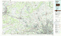 1984 Reading1986 Print · USGSSoutheastern Pennsylvania in the mid-eighties shows a landscape of established industrial hubs and rapid suburban expansion. Trace local history through landmarks like Valley Forge National Historical Park, the Willow Grove Naval Air Station, and Kutztown University.2 unique versions available
 - 1997 Map of Elverson, 1998 Print
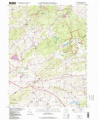 1997 Elverson1998 Print · USGSSoutheast Pennsylvania's iron heritage and wooded ridges are preserved here in the late twentieth century. Genealogists and historians can trace family roots through sites like Scarlets Mill, Bethesda Ch, and the preserved Hopewell Village.
 - 1999 Map of Pottstown, 2001 Print
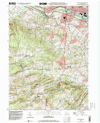 1999 Pottstown2001 Print · USGSAs the millennium approached, the Schuylkill River valley maintained a dense network of rural villages and industrial centers across Chester and Montgomery counties. Researchers can trace historic family landmarks and local institutions like St Peters Ch, Coventryville, and the grounds of the Hill Sch.
End of results
Showing maps 1-17 of 17
Top cities near Warwick Township
- Reading historical maps
- Pottstown historical maps
- West Goshen Township historical maps
- West Chester historical maps
- Muhlenberg Park historical maps
- Limerick Township historical maps
See more
Top neighborhoods of Warwick Township
- Pine Swamp historical maps
- Knauertown historical maps
- Saint Peters historical maps
- Trythall historical maps
- Harmonyville historical maps
Frequently asked questions
- What are the different types of historical maps available for Warwick Township?
- What is the oldest map of Warwick Township?
- Where can I purchase historical maps of Warwick Township for my home or office?
- Where can I download high-res historical maps of Warwick Township?
- Are there historical topographic maps available for Warwick Township?
- Is there historical aerial imagery available for Warwick Township?
- Where are historical maps of Warwick Township sourced from?