2000s (21st Century) Maps of Surveyor, Girard Township
Explore 6 historic maps of Surveyor from the 2000s (21st Century). These maps offer a rare glimpse into what life looked like during the 2000s — showing old roads, neighborhoods, homes, and landmarks that have changed or disappeared over time.
Whether you're researching your family's past, planning a metal detecting trip, or studying how Surveyor's landscape evolved across the 2000s, these high-resolution maps are a powerful tool for exploring the history of this region.
- Focus on a specific era: All maps on this page are from the 2000s, giving you a focused view of this time period.
- See what’s changed: Compare century-old streets, trails, and buildings to today's modern landscape using overlays and satellite layers.
- Research with precision: Use these maps for genealogy, historical research, land use analysis, or educational projects.
- View, download, or print: Maps are fully viewable online in high resolution, and can be downloaded or printed for your own records.
Start exploring Surveyor's history through authentic maps from the 2000s. This is your window into the past.
Surveyor, Girard Township maps
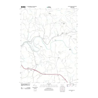
(6)- 2000 Map of Lecontes Mills, 2001 Print
 2000 Lecontes Mills2001 Print · USGSClearfield County at the turn of the century shows a unique mix of heavy industry and rural Pennsylvania life along the West Branch Susquehanna River. Genealogists and historians can trace family roots through sites like Lecontes Mills, Shiloh Cem, and the old Township Sch.
 - 2010 Map of Lecontes Mills, 2010 Print
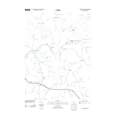
 2010 Lecontes Mills2010 Print · USGSCovers Surveyor, including Goshen Township, Lawrence Township, and other nearby areas
 - 2013 Map of Lecontes Mills, 2013 Print
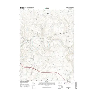
 2013 Lecontes Mills2013 Print · USGSCovers Surveyor, including Goshen Township, Lawrence Township, and other nearby areas
 - 2016 Map of Lecontes Mills, 2016 Print
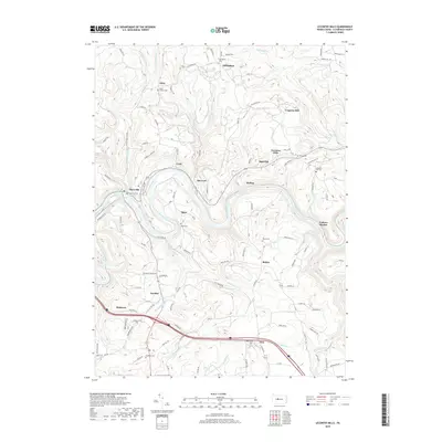
 2016 Lecontes Mills2016 Print · USGSCovers Surveyor, including Goshen Township, Lawrence Township, and other nearby areas
 - 2019 Map of Lecontes Mills, 2019 Print
 2019 Lecontes Mills2019 Print · USGSCovers Surveyor, including Goshen Township, Lawrence Township, and other nearby areas
 - 2023 Map of Lecontes Mills, 2023 Print
 2023 Lecontes Mills2023 Print · USGSThe West Branch Susquehanna River winds through Clearfield County in the early twenty-first century, connecting historic riverside hamlets. Genealogists can locate numerous burial sites including Egypt Cem, Shiloh Cem, and Bradford Cem.
End of results
Showing maps 1-6 of 6
Top cities near Surveyor
- Clearfield historical maps
- Philipsburg historical maps
- Curwensville historical maps
- Graham historical maps
- Bigler historical maps
- Osceola Mills historical maps
See more
Frequently asked questions
- What are the different types of historical maps available for Surveyor?
- What is the oldest map of Surveyor?
- Where can I purchase historical maps of Surveyor for my home or office?
- Where can I download high-res historical maps of Surveyor?
- Are there historical topographic maps available for Surveyor?
- Is there historical aerial imagery available for Surveyor?
- Where are historical maps of Surveyor sourced from?