1950s Maps of Sandy Township, Pennsylvania
Explore 5 historic maps of Sandy Township from the 1950s. These maps offer a rare glimpse into what life looked like during the 1950s — showing old roads, neighborhoods, homes, and landmarks that have changed or disappeared over time.
Whether you're researching your family's past, planning a metal detecting trip, or studying how Sandy Township's landscape evolved across the 1950s, these high-resolution maps are a powerful tool for exploring the history of this region.
- Focus on a specific era: All maps on this page are from the 1950s, giving you a focused view of this time period.
- See what’s changed: Compare century-old streets, trails, and buildings to today's modern landscape using overlays and satellite layers.
- Research with precision: Use these maps for genealogy, historical research, land use analysis, or educational projects.
- View, download, or print: Maps are fully viewable online in high resolution, and can be downloaded or printed for your own records.
Start exploring Sandy Township's history through authentic maps from the 1950s. This is your window into the past.
Sandy Township, PA maps
(5)- 1957 Map of Warren, 1964 Print
 1957 Warren1964 Print · USGSThe northern Pennsylvania oil and timber country comes into focus in the mid-fifties, showing the region before modern highway expansions. Trace the industrial rail networks of the Pennsylvania RR and the early Allegheny River Reservoir near Warren and Oil City.4 unique versions available
 - 1958 Map of Warren
 1958 Warren1958 Print · USGSNorthern Pennsylvania’s timber and oil country is captured here during the late fifties, showing the interplay of industrial valleys and vast state forests. Genealogists can trace family connections across the Cornplanter Indian Reservation or through rail hubs like Oil City and Saint Marys.
 - 1959 Map of Warren
 1959 Warren1959 Print · USGSNorthern Pennsylvania's oil and timber country comes alive in this late-fifties study of the forest-clad plateaus. Trace the historic Cornplanter (Indian Reservation), the sprawling Oil Field, and the rail lines of the Pennsylvania RR.2 unique versions available
 - 1959 Map of Luthersburg, 1960 Print
 1959 Luthersburg1960 Print · USGSClearfield County's coal and rail landscape comes to life in this late-fifties study of the area between DU BOIS and Rockton. Researchers can trace the BALTIMORE AND OHIO line through old stops like Luthersburg Sta and locate family landmarks such as St Johns Ch or Morningside Cemetery.5 unique versions available
 - 1959 Map of Sabula, 1960 Print
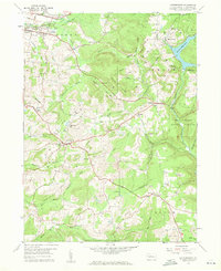
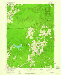 1959 Sabula1960 Print · USGSThe highland railroads and coal-mining operations of Clearfield and Jefferson counties are documented here in the late fifties. Researchers can trace historic family burial sites at Bundy Cem and Morningside Cemetery or locate the Sabula Tunnel and Boy Scout Camp.7 unique versions available
End of results
Showing maps 1-5 of 5
Top cities near Sandy Township
- DuBois historical maps
- Winslow historical maps
- Reynoldsville historical maps
- Curwensville historical maps
- Brockway historical maps
- Warsaw Township historical maps
See more
Top neighborhoods of Sandy Township
- Adrian Furnace historical maps
- Iselin Heights historical maps
- Sabula historical maps
- West Liberty historical maps
- Treasure Lake historical maps
- C and M Junction historical maps
See more
Frequently asked questions
- What are the different types of historical maps available for Sandy Township?
- What is the oldest map of Sandy Township?
- Where can I purchase historical maps of Sandy Township for my home or office?
- Where can I download high-res historical maps of Sandy Township?
- Are there historical topographic maps available for Sandy Township?
- Is there historical aerial imagery available for Sandy Township?
- Where are historical maps of Sandy Township sourced from?