1940s Maps of Westport, Noyes Township
Explore 3 historic maps of Westport from the 1940s. These maps offer a rare glimpse into what life looked like during the 1940s — showing old roads, neighborhoods, homes, and landmarks that have changed or disappeared over time.
Whether you're researching your family's past, planning a metal detecting trip, or studying how Westport's landscape evolved across the 1940s, these high-resolution maps are a powerful tool for exploring the history of this region.
- Focus on a specific era: All maps on this page are from the 1940s, giving you a focused view of this time period.
- See what’s changed: Compare century-old streets, trails, and buildings to today's modern landscape using overlays and satellite layers.
- Research with precision: Use these maps for genealogy, historical research, land use analysis, or educational projects.
- View, download, or print: Maps are fully viewable online in high resolution, and can be downloaded or printed for your own records.
Start exploring Westport's history through authentic maps from the 1940s. This is your window into the past.
Westport, Noyes Township maps
(3)- 1946 Map of Renovo West, 1953 Print
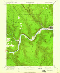
 1946 Renovo West1953 Print · USGSClinton County's river valleys and ridgelines come alive in this mid-century survey of the Pennsylvania wilds. Trace the industrial footprint of the Pennsylvania RR through Renovo or find family history at Laurel Hill Cem and Summerson Cem.9 unique versions available
 - 1946 Map of Renovo West, 1959 Print
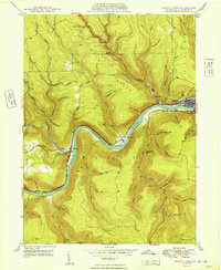
 1946 Renovo West1959 Print · USGSClinton County during the post-war era shows a landscape of river-valley industry and upland extraction. You can trace the rail networks through Renovo, find family plots at Noyes Cem, and locate the Strip Mine operations above Westport.4 unique versions available
 - 1949 Map of Renovo West
 1949 Renovo West1949 Print · USGSClinton County's river-and-rail corridor is captured in the late 1940s as industry thrives along the riverbanks. Researchers can trace family roots at St Josephs Cem, explore the mountain village of Westport, and follow the old PENNSYLVANIA railroad line.2 unique versions available
End of results
Showing maps 1-3 of 3
Top cities near Westport
- Karthaus Township historical maps
- South Renovo historical maps
- Leidy Township historical maps
- Wharton Township historical maps
Frequently asked questions
- What are the different types of historical maps available for Westport?
- What is the oldest map of Westport?
- Where can I purchase historical maps of Westport for my home or office?
- Where can I download high-res historical maps of Westport?
- Are there historical topographic maps available for Westport?
- Is there historical aerial imagery available for Westport?
- Where are historical maps of Westport sourced from?