Old Maps of Vernon Township, Pennsylvania for Metal Detecting
Plan your next treasure hunt with 34 historic maps of Vernon Township. Find old homesites, ghost towns, trails, and gathering spots that may be lost to time — perfect for identifying promising metal detecting locations.
- Locate forgotten sites: Uncover places like long-lost settlements, abandoned rail lines, or gathering spots.
- Plan better hunts: Use map overlays combined with LiDAR or satellite views to narrow in on historically rich areas.
- Made for detectorists: Thousands of hobbyists use these maps to discover relics, coins, and hidden history.
Use these historic maps to boost your research and find new opportunities beneath the surface of Vernon Township.
Vernon Township, PA maps
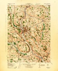
(34)- 1906 Map of Linesville, 1958 Print
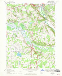
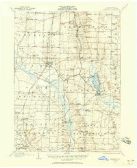 1906 Linesville1958 Print · USGSCrawford County at the turn of the century is defined by its massive wetland systems and the busy rail corridors crossing the Pymatuning Swamp. Researchers can trace the early layout of Exposition Park on Conneaut Lake or locate old rural centers like Espyville Station and Center Road Station.
 - 1908 Map of Linesville
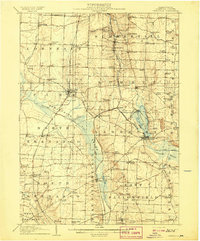 1908 Linesville1908 Print · USGSCrawford County at the turn of the century is a landscape of expansive wetlands and rising rail towns. Genealogists can trace family roots through numerous country schools like Brush College School or locate the historic Steamboat Route on Conneaut Lake.4 unique versions available
 - 1923 Map of Meadville, 1962 Print
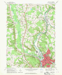
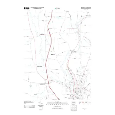
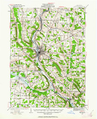 1923 Meadville1962 Print · USGSCrawford County's river valleys and rail corridors are captured here in the early 1920s, centered on the growing industrial hub of Meadville. Researchers can locate dozens of country schoolhouses like Huller School and trace the paths of the Erie R R and Perry Highway.
 - 1925 Map of Meadville
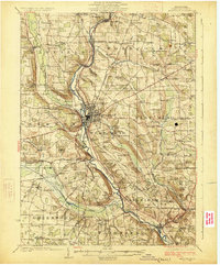 1925 Meadville1925 Print · USGSCrawford County settlements and rail corridors are captured in detail here during the mid-twenties. Genealogists can locate dozens of family-named schoolhouses and landmarks, from Booths Church to the County Farm and Frenchtown.3 unique versions available
 - 1943 Map of Meadville
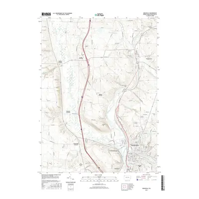
 1943 Meadville1943 Print · USGSCrawford County's river valleys and rail corridors are captured in high detail in the early 1940s, centered on the bustling city of Meadville. Genealogists and researchers can trace local landmarks like the County Farm, dozens of rural schools such as Hatch Sch, and the winding path of the ERIE railroad.
 - 1950 Map of Cleveland
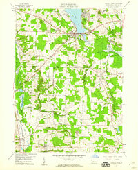
 1950 Cleveland1950 Print · USGSCovers Vernon Township, including Cleveland, Akron, and other nearby areas
 - 1956 Map of Cleveland, 1967 Print
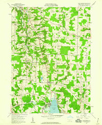
 1956 Cleveland1967 Print · USGSNortheast Ohio and Western Pennsylvania are shown at their industrial height during the mid-fifties, from the steel mills to the lakeshore. Researchers can trace the massive Ravenna Arsenal, the Ohio Turnpike, and vanished rail sidings of the B & O RR.3 unique versions available
 - 1959 Map of Harmonsburg, 1960 Print
 1959 Harmonsburg1960 Print · USGSCrawford County's lake district is captured here in the late fifties, centered on the recreational and rail hub near the northern tip of the lake. Local historians can trace the paths of the Bessemer and Lake Erie Extension Canal and locate family landmarks like Oak Hill Cem and Dicksonburg.4 unique versions available
 - 1959 Map of Conneaut Lake, 1960 Print
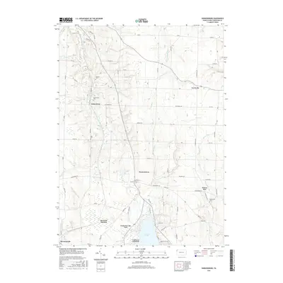
 1959 Conneaut Lake1960 Print · USGSCrawford County in the late fifties shows a landscape balancing lakeside recreation with heavy industry and rail transport. Genealogists and historians can trace family plots at Adsit Cem or follow the path of the Erie RR and the Lake Erie and Ohio River Canal.4 unique versions available
 - 1962 Map of Cleveland
 1962 Cleveland1962 Print · USGSNortheast Ohio and the Pennsylvania borderlands appear here during the industrial peak of the early sixties. Genealogists and historians can trace the expansive rail lines of the Nickel Plate Road and the growth of suburbs from Parma to Lyndhurst.
 - 1968 Map of Meadville, 1970 Print
 1968 Meadville1970 Print · USGSMeadville and the surrounding Crawford County townships are captured here in the late sixties as the valley’s industrial and civic life centered on the river. Genealogists and local historians can trace family-named crossroads like Onspaugh Corners or locate graves in St Agatha Cemetery and Greendale Cem.4 unique versions available
 - 1968 Map of Geneva, 1970 Print
 1968 Geneva1970 Print · USGSCrawford County's rural townships and wetlands are captured in the late sixties as the new interstate began to reshape local transit. Genealogists and local historians can trace family-named sites like Anderson Cem and Allison Corners or the old rail lines at Buchanan Station.4 unique versions available
 - 1986 Map of Ashtabula
 1986 Ashtabula1986 Print · USGSThe Lake Erie shoreline and the rural borderlands of Ohio and Pennsylvania are captured here as they appeared in the 1980s. You can trace industrial rail lines like the BESSEMER AND LAKE ERIE or locate family sites near Kelloggsville Cem and Pymatuning State Park.2 unique versions available
 - 1998 Map of Meadville, 1999 Print
 1998 Meadville1999 Print · USGSMeadville and the French Creek valley are shown here at the close of the twentieth century, balancing industrial heritage with its role as an educational hub. Genealogists and historians can trace family sites at Littles Corners, explore the grounds of Allegheny College, and locate numerous local burials at Greendale Cem and St Agathas Cemetery.
 - 2010 Map of Harmonsburg, 2010 Print
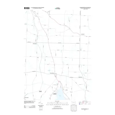
 2010 Harmonsburg2010 Print · USGSCovers Vernon Township, including Summerhill Township, Dicksonburg, and other nearby areas
 - 2010 Map of Geneva, 2010 Print
 2010 Geneva2010 Print · USGSCovers Vernon Township, including Meadville, West Mead Township, and other nearby areas
 - 2010 Map of Conneaut Lake, 2010 Print
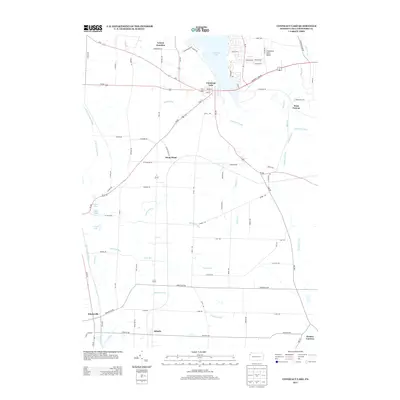
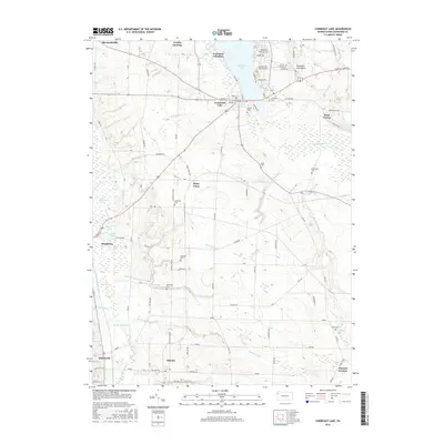
 2010 Conneaut Lake2010 Print · USGSCovers Vernon Township, including Conneaut Lake, West Fallowfield Township, and other nearby areas
 - 2010 Map of Meadville, 2010 Print
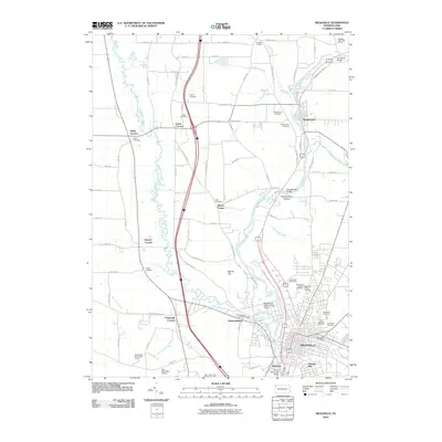 2010 Meadville2010 Print · USGSCovers Vernon Township, including Meadville, Saegertown, and other nearby areas
 - 2013 Map of Geneva, 2013 Print
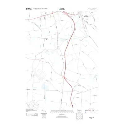 2013 Geneva2013 Print · USGSCovers Vernon Township, including Meadville, West Mead Township, and other nearby areas
 - 2013 Map of Conneaut Lake, 2013 Print
 2013 Conneaut Lake2013 Print · USGSCovers Vernon Township, including Conneaut Lake, West Fallowfield Township, and other nearby areas
 - 2013 Map of Harmonsburg, 2013 Print
 2013 Harmonsburg2013 Print · USGSCovers Vernon Township, including Summerhill Township, Dicksonburg, and other nearby areas
 - 2013 Map of Meadville, 2013 Print
 2013 Meadville2013 Print · USGSCovers Vernon Township, including Meadville, Saegertown, and other nearby areas
 - 2016 Map of Harmonsburg, 2016 Print
 2016 Harmonsburg2016 Print · USGSCovers Vernon Township, including Summerhill Township, Dicksonburg, and other nearby areas
 - 2016 Map of Meadville, 2016 Print
 2016 Meadville2016 Print · USGSCovers Vernon Township, including Meadville, Saegertown, and other nearby areas
 - 2016 Map of Conneaut Lake, 2016 Print
 2016 Conneaut Lake2016 Print · USGSCovers Vernon Township, including Conneaut Lake, West Fallowfield Township, and other nearby areas
Showing maps 1-25 of 34
Top cities near Vernon Township
- Meadville historical maps
- Greenville historical maps
- Cambridge Springs historical maps
- Spring Township historical maps
- Linesville historical maps
- Cochranton historical maps
See more
Top neighborhoods of Vernon Township
- Fredericksburg historical maps
- Keborts Corners historical maps
- Watson Run historical maps
- West Vernon historical maps
- Kerrtown historical maps
- Onspaugh Corners historical maps
See more
Frequently asked questions
- What are the different types of historical maps available for Vernon Township?
- What is the oldest map of Vernon Township?
- Where can I purchase historical maps of Vernon Township for my home or office?
- Where can I download high-res historical maps of Vernon Township?
- Are there historical topographic maps available for Vernon Township?
- Is there historical aerial imagery available for Vernon Township?
- Where are historical maps of Vernon Township sourced from?