Old Maps of West Mead Township, Pennsylvania for Academic Research
Study the evolution of West Mead Township with 32 high-resolution historic maps. Whether you're teaching, researching, or modeling changes in land use, these maps provide essential visual documentation of urban, environmental, and geographic change.
- Analyze long-term change: Track patterns in development, transportation, and natural features.
- Ideal for environmental or urban studies: Support academic projects with primary historical map data.
- Use in the classroom or lab: Educators and researchers rely on these maps to bring historical context to life.
These maps are a powerful tool for teaching, research, and visualizing how West Mead Township has changed over the decades.
West Mead Township, PA maps
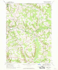
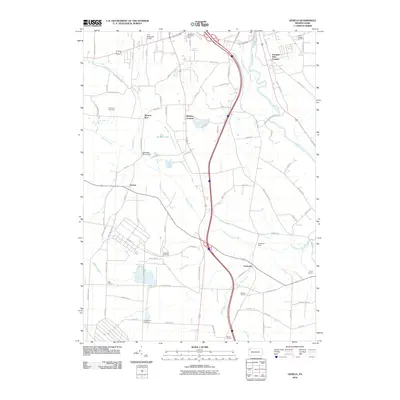
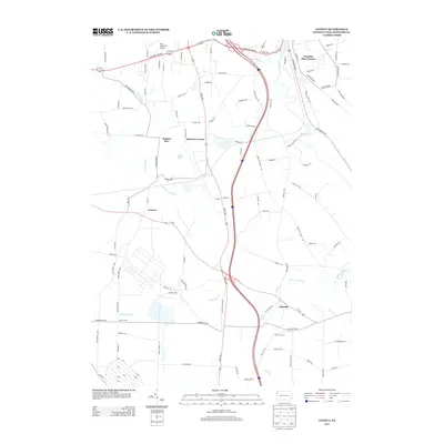
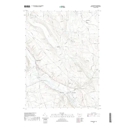
(32)- 1923 Map of Meadville, 1962 Print
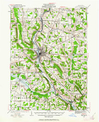 1923 Meadville1962 Print · USGSCrawford County's river valleys and rail corridors are captured here in the early 1920s, centered on the growing industrial hub of Meadville. Researchers can locate dozens of country schoolhouses like Huller School and trace the paths of the Erie R R and Perry Highway.
 - 1925 Map of Meadville
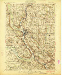 1925 Meadville1925 Print · USGSCrawford County settlements and rail corridors are captured in detail here during the mid-twenties. Genealogists can locate dozens of family-named schoolhouses and landmarks, from Booths Church to the County Farm and Frenchtown.3 unique versions available
 - 1943 Map of Meadville
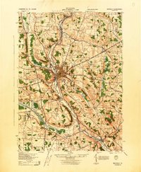 1943 Meadville1943 Print · USGSCrawford County's river valleys and rail corridors are captured in high detail in the early 1940s, centered on the bustling city of Meadville. Genealogists and researchers can trace local landmarks like the County Farm, dozens of rural schools such as Hatch Sch, and the winding path of the ERIE railroad.
 - 1950 Map of Cleveland
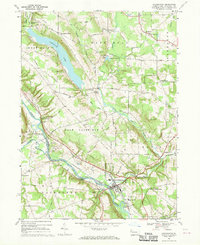
 1950 Cleveland1950 Print · USGSCovers West Mead Township, including Cleveland, Akron, and other nearby areas
 - 1956 Map of Cleveland, 1967 Print
 1956 Cleveland1967 Print · USGSNortheast Ohio and Western Pennsylvania are shown at their industrial height during the mid-fifties, from the steel mills to the lakeshore. Researchers can trace the massive Ravenna Arsenal, the Ohio Turnpike, and vanished rail sidings of the B & O RR.3 unique versions available
 - 1962 Map of Cleveland
 1962 Cleveland1962 Print · USGSNortheast Ohio and the Pennsylvania borderlands appear here during the industrial peak of the early sixties. Genealogists and historians can trace the expansive rail lines of the Nickel Plate Road and the growth of suburbs from Parma to Lyndhurst.
 - 1967 Map of Cochranton, 1970 Print
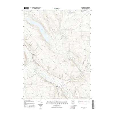
 1967 Cochranton1970 Print · USGSPennsylvania's Crawford County comes into focus during the late 1960s, showing a landscape shaped by the French Creek valley and the Erie-Lackawanna railroad. Genealogists can trace family names at numerous crossroads like Frenchtown and Kasters Corners or locate local landmarks including St Marks Ch and Ponce de Leon Spring.2 unique versions available
 - 1967 Map of Blooming Valley, 1970 Print
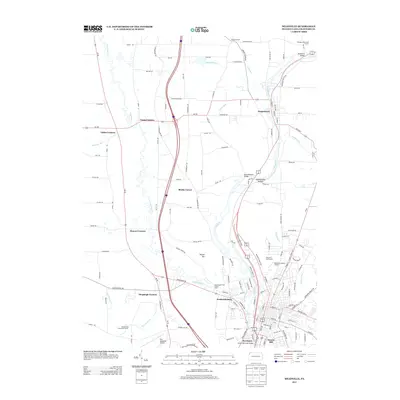
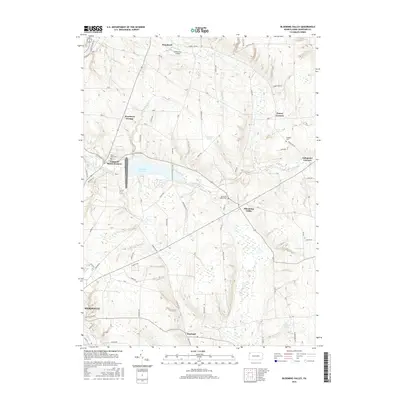
 1967 Blooming Valley1970 Print · USGSCrawford County's rural landscape is captured here in the late 1960s, showing the agricultural heartland between Woodcock and Blooming Valley. Researchers can trace family roots at Mt Blair Cem & Ch, Woodcock Grange, and the crossroads of Fountain House Corners.4 unique versions available
 - 1968 Map of Meadville, 1970 Print
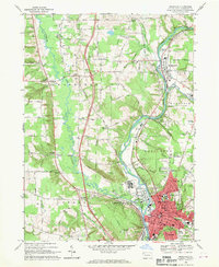 1968 Meadville1970 Print · USGSMeadville and the surrounding Crawford County townships are captured here in the late sixties as the valley’s industrial and civic life centered on the river. Genealogists and local historians can trace family-named crossroads like Onspaugh Corners or locate graves in St Agatha Cemetery and Greendale Cem.4 unique versions available
 - 1968 Map of Geneva, 1970 Print
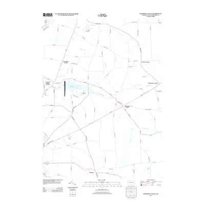
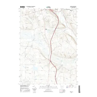
 1968 Geneva1970 Print · USGSCrawford County's rural townships and wetlands are captured in the late sixties as the new interstate began to reshape local transit. Genealogists and local historians can trace family-named sites like Anderson Cem and Allison Corners or the old rail lines at Buchanan Station.4 unique versions available
 - 1986 Map of Ashtabula
 1986 Ashtabula1986 Print · USGSThe Lake Erie shoreline and the rural borderlands of Ohio and Pennsylvania are captured here as they appeared in the 1980s. You can trace industrial rail lines like the BESSEMER AND LAKE ERIE or locate family sites near Kelloggsville Cem and Pymatuning State Park.2 unique versions available
 - 1998 Map of Meadville, 1999 Print
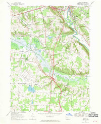
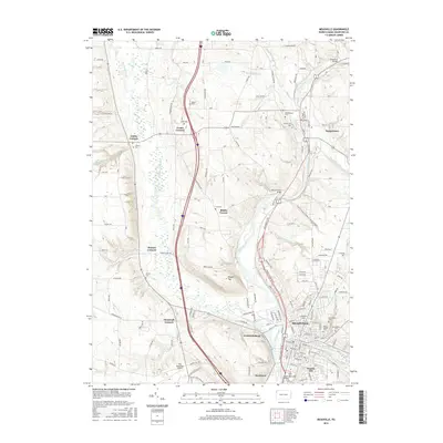
 1998 Meadville1999 Print · USGSMeadville and the French Creek valley are shown here at the close of the twentieth century, balancing industrial heritage with its role as an educational hub. Genealogists and historians can trace family sites at Littles Corners, explore the grounds of Allegheny College, and locate numerous local burials at Greendale Cem and St Agathas Cemetery.
 - 2010 Map of Cochranton, 2010 Print
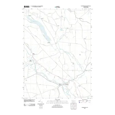 2010 Cochranton2010 Print · USGSCovers West Mead Township, including Cochranton, Randolph Township, and other nearby areas
 - 2010 Map of Geneva, 2010 Print
 2010 Geneva2010 Print · USGSCovers West Mead Township, including Meadville, Union Township, and other nearby areas
 - 2010 Map of Blooming Valley, 2010 Print
 2010 Blooming Valley2010 Print · USGSCovers West Mead Township, including Meadville, Blooming Valley, and other nearby areas
 - 2010 Map of Meadville, 2010 Print
 2010 Meadville2010 Print · USGSCovers West Mead Township, including Meadville, Saegertown, and other nearby areas
 - 2013 Map of Cochranton, 2013 Print
 2013 Cochranton2013 Print · USGSCovers West Mead Township, including Cochranton, Randolph Township, and other nearby areas
 - 2013 Map of Geneva, 2013 Print
 2013 Geneva2013 Print · USGSCovers West Mead Township, including Meadville, Union Township, and other nearby areas
 - 2013 Map of Meadville, 2013 Print
 2013 Meadville2013 Print · USGSCovers West Mead Township, including Meadville, Saegertown, and other nearby areas
 - 2013 Map of Blooming Valley, 2013 Print
 2013 Blooming Valley2013 Print · USGSCovers West Mead Township, including Meadville, Blooming Valley, and other nearby areas
 - 2016 Map of Meadville, 2016 Print
 2016 Meadville2016 Print · USGSCovers West Mead Township, including Meadville, Saegertown, and other nearby areas
 - 2016 Map of Cochranton, 2016 Print
 2016 Cochranton2016 Print · USGSCovers West Mead Township, including Cochranton, Randolph Township, and other nearby areas
 - 2016 Map of Blooming Valley, 2016 Print
 2016 Blooming Valley2016 Print · USGSCovers West Mead Township, including Meadville, Blooming Valley, and other nearby areas
 - 2016 Map of Geneva, 2016 Print
 2016 Geneva2016 Print · USGSCovers West Mead Township, including Meadville, Union Township, and other nearby areas
 - 2019 Map of Cochranton, 2019 Print
 2019 Cochranton2019 Print · USGSCovers West Mead Township, including Cochranton, Randolph Township, and other nearby areas
Showing maps 1-25 of 32
Top cities near West Mead Township
- Meadville historical maps
- Cambridge Springs historical maps
- Spring Township historical maps
- Cochranton historical maps
- Saegertown historical maps
- Salem historical maps
See more
Top neighborhoods of West Mead Township
Frequently asked questions
- What are the different types of historical maps available for West Mead Township?
- What is the oldest map of West Mead Township?
- Where can I purchase historical maps of West Mead Township for my home or office?
- Where can I download high-res historical maps of West Mead Township?
- Are there historical topographic maps available for West Mead Township?
- Is there historical aerial imagery available for West Mead Township?
- Where are historical maps of West Mead Township sourced from?