1900s (20th Century) Maps of Lower Swatara Township, Pennsylvania
Explore 28 historic maps of Lower Swatara Township from the 1900s (20th Century). These maps offer a rare glimpse into what life looked like during the 1900s — showing old roads, neighborhoods, homes, and landmarks that have changed or disappeared over time.
Whether you're researching your family's past, planning a metal detecting trip, or studying how Lower Swatara Township's landscape evolved across the 1900s, these high-resolution maps are a powerful tool for exploring the history of this region.
- Focus on a specific era: All maps on this page are from the 1900s, giving you a focused view of this time period.
- See what’s changed: Compare century-old streets, trails, and buildings to today's modern landscape using overlays and satellite layers.
- Research with precision: Use these maps for genealogy, historical research, land use analysis, or educational projects.
- View, download, or print: Maps are fully viewable online in high resolution, and can be downloaded or printed for your own records.
Start exploring Lower Swatara Township's history through authentic maps from the 1900s. This is your window into the past.
Lower Swatara Township, PA maps
(28)- 1906 Map of New Cumberland
 1906 New Cumberland1906 Print · USGSCentral Pennsylvania at the opening of the twentieth century shows a landscape transitioning from canal-era transit to a heavy rail and industrial economy. Genealogists can locate family landmarks like Shafer Schoolhouse, Salem Church, and the Middletown Ferry.8 unique versions available
 - 1908 Map of Middletown
 1908 Middletown1908 Print · USGSThe Susquehanna River corridor thrives in the early 1900s as a hub for the Pennsylvania Railroad and the burgeoning industry of Lancaster and Dauphin counties. Researchers can trace the path of the Pennsylvania Canal (Abandoned) and locate family-named landmarks like Shocks Mills or Hoffer Church.7 unique versions available
 - 1924 Map of Hummelstown
 1924 Hummelstown1924 Print · USGSDauphin and Lebanon Counties in the mid-twenties show a landscape defined by mountain gaps and the reach of the Philadelphia and Reading Railroad. Researchers can trace historic church sites like Walmers Church, early industries at Union Waterworks, and vanished rail stops like Cold Spring.
 - 1924 Map of Harrisburg
 1924 Harrisburg1924 Print · USGSThe Susquehanna River corridor at the state capital reveals a landscape of industrial river gaps and ridge-line valleys in the 1920s. Genealogists and historians can trace the paths of the Pennsylvania Canal and find landmarks like the State Lunatic Asylum and Fort Hunter.
 - 1943 Map of New Cumberland
 1943 New Cumberland1943 Print · USGSGreater Harrisburg and the lower Susquehanna valley appear here in the midst of the Second World War, showing a landscape of intense military and social transition. Researchers can trace family roots through numerous country landmarks like Eberlys Mill, the Methodist Orphanage, and Messiah Bible College.
 - 1943 Map of Middletown
 1943 Middletown1943 Print · USGSAs World War II mobilization reached its peak, this survey captures the Susquehanna River corridor as a vital industrial and rail artery. Genealogists and researchers can trace family landmarks like Donegal Springs Church, Codorus Furnace, and the early layout of Three Mile Island.
 - 1943 Map of Harrisburg
 1943 Harrisburg1943 Print · USGSThe Pennsylvania capital and its surrounding Susquehanna riverfront are seen here during the war years. Researchers can trace the extensive rail networks and find local landmarks like Fort Hunter, Good Hope Mills, and Wenrichs Ch.3 unique versions available
 - 1943 Map of Hummelstown
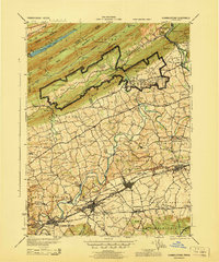 1943 Hummelstown1943 Print · USGSDauphin and Lebanon counties appear here during the Second World War as military and industrial growth transformed the countryside. Researchers can trace family landmarks and rural infrastructure, from Moonshine Ch and Union Deposit to the Hershey Zoo.
 - 1947 Map of Hummelstown
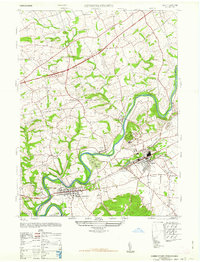 1947 Hummelstown1947 Print · USGSThe Pennsylvania countryside between Hummelstown and Hershey appears in the late 1940s as a mix of rural schools and corporate expansion. Trace the early layout of Hershey Zoo and Hershey Stadium alongside landmarks like Union Deposit and Stoverdale Station.2 unique versions available
 - 1947 Map of Harrisburg East
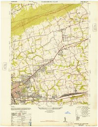 1947 Harrisburg East1947 Print · USGSDauphin County expansion is evident in the late 1940s as suburban communities like Progress and Paxtang grow alongside critical rail lines. Genealogists and historians can trace Prospect Hill Cemetery, the Abandoned Race Track, and early aviation at Penn-Harris Airport.4 unique versions available
 - 1950 Map of Harrisburg, 1952 Print
 1950 Harrisburg1952 Print · USGSMid-century Central Pennsylvania comes alive through its dense rail networks and river valley settlements during the post-war industrial era. Genealogists and historians can trace family roots through hubs like Harrisburg, locate Carlisle Barracks, or follow the Pennsylvania RR through the Lebanon Valley.
 - 1956 Map of New Cumberland, 1958 Print
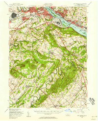 1956 New Cumberland1958 Print · USGSMid-century development meets deep-rooted Pennsylvania history as the post-war expansion of Harrisburg reaches toward the rural townships of York County. Trace family roots and local landmarks from Eberlys Mill and the Quaker Meetinghouse Cem to the sprawling Harrisburg State Airport.3 unique versions available
 - 1956 Map of Harrisburg, 1958 Print
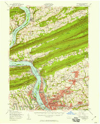 1956 Harrisburg1958 Print · USGSThe Pennsylvania state capital and its surrounding mountain gaps are captured here in the mid-1950s as suburban expansion met the Susquehanna's industrial riverfront. Trace the path of the Stony Creek Railroad or locate family roots at Good Hope Mills and the Rutter Sch.6 unique versions available
 - 1956 Map of Hummelstown, 1958 Print
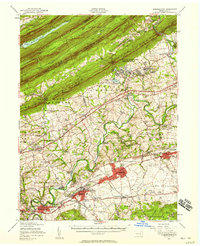 1956 Hummelstown1958 Print · USGSDauphin and Lebanon Counties are shown in the mid-1950s as the chocolate industry and military training shaped the local landscape. Genealogists and historians can trace family roots through labeled landmarks like Balsbaugh Ch, Harper Tavern, and the Manada Furnace.3 unique versions available
 - 1956 Map of Middletown, 1959 Print
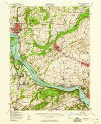 1956 Middletown1959 Print · USGSThe Susquehanna River corridor bustles with Cold War-era industry and riverside life in the mid-1950s. Genealogists and local researchers can trace family landmarks like Shenks Cem, identify regional education hubs such as Elizabethville College, or locate the sprawling Olmsted AFB.2 unique versions available
 - 1957 Map of Harrisburg
 1957 Harrisburg1957 Print · USGSMid-century Central Pennsylvania comes into focus as a bustling network of rail, river, and mountain ridges. Genealogists and historians can trace the development of the State Capitol and surrounding hubs like Middletown, Columbia, and Pottsville.7 unique versions available
 - 1961 Map of Harrisburg
 1961 Harrisburg1961 Print · USGSCentral Pennsylvania is shown at a mid-century peak of industrial and military activity, from the Susquehanna water gaps to the fertile Dutch Country. Genealogists and historians can trace the rail corridors of the Pennsylvania RR and find landmarks like Carlisle Barracks or the Anthracite Coal Fields.2 unique versions available
 - 1963 Map of Steelton, 1965 Print
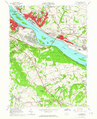 1963 Steelton1965 Print · USGSThe Susquehanna River corridor south of Harrisburg is shown here at its industrial and military peak in the early sixties. Genealogists can trace family names at Paddletown Cem and Fisher Cem or locate the historic Redland Friends Meetinghouse.3 unique versions available
 - 1963 Map of Middletown, 1965 Print
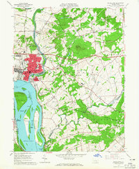 1963 Middletown1965 Print · USGSMiddletown and the lower Susquehanna River are captured in the early sixties as military and rail infrastructure dominated the shoreline. Trace family history and local industry through Olmsted AF Base, St Peters Ch, and the many islands like Three Mile Island.5 unique versions available
 - 1964 Map of Harrisburg
 1964 Harrisburg1964 Print · USGSCentral Pennsylvania in the mid-fifties reveals a landscape shaped by ridge-and-valley geology and critical Cold War infrastructure. Researchers can trace the massive Indiantown Gap Military Reservation or the rail corridors of the Pennsylvania RR and Reading RR.
 - 1969 Map of Harrisburg East, 1972 Print
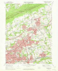 1969 Harrisburg East1972 Print · USGSDauphin County’s eastern suburbs were in a period of rapid mid-century growth as the interstate system reached the area. Researchers can trace the development of Colonial Park and Progress, locating family sites near Shoops Cemetery or the Reading rail line.3 unique versions available
 - 1969 Map of Hershey, 1972 Print
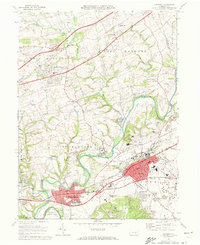 1969 Hershey1972 Print · USGSDauphin County’s industrial and institutional landscape is captured here during a period of significant regional growth. Researchers can trace the development of Hershey Park and the Hershey Medical Center alongside historic sites like Indian Echo Caverns.4 unique versions available
 - 1977 Map of Hershey, 1979 Print
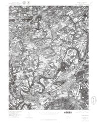 1977 Hershey1979 Print · USGSDauphin County's industrial and residential heart is captured here in the late seventies, showing the rapid development around its famous chocolate center. Researchers can trace the winding course of Swatara Creek past the established streets of Hummelstown, Hockersville, and Union Deposit.
 - 1984 Map of Harrisburg, 1985 Print
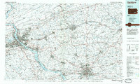 1984 Harrisburg1985 Print · USGSCentral Pennsylvania in the mid-eighties shows a landscape defined by the winding Susquehanna River and the industrial growth of its river towns. Researchers can trace the rail corridors of Amtrak and Conrail or explore the bounds of Fort Indiantown Gap Military Reservation.2 unique versions available
 - 1993 Map of Harrisburg East, 1999 Print
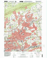 1993 Harrisburg East1999 Print · USGSDauphin County's eastern suburban corridor is captured here in the early nineties as residential growth expanded toward the base of BLUE MOUNTAIN. Researchers can trace family history through local landmarks like Shoops Cemetery, Harrisburg State Hospital, and the old CONRAIL rail lines.
Showing maps 1-25 of 28
Top cities near Lower Swatara Township
- Harrisburg historical maps
- York historical maps
- Colonial Park historical maps
- Hershey historical maps
- Elizabethtown historical maps
- Progress historical maps
See more
Top neighborhoods of Lower Swatara Township
- Freys Grove historical maps
- Woodridge historical maps
- Shope Gardens historical maps
- Greenwood Hills historical maps
Frequently asked questions
- What are the different types of historical maps available for Lower Swatara Township?
- What is the oldest map of Lower Swatara Township?
- Where can I purchase historical maps of Lower Swatara Township for my home or office?
- Where can I download high-res historical maps of Lower Swatara Township?
- Are there historical topographic maps available for Lower Swatara Township?
- Is there historical aerial imagery available for Lower Swatara Township?
- Where are historical maps of Lower Swatara Township sourced from?