1940s Maps of Lykens Township, Pennsylvania
Explore 6 historic maps of Lykens Township from the 1940s. These maps offer a rare glimpse into what life looked like during the 1940s — showing old roads, neighborhoods, homes, and landmarks that have changed or disappeared over time.
Whether you're researching your family's past, planning a metal detecting trip, or studying how Lykens Township's landscape evolved across the 1940s, these high-resolution maps are a powerful tool for exploring the history of this region.
- Focus on a specific era: All maps on this page are from the 1940s, giving you a focused view of this time period.
- See what’s changed: Compare century-old streets, trails, and buildings to today's modern landscape using overlays and satellite layers.
- Research with precision: Use these maps for genealogy, historical research, land use analysis, or educational projects.
- View, download, or print: Maps are fully viewable online in high resolution, and can be downloaded or printed for your own records.
Start exploring Lykens Township's history through authentic maps from the 1940s. This is your window into the past.
Lykens Township, PA maps
(6)- 1943 Map of Millersburg
 1943 Millersburg1943 Print · USGSDauphin and Northumberland counties appear here during the mid-1940s, defined by the river-and-rail economy along the Susquehanna River. Researchers can trace the heritage of small valley towns through landmarks like St Johns Church, Morning Glory School, and the Limestone Quarries.
 - 1943 Map of Lykens
 1943 Lykens1943 Print · USGSDauphin and Schuylkill counties are shown in the 1940s as a high-density corridor of anthracite coal production and valley farming. Genealogists and industrial historians can trace the Reading rail lines connecting Williamstown to an Abandoned Colliery and rural landmarks like Himmels Ch.
 - 1947 Map of Elizabethville
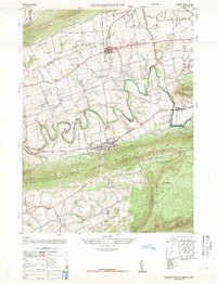 1947 Elizabethville1947 Print · USGSPost-war Dauphin County unfolds across the Lykens Valley in this mid-century survey of rural townships and mountain ridges. Genealogists can trace family roots through numerous local landmarks like Maple Grove Cem, Straw Church & Cem, and the Pennsylvania RR corridor.2 unique versions available
 - 1947 Map of Klingerstown
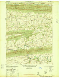 1947 Klingerstown1947 Print · USGSThe rural borderlands of Northumberland and Schuylkill counties are captured here just after the war. Genealogists can trace family names through landmarks like St Peters-Himmels Church, the Kissingers School, and the village of Rough and Ready.2 unique versions available
 - 1947 Map of Pillow
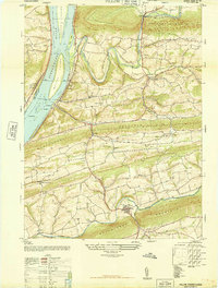 1947 Pillow1947 Print · USGSThe river and ridge country of Dauphin and Northumberland Counties comes alive in this post-war survey. Genealogists can trace family roots through numerous local landmarks like Withers School, St Pauls Church, and the riverfront at Port Trevorton.3 unique versions available
 - 1947 Map of Lykens
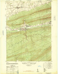 1947 Lykens1947 Print · USGSDauphin County’s northern coal valleys are captured here in the late 1940s, showing the industrial pulse of the region between massive mountain ridges. Researchers can trace the rail spurs of the Reading line and locate landmarks like the Anthracite Plant, Salladas School, and the County Fair Grounds.3 unique versions available
End of results
Showing maps 1-6 of 6
Top cities near Lykens Township
- Sunbury historical maps
- Shamokin historical maps
- Selinsgrove historical maps
- Hegins Township historical maps
- East Hanover Township historical maps
- Lykens historical maps
See more
Top neighborhoods of Lykens Township
Frequently asked questions
- What are the different types of historical maps available for Lykens Township?
- What is the oldest map of Lykens Township?
- Where can I purchase historical maps of Lykens Township for my home or office?
- Where can I download high-res historical maps of Lykens Township?
- Are there historical topographic maps available for Lykens Township?
- Is there historical aerial imagery available for Lykens Township?
- Where are historical maps of Lykens Township sourced from?