Old Maps of Upper Providence Township, Pennsylvania for Academic Research
Study the evolution of Upper Providence Township with 22 high-resolution historic maps. Whether you're teaching, researching, or modeling changes in land use, these maps provide essential visual documentation of urban, environmental, and geographic change.
- Analyze long-term change: Track patterns in development, transportation, and natural features.
- Ideal for environmental or urban studies: Support academic projects with primary historical map data.
- Use in the classroom or lab: Educators and researchers rely on these maps to bring historical context to life.
These maps are a powerful tool for teaching, research, and visualizing how Upper Providence Township has changed over the decades.
Upper Providence Township, PA maps
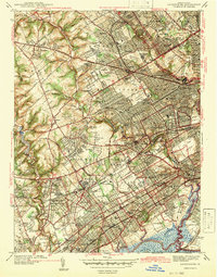
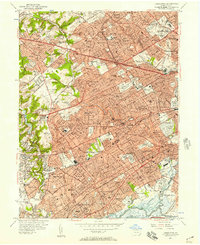
(22)- 1894 Map of Chester, 1954 Print
 1894 Chester1954 Print · USGSThe Delaware River corridor near Chester was a hive of rail activity and water-powered industry at the close of the century. Genealogists and historians can trace family-named mills such as Llewellyn Mills or visit the campus of the Williamson School and the borough of Media.2 unique versions available
 - 1896 Map of Chester
 1896 Chester1896 Print · USGSThe industrial corridor along the Delaware River thrives at the close of the nineteenth century as railroads and mills reshape the landscape. Genealogists can trace early homesteads and institutions like the Williamson School, Sharon Academy, and Sycamore Mills.
 - 1898 Map of Chester
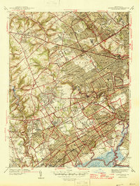
 1898 Chester1898 Print · USGSThe Delaware River shoreline at the end of the nineteenth century reveals a landscape of industrial riverfronts and emerging mill towns. Genealogists and historians can trace family roots through numerous small settlements and institutions like Village Green, Booth Corner, and the Williamson School.10 unique versions available
 - 1901 Map of Camden
 1901 Camden1901 Print · USGSThe Delaware River valley at the turn of the century shows a bustling corridor of early industrial growth and established mill towns. Researchers can trace the heritage of local industry at Sycamore Mills or locate early settlements like Penns Grove and Village Green.3 unique versions available
 - 1942 Map of Camden
 1942 Camden1942 Print · USGSThe Philadelphia and Camden metropolitan corridor is captured here at the height of the Second World War. Genealogists and historians can trace rail networks like the Reading R.R. and locate communities from Swedesboro to Merchantville.
 - 1942 Map of Lansdowne
 1942 Lansdowne1942 Print · USGSDelaware County townships thrive just before the mid-century, showing a landscape of dense residential growth and institutional landmarks. Genealogists can trace family sites near Holy Cross Cemetery or old rail hubs like Morton Sta and Lansdowne Sta.
 - 1945 Map of Media
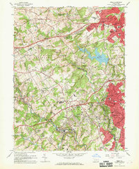
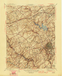 1945 Media1945 Print · USGSDelaware County is captured here in the mid-1940s, a period when traditional country estates and institutional campuses began meeting suburban expansion. Researchers can trace historic family landmarks like Tyler Arboretum, find old school sites like Sleighton Farm School, and locate the mills of Glen Riddle.2 unique versions available
 - 1946 Map of Lansdowne
 1946 Lansdowne1946 Print · USGSDelaware County enters the post-war era as a thriving network of rail-connected suburbs and institutional landmarks. Genealogists can trace family plots across Arlington Cemetery or locate old community hubs like Leipers Ch and Swarthmore College.2 unique versions available
 - 1946 Map of Wilmington, 1948 Print
 1946 Wilmington1948 Print · USGSThe Delaware Valley and Jersey Shore emerge in this mid-century portrait of a region defined by river commerce and seaside growth. Genealogists and historians can trace the rail networks of the Pennsylvania Railroad, locate early airfields like Dover Airpark, and find river defenses at Fort Delaware.2 unique versions available
 - 1955 Map of Wilmington
 1955 Wilmington1955 Print · USGSThe Delaware Valley and Jersey Shore are seen here during the mid-fifties era of rapid suburban expansion and highway development. You can trace the path of the New Jersey Turnpike, locate the Fort Dix Military Reservation, or explore the rail networks of the Pennsylvania Railroad.
 - 1955 Map of Media
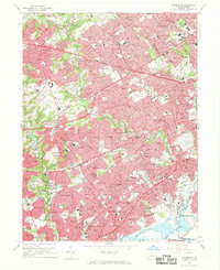
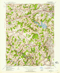 1955 Media1955 Print · USGSMid-century Delaware County was a landscape of significant private institutions and emerging suburbs just before the full suburban boom. Genealogists and researchers can trace local landmarks like Tyler Arboretum, the Williamson Trade School, and the historic rail junction at Wawa.2 unique versions available
 - 1956 Map of Lansdowne, 1957 Print
 1956 Lansdowne1957 Print · USGSEastern Delaware County was reaching its mid-century peak of suburban rail-and-road density in the 1950s. Researchers can trace historic property lines near Swarthmore College, locate ancestral sites in Holy Cross Cemetery, and follow the busy Pennsylvania Railroad corridor through Lansdowne and Darby.2 unique versions available
 - 1957 Map of Wilmington
 1957 Wilmington1957 Print · USGSThe mid-Atlantic coastal plain comes alive in the mid-fifties as the New Jersey Turnpike and Garden State Parkway redefine travel. Researchers can trace the rail-to-road transition and find landmarks like Ship John Shoal Light and the Fort Dix Military Reservation.2 unique versions available
 - 1959 Map of Wilmington
 1959 Wilmington1959 Print · USGSThe Delaware Valley and Jersey Shore are seen here in the late fifties, during a period of massive suburban and highway expansion. Researchers can trace mid-century infrastructure like the N J Turnpike or locate coastal landmarks from Barnegat Bay to the Maurice River.3 unique versions available
 - 1966 Map of Media, 1968 Print
 1966 Media1968 Print · USGSDelaware County is captured here in the mid-1960s as suburban expansion meets the region's historic institutional estates. Researchers can trace family roots at Sleighton Farm School, locate the Tyler Arboretum, or follow the Penn Central line through Wawa.3 unique versions available
 - 1966 Map of Wilmington, 1968 Print
 1966 Wilmington1968 Print · USGSThe Delaware Valley and Jersey Shore are seen here in the mid-1960s, documenting a landscape of dense industrial cities and emerging coastal resorts. Researchers can trace the sprawling rail networks of the Pennsylvania Railroad or locate landmarks like Fort Dix Military Reservation and Elk Neck State Park.4 unique versions available
 - 1967 Map of Lansdowne, 1969 Print
 1967 Lansdowne1969 Print · USGSDelaware County and West Philadelphia underwent significant suburban maturation during the mid-sixties. Researchers can trace family ties through numerous local landmarks like Swarthmore College, SS Peter and Paul Cemetery, and the Little Flower Institute.4 unique versions available
 - 1972 Map of Wilmington, 1976 Print
 1972 Wilmington1976 Print · USGSThe Delaware Valley and Jersey Shore are seen here in the 1970s, showcasing the region's dense transport networks and vast state forests. Trace early coastal development near Atlantic City or locate rural landmarks like Mount Holly and Dover Air Force Base.2 unique versions available
 - 1984 Map of Wilmington, 1986 Print
 1984 Wilmington1986 Print · USGSThe Delaware Valley in the mid-eighties was a powerhouse of transit and industry where Delaware, New Jersey, Pennsylvania, and Maryland meet. Researchers can trace the sprawling rail networks of SEPTA and PATCO or locate historic sites like Fort Delaware State Park and Valley Forge State Forest.2 unique versions available
 - 1995 Map of Media, 1999 Print
 1995 Media1999 Print · USGSThe Delaware County suburbs of Media and Newtown Square appear in the mid-1990s as a landscape of established estates and modern developments. Genealogists and historians can trace institutional landmarks like Sleighton Farm School, the Fair Acres County Home, and Bowling Green Cem.
 - 2023 Map of Media, 2023 Print
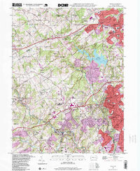
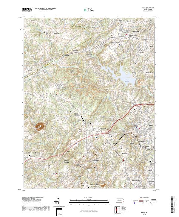 2023 Media2023 Print · USGSThe suburbs of Delaware County are shown in fine detail during the early 2020s, revealing a landscape where modern development meets centuries of Quaker history. Local researchers can trace family roots at Sandy Bank Burial Ground, the Willistown Friends Cem, and the colonial-era site of Sycamore Mills.
 - 2023 Map of Lansdowne, 2023 Print
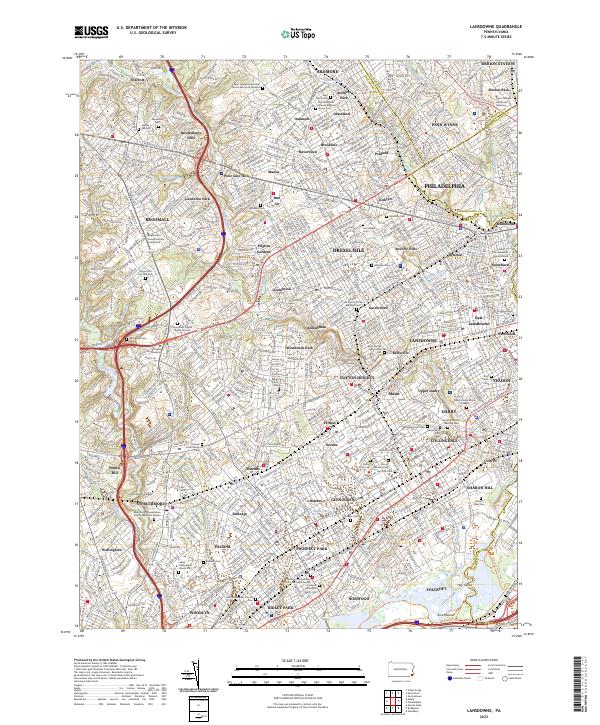 2023 Lansdowne2023 Print · USGSThe suburban development of Delaware County and Philadelphia's western edge is shown here in detail. Genealogy researchers can trace family plots at the Old Haverford Friends Meeting House or the Darby-Friends Burial Ground.
End of results
Showing maps 1-22 of 22
Top cities near Upper Providence Township
- Philadelphia historical maps
- Upper Darby historical maps
- Wilmington historical maps
- Chester historical maps
- Cheltenham Township historical maps
- Norristown historical maps
See more
Top neighborhoods of Upper Providence Township
- Worrell historical maps
- Rose Tree historical maps
- Blue Hill historical maps
- Moylan historical maps
- Sycamore Mills historical maps
Frequently asked questions
- What are the different types of historical maps available for Upper Providence Township?
- What is the oldest map of Upper Providence Township?
- Where can I purchase historical maps of Upper Providence Township for my home or office?
- Where can I download high-res historical maps of Upper Providence Township?
- Are there historical topographic maps available for Upper Providence Township?
- Is there historical aerial imagery available for Upper Providence Township?
- Where are historical maps of Upper Providence Township sourced from?