2020s Maps of Benezette Township, Pennsylvania
Explore 8 historic maps of Benezette Township from the 2020s. These maps offer a rare glimpse into what life looked like during the 2020s — showing old roads, neighborhoods, homes, and landmarks that have changed or disappeared over time.
Whether you're researching your family's past, planning a metal detecting trip, or studying how Benezette Township's landscape evolved across the 2020s, these high-resolution maps are a powerful tool for exploring the history of this region.
- Focus on a specific era: All maps on this page are from the 2020s, giving you a focused view of this time period.
- See what’s changed: Compare century-old streets, trails, and buildings to today's modern landscape using overlays and satellite layers.
- Research with precision: Use these maps for genealogy, historical research, land use analysis, or educational projects.
- View, download, or print: Maps are fully viewable online in high resolution, and can be downloaded or printed for your own records.
Start exploring Benezette Township's history through authentic maps from the 2020s. This is your window into the past.
Benezette Township, PA maps
(8)- 2023 Map of Driftwood, 2023 Print
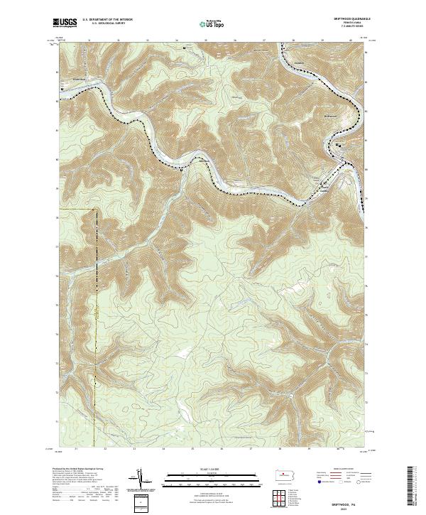 2023 Driftwood2023 Print · USGSThe confluence of the Sinnemahoning Creek branches in the early twenty-first century reveals a landscape shaped by narrow valleys and river-bound settlements. Researchers can locate several burial grounds, including Saint James Catholic Cem and Mix Cem, alongside the historic streets of Driftwood.
 - 2023 Map of Dents Run, 2023 Print
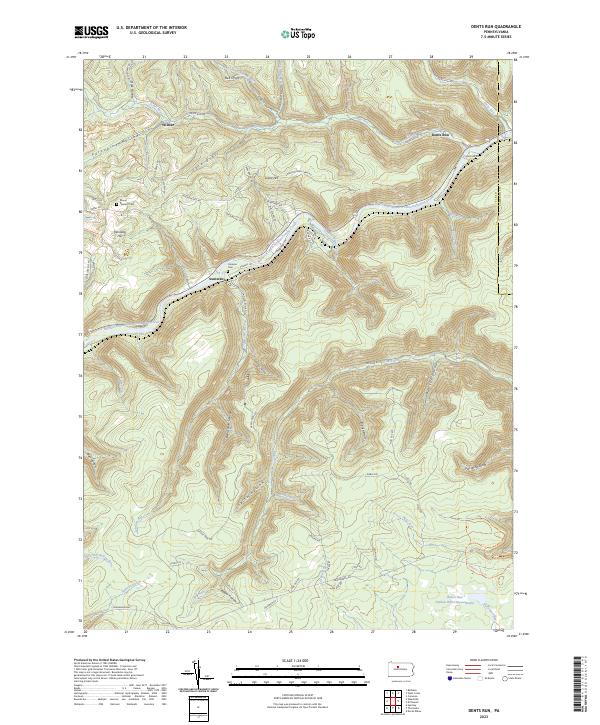 2023 Dents Run2023 Print · USGSElk County’s deep valleys and high ridges are shown here in the 2020s, centered on the Bennett Branch Sinnemahoning Creek corridor. Researchers can locate remote settlements like Sumerson and Wilmer, or trace family sites at Mount Pleasant Cem and Johnson Cem.
 - 2023 Map of Devils Elbow, 2023 Print
 2023 Devils Elbow2023 Print · USGSThe rugged junction of Clearfield, Elk, and Cameron counties is captured here in the 2020s, showing a landscape defined by deep creek valleys. Researchers can trace the winding paths of Mosquito Creek and find locations like Piper and Arnold Mountain.
 - 2023 Map of West Creek, 2023 Print
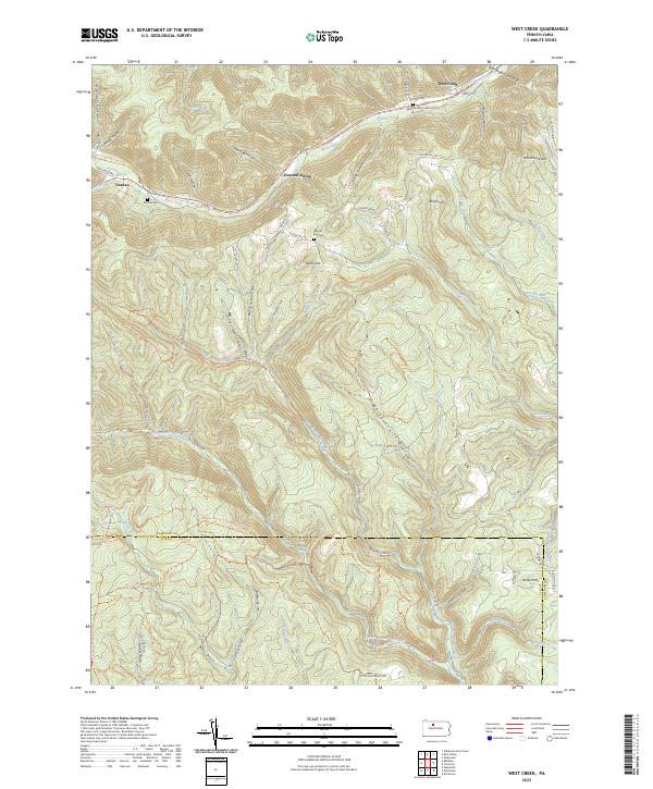 2023 West Creek2023 Print · USGSCameron and Elk counties meet in this 2020s survey of the Pennsylvania Wilds, a landscape defined by deep hollows and remote ridges. Genealogists can trace family names at Morrison Cem or Moore Hill Cem and explore the legacy of Howard Siding and Truman.
 - 2023 Map of The Knobs, 2023 Print
 2023 The Knobs2023 Print · USGSClearfield and Elk Counties appear here in the early twenty-first century, showing a landscape defined by high ridges and deep runs. Trace the historical paths of the Caledonia Pike and the Elk Co Clearfield Co line near The Big Knob.
 - 2023 Map of Huntley, 2023 Print
 2023 Huntley2023 Print · USGSNorthern Clearfield County is shown here as a sprawling territory of state forests and parks during the early twenty-first century. Researchers can trace the rugged topography of Chestnut Ridge and find local landmarks such as Huntley, Panther Rocks, and Medix Run.
 - 2023 Map of Rathbun, 2023 Print
 2023 Rathbun2023 Print · USGSThe borderlands of Elk and Cameron counties come into focus in the 2020s, showing the deep valley of West Creek. Trace local history through the Market Cem and the small settlements of Rathbun, Beechwood, and Swissmont.
 - 2023 Map of Weedville, 2023 Print
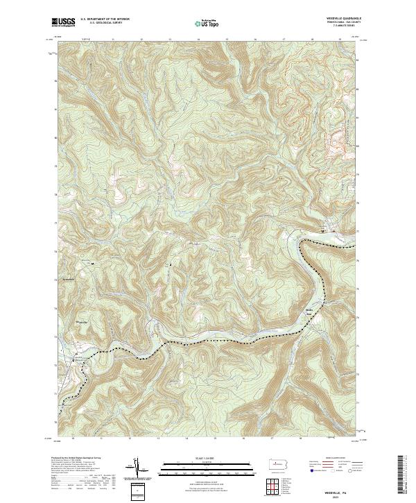 2023 Weedville2023 Print · USGSElk County’s deep valleys and timbered ridges are captured in this modern survey of the Bennett Branch valley. Researchers can trace the layout of mountain settlements and find local burial sites like Saint Joseph Cem and the Weedville United Methodist Cem.
End of results
Showing maps 1-8 of 8
Top cities near Benezette Township
- Saint Marys historical maps
- Emporium historical maps
- Karthaus Township historical maps
- Goshen Township historical maps
- Driftwood historical maps
Top neighborhoods of Benezette Township
- Grant historical maps
- Sumerson historical maps
- Dents Run historical maps
- Wilmer historical maps
- Medix Run historical maps
Frequently asked questions
- What are the different types of historical maps available for Benezette Township?
- What is the oldest map of Benezette Township?
- Where can I purchase historical maps of Benezette Township for my home or office?
- Where can I download high-res historical maps of Benezette Township?
- Are there historical topographic maps available for Benezette Township?
- Is there historical aerial imagery available for Benezette Township?
- Where are historical maps of Benezette Township sourced from?