Old Maps of Jay Township, Pennsylvania
Explore 26 old maps of Jay Township, spanning from 1929 to today. These high-resolution historic maps reveal how streets, neighborhoods, landmarks, and natural features evolved over time — perfect for genealogy, metal detecting, research, and local history exploration.
What you can do with these maps:
- See how Jay Township changed over time: Compare historical maps to modern-day views to trace roads, homesites, rail lines & more.
- View detailed metadata: Each map includes creators, publishers, year, scale, and archive source.
- Overlay maps with satellite & LiDAR: Visualize the past alongside modern tools to explore terrain & human change.
- Trusted historical sources: Maps sourced from the USGS, Library of Congress, and other archives.
- Access maps your way: View online, download high-res files, or order prints for personal or research use.
Start exploring old maps of Jay Township to uncover forgotten places, hidden landmarks, and the deep history beneath your feet.
Jay Township, PA maps
(26)- 1929 Map of Clearfield
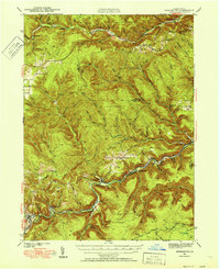
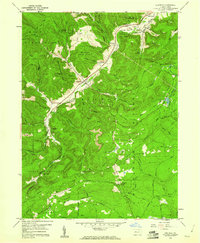
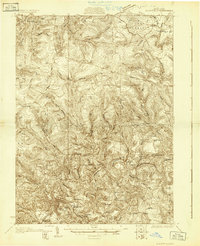 1929 Clearfield1929 Print · USGSThe riverfront and rail lines of central Pennsylvania come alive in this late 1920s survey of the West Branch Susquehanna River valley. Genealogists and historians can trace the foundations of local society through landmarks like the Leonard Waterford Sch and the rural crossroads of LeContes Mills.2 unique versions available
 - 1929 Map of Penfield, 1954 Print
 1929 Penfield1954 Print · USGSCentral Pennsylvania's rugged plateau and coal regions are mapped here in the late twenties, showing the intersection of major rail lines and isolated mountain communities. Genealogists can locate family landmarks like the Hoover Farm and several vanished rural schoolhouses including Hickory Sch and Laborde Sch.3 unique versions available
 - 1932 Map of Clearfield
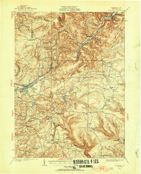
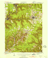
 1932 Clearfield1932 Print · USGSClearfield and the West Branch of the Susquehanna are captured here in the early 1930s as a vital hub of rail and river industry. Researchers can trace ancestral locations through numerous rural landmarks like Lecontes Mills, Goshen Ch, and Mt Sinai Sch.4 unique versions available
 - 1932 Map of Penfield
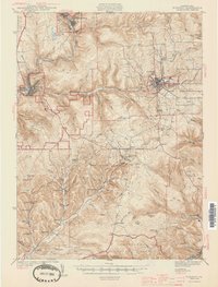
 1932 Penfield1932 Print · USGSClearfield County is shown in the early thirties at a time when mountain railroads and forest management defined the region. Local historians can trace the paths of the Pennsylvania RR through Penfield or locate schools such as Coal Hill Sch and Hickory Sch.3 unique versions available
 - 1941 Map of Benezette, 1952 Print
 1941 Benezette1952 Print · USGSElk County at the start of the 1940s reveals a network of valley settlements defined by the Pennsylvania RR and Sinnemahoning Creek. Researchers can trace rural life through scattered landmarks like Mt Zion Ch, Rathbun Sch, and the high point at Winslow Hill.3 unique versions available
 - 1941 Map of Ridgway, 1956 Print
 1941 Ridgway1956 Print · USGSElk County at the start of the 1940s reveals a landscape shaped by coal mining and heavy rail industry. Genealogists can locate family homes near Dagus Mines or trace the early foundations of Ridgway and St. Marys.2 unique versions available
 - 1943 Map of Benezette
 1943 Benezette1943 Print · USGSElk and Cameron counties are captured during the early 1940s, showing a landscape of deep timber-run hollows and active rail corridors. Local historians can locate vanished schoolhouses like Rathbun Sch, mountain churches such as Mt Zion Ch, and the winding tracks of the Pennsylvania railroad.2 unique versions available
 - 1944 Map of Ridgway
 1944 Ridgway1944 Print · USGSElk County at the height of its industrial rail era reveals a landscape of coal mines and mountain settlements. Trace the operations of the Toby Mine and Kyler Mine or find family roots at Decker Chapel and Gardner Hill Sch.3 unique versions available
 - 1957 Map of Warren, 1964 Print
 1957 Warren1964 Print · USGSThe northern Pennsylvania oil and timber country comes into focus in the mid-fifties, showing the region before modern highway expansions. Trace the industrial rail networks of the Pennsylvania RR and the early Allegheny River Reservoir near Warren and Oil City.4 unique versions available
 - 1958 Map of Warren
 1958 Warren1958 Print · USGSNorthern Pennsylvania’s timber and oil country is captured here during the late fifties, showing the interplay of industrial valleys and vast state forests. Genealogists can trace family connections across the Cornplanter Indian Reservation or through rail hubs like Oil City and Saint Marys.
 - 1959 Map of Warren
 1959 Warren1959 Print · USGSNorthern Pennsylvania's oil and timber country comes alive in this late-fifties study of the forest-clad plateaus. Trace the historic Cornplanter (Indian Reservation), the sprawling Oil Field, and the rail lines of the Pennsylvania RR.2 unique versions available
 - 1959 Map of Huntley, 1960 Print
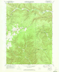
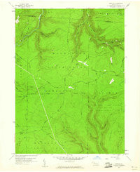 1959 Huntley1960 Print · USGSThe high woods of Clearfield and Elk counties are captured here at the end of the 1950s, showing a land balanced between resource extraction and recreation. Researchers can trace early energy development at various Gas Well sites or locate landmarks like Panther Rocks and Parker Dam State Park.3 unique versions available
 - 1959 Map of Penfield, 1960 Print
 1959 Penfield1960 Print · USGSClearfield County is shown at a mid-century peak of resource extraction and forestry during the late 1950s. Genealogists and historians can trace rail-side settlements like Penfield and Winterburn, or locate family sites near the Mt Pleasant Cem and Laurel Run Cem.5 unique versions available
 - 1969 Map of Rathbun, 1972 Print
 1969 Rathbun1972 Print · USGSElk and Cameron counties are shown here in the late sixties as a landscape of remote mountain rail stops and state-managed timberlands. Genealogists can trace family footprints near Rathbun and Beechwood or locate the Cem and Strip Mine works near Goetz Summit.3 unique versions available
 - 1969 Map of Saint Marys, 1972 Print
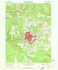 1969 Saint Marys1972 Print · USGSElk County at the close of the 1960s shows a thriving mountain community defined by its Catholic heritage and coal-country industry. Genealogists and local historians can trace landmarks like Decker Chapel, Sacred Heart Ch, and the Strip Mines around Grandview.3 unique versions available
 - 1970 Map of Kersey, 1972 Print
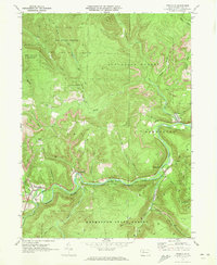
 1970 Kersey1972 Print · USGSThe Elk County coal and timber country is captured here in the early seventies, showing a landscape shaped by resource extraction. Local historians can trace the Penn Central rail line and locate specific operations at Dagus Mines, Coal Hollow, and Byrnedale.3 unique versions available
 - 1970 Map of Weedville, 1973 Print
 1970 Weedville1973 Print · USGSElk County at the start of the 1970s reveals a rugged coal and gas landscape along the Bennett Branch Sinnemahoning Creek. Trace the path of the Penn Central rail line through Weedville and Benezette, or locate family sites at Mt Zion Ch and Gray Cem.3 unique versions available
 - 1971 Map of Warren
 1971 Warren1971 Print · USGSNorth Central Pennsylvania is captured here in the early seventies, showing a landscape defined by industrial centers and massive state forests. Genealogists and historians can trace the rail lines of the Penn Central and Erie Lackawanna connecting towns like Warren, Kane, and Du Bois.
 - 1983 Map of Clearfield, 1984 Print
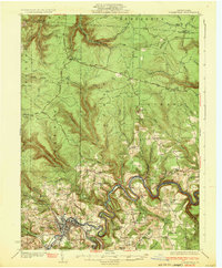
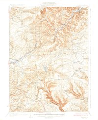
 1983 Clearfield1984 Print · USGSPennsylvania's coal and timber heartland is captured in the early eighties as industrial hubs like Du Bois and Saint Marys thrived among the state forests. Genealogists can locate family landmarks like Morningside Cemetery, the old works at Dagus Mines, and the rural community of Byrnedale.
 - 1993 Map of Penfield, 1998 Print
 1993 Penfield1998 Print · USGSClearfield County's timber and rail history is etched into the landscape during the 1990s as the Penn Central line winds through the Bennett Branch valley. Genealogists and researchers can trace family landmarks like Mt Pleasant Cem, Bundy Cem, and the quiet settlements of Winterburn and Hollywood.
 - 2023 Map of Penfield, 2023 Print
 2023 Penfield2023 Print · USGSThe Elk and Clearfield County line comes alive in the modern era, showing the mountain settlements of Penfield and Winterburn. Genealogists can trace family heritage at Mount Pleasant Cem and Bundy Cem or explore the S.B. Elliott State Park Snowmobile Trails Trl.
 - 2023 Map of Kersey, 2023 Print
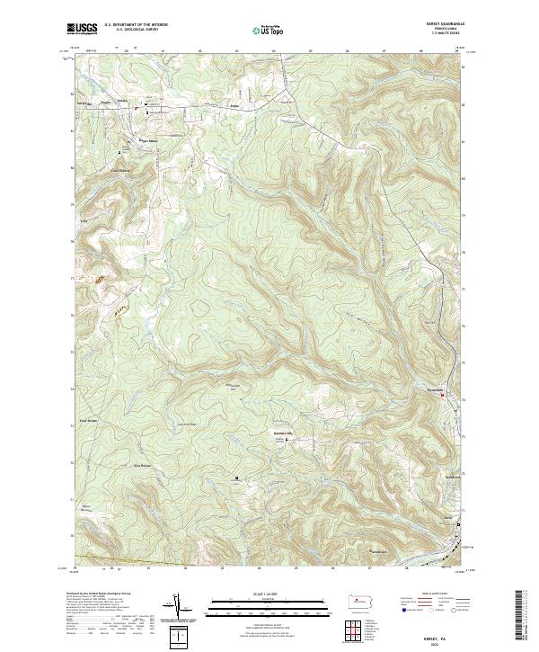 2023 Kersey2023 Print · USGSElk County at the edge of the plateau reveals a landscape shaped by early mining and mountain settlements. Genealogists can trace family names at Elkton Cem or Maria Lutheran Cem and locate industrial landmarks like Dagus Mines and Coal Hollow.
 - 2023 Map of Saint Marys, 2023 Print
 2023 Saint Marys2023 Print · USGSSt. Marys and the surrounding Elk County hills appear in detail in the 2020s, showing a landscape defined by industry and faith. Genealogists can locate several key burial sites including Saint Michael's Cem and the Saint Joseph Convent Cem.
 - 2023 Map of Huntley, 2023 Print
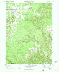
 2023 Huntley2023 Print · USGSNorthern Clearfield County is shown here as a sprawling territory of state forests and parks during the early twenty-first century. Researchers can trace the rugged topography of Chestnut Ridge and find local landmarks such as Huntley, Panther Rocks, and Medix Run.
 - 2023 Map of Rathbun, 2023 Print
 2023 Rathbun2023 Print · USGSThe borderlands of Elk and Cameron counties come into focus in the 2020s, showing the deep valley of West Creek. Trace local history through the Market Cem and the small settlements of Rathbun, Beechwood, and Swissmont.
Showing maps 1-25 of 26
Top cities near Jay Township
- Saint Marys historical maps
- Sandy Township historical maps
- Johnsonburg historical maps
- Goshen Township historical maps
- Benezette Township historical maps
Top neighborhoods of Jay Township
- Caledonia historical maps
- Force historical maps
- Weedville historical maps
- Byrnedale historical maps
- Scattertown historical maps
Frequently asked questions
- What are the different types of historical maps available for Jay Township?
- What is the oldest map of Jay Township?
- Where can I purchase historical maps of Jay Township for my home or office?
- Where can I download high-res historical maps of Jay Township?
- Are there historical topographic maps available for Jay Township?
- Is there historical aerial imagery available for Jay Township?
- Where are historical maps of Jay Township sourced from?