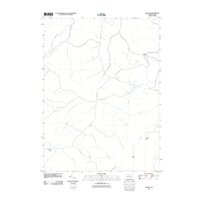
2010 Map of Huntley
USGS Topo · Published 2010About this map
Huntley serves as the primary focal point of this 2010 survey, located at the confluence where Medix Run meets the Jack Dent Branch. The landscape is defined by its intricate drainage systems, including the headwaters of Trout Run and Saunders Run, which carve through the high ground of Chestnut Ridge. This region is characterized by its legacy of resource extraction and transit, evidenced by the presence of Wallace Mine Rd and the long-established Caledonia Pike. To the southwest, the distinctive geological formation of Panther Rocks stands near the source of Little Laurel Run. The map provides a look at the network of forest roads like Shaggers Inn Rd and McGeorge Rd that provide access to the remote hollows, such as Bee Hollow, where numerous small runs like Pray Run and Alex Branch converge.
Find a feature on this map
37 named features on this map. Tap any name to fly to it.
Don’t see what you’re looking for? This feature index may not catch every label — zoom into the map to look around manually.
Map Details
Editions of this 2010 Huntley Map
This is the sole edition of this map. No revisions or reprints were ever made.
Other maps of this area

1929 · Clearfield
USGS Topo · 1:48,000

1929 · Penfield
USGS Topo · 1:62,500

1932 · Clearfield
USGS Topo · 1:62,500

1932 · Penfield
USGS Topo · 1:62,500

1941 · Benezette
USGS Topo · 1:62,500

1941 · Ridgway
USGS Topo · 1:62,500

1943 · Benezette
USGS Topo · 1:62,500

1944 · Ridgway
USGS Topo · 1:62,500

1957 · Warren
USGS Topo · 1:250,000

1958 · Warren
USGS Topo · 1:250,000