2020s Maps of Springfield Township, Pennsylvania
Explore 6 historic maps of Springfield Township from the 2020s. These maps offer a rare glimpse into what life looked like during the 2020s — showing old roads, neighborhoods, homes, and landmarks that have changed or disappeared over time.
Whether you're researching your family's past, planning a metal detecting trip, or studying how Springfield Township's landscape evolved across the 2020s, these high-resolution maps are a powerful tool for exploring the history of this region.
- Focus on a specific era: All maps on this page are from the 2020s, giving you a focused view of this time period.
- See what’s changed: Compare century-old streets, trails, and buildings to today's modern landscape using overlays and satellite layers.
- Research with precision: Use these maps for genealogy, historical research, land use analysis, or educational projects.
- View, download, or print: Maps are fully viewable online in high resolution, and can be downloaded or printed for your own records.
Start exploring Springfield Township's history through authentic maps from the 2020s. This is your window into the past.
Springfield Township, PA maps
(6)- 2023 Map of Kingwood, 2023 Print
 2023 Kingwood2023 Print · USGSSomerset County's ridge-and-valley landscape is documented here in the early twenty-first century, showing the enduring rural character of Laurel Hill. Genealogists can trace deep local roots through family landmarks like the John Younkin Family Graveyard and Schrock Family Cem.
 - 2023 Map of South Connellsville, 2023 Print
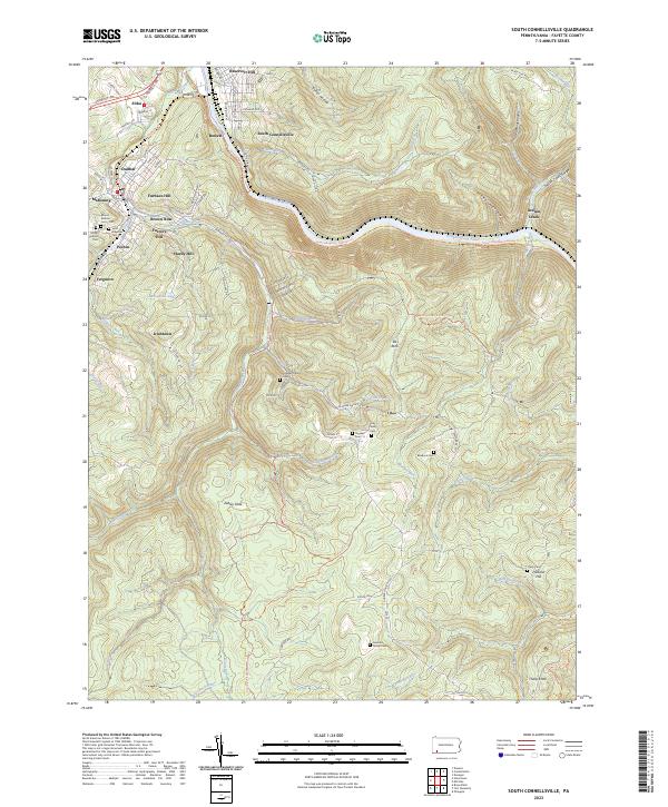 2023 South Connellsville2023 Print · USGSFayette County's river-carved landscape is shown in contemporary detail, tracing the path of the Youghiogheny River and its rail corridors. Genealogists can locate family landmarks like the Hay Family Cem and the Tharp Cem, or trace early settlements at Irishtown and Pechin.
 - 2023 Map of Mill Run, 2023 Print
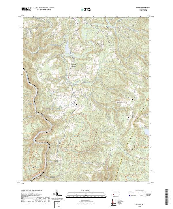 2023 Mill Run2023 Print · USGSFayette County ridge country is captured here in the 2020s, showing the deeply carved river corridors and highland settlements. Genealogists can locate family burial grounds like the Grimm Family Cem and Collins Family Cem near Normalville.
 - 2023 Map of Seven Springs, 2023 Print
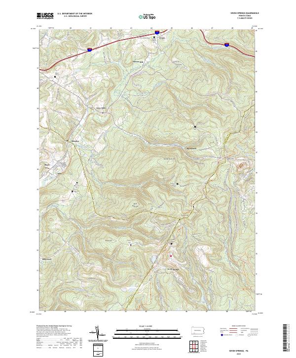 2023 Seven Springs2023 Print · USGSSeven Springs and the tri-county borders of Somerset, Westmoreland, and Fayette counties are captured here in the twenty-first century. Researchers can trace family sites like Franklin Lutheran Cem and Walnut Hill Cem or locate Horners Mill and Jones Mills.
 - 2023 Map of Donegal, 2023 Print
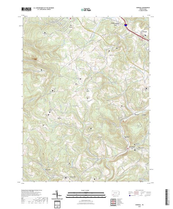 2023 Donegal2023 Print · USGSThe Laurel Highlands at the Westmoreland and Fayette border come into focus in this recent survey of the Indian Creek valley. Researchers can trace numerous family-named landmarks and burial grounds like the Keefer Family Cem and Stouffer Cem near Indian Head.
 - 2023 Map of Connellsville, 2023 Print
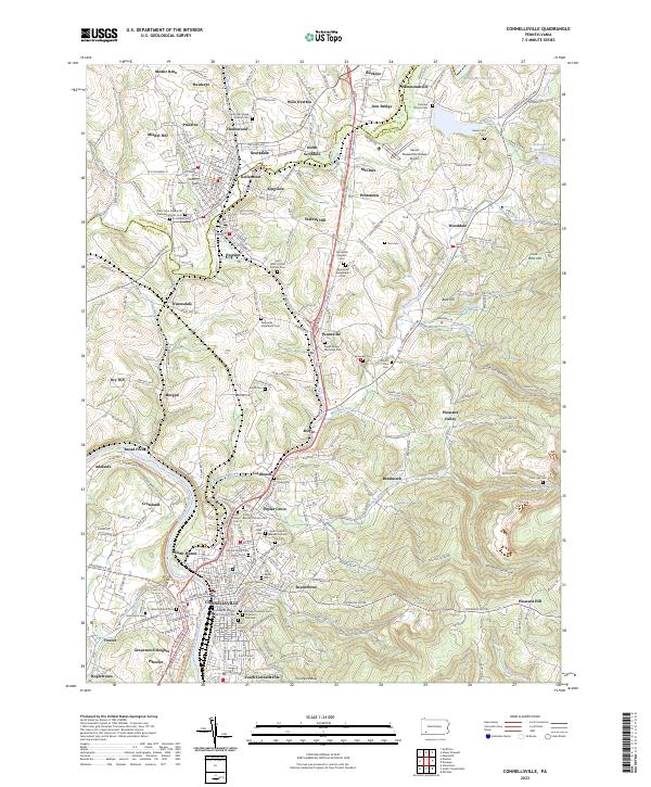 2023 Connellsville2023 Print · USGSWestern Pennsylvania’s industrial river valley and coal-country settlements are documented here in recent detail. Researchers can trace family sites from Scottdale to Connellsville, including Hill Grove Cem, Holy Trinity Roman Catholic Cem, and the Southwest Pennsylvania RR.
End of results
Showing maps 1-6 of 6
Top cities near Springfield Township
- Connellsville historical maps
- Scottdale historical maps
- Mount Pleasant historical maps
- South Connellsville historical maps
- Dunbar historical maps
- Everson historical maps
See more
Top neighborhoods of Springfield Township
- Normalville historical maps
- Rasler Run historical maps
- Fairmont historical maps
- Indian Creek historical maps
- Pleasant Hill historical maps
- Rogers Mill historical maps
See more
Frequently asked questions
- What are the different types of historical maps available for Springfield Township?
- What is the oldest map of Springfield Township?
- Where can I purchase historical maps of Springfield Township for my home or office?
- Where can I download high-res historical maps of Springfield Township?
- Are there historical topographic maps available for Springfield Township?
- Is there historical aerial imagery available for Springfield Township?
- Where are historical maps of Springfield Township sourced from?