1900s (20th Century) Maps of Letterkenny Township, Pennsylvania
Explore 32 historic maps of Letterkenny Township from the 1900s (20th Century). These maps offer a rare glimpse into what life looked like during the 1900s — showing old roads, neighborhoods, homes, and landmarks that have changed or disappeared over time.
Whether you're researching your family's past, planning a metal detecting trip, or studying how Letterkenny Township's landscape evolved across the 1900s, these high-resolution maps are a powerful tool for exploring the history of this region.
- Focus on a specific era: All maps on this page are from the 1900s, giving you a focused view of this time period.
- See what’s changed: Compare century-old streets, trails, and buildings to today's modern landscape using overlays and satellite layers.
- Research with precision: Use these maps for genealogy, historical research, land use analysis, or educational projects.
- View, download, or print: Maps are fully viewable online in high resolution, and can be downloaded or printed for your own records.
Start exploring Letterkenny Township's history through authentic maps from the 1900s. This is your window into the past.
Letterkenny Township, PA maps
(32)- 1900 Map of Mercersburg
 1900 Mercersburg1900 Print · USGSFranklin County at the turn of the century is captured here as a landscape of iron furnaces and valley farms. Trace the early transport lines through Mercersburg, Richmond Furnace, and the old Southern Pennsylvania Br. rail line.
 - 1902 Map of Chambersburg
 1902 Chambersburg1902 Print · USGSFranklin County at the dawn of the new century shows a thriving valley dominated by the rail lines connecting Chambersburg, Greencastle, and Waynesboro. Genealogists and historians can trace long-gone stops and industrial sites like Guilford Siding, Browns Mills, and the Pond Bank iron area.7 unique versions available
 - 1902 Map of Mercersburg
 1902 Mercersburg1902 Print · USGSFranklin and Fulton counties at the opening of the twentieth century show a landscape defined by iron furnaces and mountain gaps. Genealogists and historians can trace rail lines to Mercersburg Junction or locate family sites near Welsh Run and Foltz.5 unique versions available
 - 1923 Map of Shippensburg
 1923 Shippensburg1923 Print · USGSShippensburg and its surrounding valley floor were defined by the rail lines and agricultural networks of the early twentieth century. Genealogists can locate dozens of country schools and churches, including Brookside School, Lurgan Sta, and the State Normal School campus.3 unique versions available
 - 1939 Map of Orbisonia, 1954 Print
 1939 Orbisonia1954 Print · USGSOrbisonia and the surrounding mountain gaps are captured in the late thirties just as the modern turnpike was transforming the valley. Researchers can trace the narrow-gauge East Broad Top RR or find rural landmarks like Burnt Cabins and Jordan Cem.7 unique versions available
 - 1940 Map of Orbisonia
 1940 Orbisonia1940 Print · USGSCentral Pennsylvania's Ridge and Valley province is captured here just as the Pennsylvania Turnpike reached Burnt Cabins. Researchers can trace the narrow-gauge EAST BROAD TOP RR and locate family landmarks like Jordan Cem, Kuhns Mill, or St Marys Ch.2 unique versions available
 - 1942 Map of Hagerstown
 1942 Hagerstown1942 Print · USGSThe Cumberland Valley and Potomac corridor are captured here at the height of the Second World War rail-and-river era. Genealogists and historians can trace the industrial landscape of Richmond Furnace, the route of the Chesapeake and Ohio Canal, and the grounds of Camp Ritchie.
 - 1943 Map of Hagerstown
 1943 Hagerstown1943 Print · USGSThe Cumberland Valley was a critical wartime logistics hub in the 1940s, teeming with rail traffic and new military installations. Genealogists and historians can trace the Chesapeake and Ohio Canal or locate local landmarks like Richmond Furnace and Camp Ritchie.
 - 1943 Map of Chambersburg, 1955 Print
 1943 Chambersburg1955 Print · USGSChambersburg and the Cumberland Valley are seen here during the war years, dominated by the massive Letterkenny Ordnance Depot and active rail lines. Genealogists can trace family names through dozens of rural landmarks like Salem Ch and the Pennsylvania Soldiers Orphan Sch.3 unique versions available
 - 1943 Map of Mercersburg, 1955 Print
 1943 Mercersburg1955 Print · USGSFranklin County in the 1940s is captured here in its transition from a ridge-and-valley wilderness to a settled agricultural heartland. Genealogists can trace family landmarks like Claylick Sch, the historic Mercersburg Academy, and the village of Fort Loudon.2 unique versions available
 - 1943 Map of Shippensburg, 1965 Print
 1943 Shippensburg1965 Print · USGSCumberland and Franklin Counties are captured here during the Second World War as modern infrastructure began to pierce the ridges. Researchers can trace family roots through dozens of rural landmarks like State Normal Sch, Orrstown, and the Union Ch.
 - 1944 Map of St Thomas
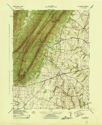 1944 St Thomas1944 Print · USGSFranklin County's deep ridges and valley farms are captured in this mid-1940s survey just as wartime industry and rural education were shifting. Researchers can trace family sites near St. Thomas, Franklin Furnace, and the Edenville Consolidated School.5 unique versions available
 - 1944 Map of Chambersburg
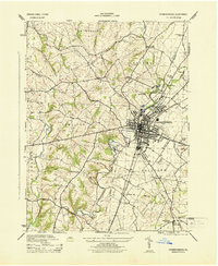 1944 Chambersburg1944 Print · USGSFranklin County at the height of the Second World War shows a landscape defined by industrial centers and burgeoning military infrastructure. Researchers can trace the dual rail lines serving Chambersburg or locate rural landmarks like U S Paper Mill and Social Island.6 unique versions available
 - 1944 Map of Orbisonia
 1944 Orbisonia1944 Print · USGSCentral Pennsylvania's ridge-and-valley landscape is shown here at the height of the narrow-gauge era just as modern highways arrived. Researchers can trace the East Broad Top RR through Rockhill, find legacy family sites like Kuhns Mill, and locate the Pennsylvania Turnpike near Burnt Cabins.3 unique versions available
 - 1945 Map of Shippensburg
 1945 Shippensburg1945 Print · USGSCumberland and Franklin counties meet at the base of the ridges in the mid-1940s, just as modern infrastructure begins to reshape the valley. Genealogists and historians can trace numerous rural schoolhouses like Clay Hill Sch and early infrastructure like the Kittatinny Tunnel and State Normal Sch.
 - 1948 Map of Baltimore
 1948 Baltimore1948 Print · USGSMaryland and Pennsylvania crossroads are captured in the late 1940s, showing a landscape defined by historic rail lines and major military installations. Genealogists can trace family connections in Gettysburg, Westminster, and near the U.S. Naval Academy in Annapolis.2 unique versions available
 - 1950 Map of Harrisburg, 1952 Print
 1950 Harrisburg1952 Print · USGSMid-century Central Pennsylvania comes alive through its dense rail networks and river valley settlements during the post-war industrial era. Genealogists and historians can trace family roots through hubs like Harrisburg, locate Carlisle Barracks, or follow the Pennsylvania RR through the Lebanon Valley.
 - 1954 Map of Baltimore
 1954 Baltimore1954 Print · USGSThe Mid-Atlantic region in the early fifties shows a landscape of growing suburban centers and heavy rail corridors. Trace mid-century transit networks and military landmarks from the Aberdeen Proving Ground to the Gettysburg National Military Park.
 - 1956 Map of Baltimore
 1956 Baltimore1956 Print · USGSMid-century Maryland and Pennsylvania are captured here during a period of massive suburban and military growth across the Chesapeake region. Genealogists and historians can trace the rail corridors of the Baltimore & Ohio RR and locate landmarks like Fort McHenry or the Aberdeen Proving Ground.
 - 1957 Map of Harrisburg
 1957 Harrisburg1957 Print · USGSMid-century Central Pennsylvania comes into focus as a bustling network of rail, river, and mountain ridges. Genealogists and historians can trace the development of the State Capitol and surrounding hubs like Middletown, Columbia, and Pottsville.7 unique versions available
 - 1957 Map of Baltimore, 1964 Print
 1957 Baltimore1964 Print · USGSMaryland and Southern Pennsylvania are shown during the mid-century expansion of the Baltimore-Washington corridor. Researchers can trace the extensive rail lines of the Baltimore & Ohio RR and locate sites like Fort Detrick and Gettysburg National Military Park.5 unique versions available
 - 1961 Map of Harrisburg
 1961 Harrisburg1961 Print · USGSCentral Pennsylvania is shown at a mid-century peak of industrial and military activity, from the Susquehanna water gaps to the fertile Dutch Country. Genealogists and historians can trace the rail corridors of the Pennsylvania RR and find landmarks like Carlisle Barracks or the Anthracite Coal Fields.2 unique versions available
 - 1961 Map of Baltimore
 1961 Baltimore1961 Print · USGSMaryland and Pennsylvania are captured at a mid-century peak of industrial and military expansion. Genealogists and historians can trace rail corridors like the Western Maryland Ry or locate regional landmarks such as Camp Detrick and Kent Island.
 - 1964 Map of Harrisburg
 1964 Harrisburg1964 Print · USGSCentral Pennsylvania in the mid-fifties reveals a landscape shaped by ridge-and-valley geology and critical Cold War infrastructure. Researchers can trace the massive Indiantown Gap Military Reservation or the rail corridors of the Pennsylvania RR and Reading RR.
 - 1966 Map of Roxbury, 1968 Print
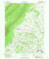 1966 Roxbury1968 Print · USGSFranklin County's landscape in the mid-1960s reveals a unique mix of high-altitude forests and strategic military infrastructure. Genealogists can trace family roots through the valley's Township Sch, Emmanuel Ch, and the extensive grounds of the Letterkenny Army Depot.4 unique versions available
Showing maps 1-25 of 32
Top cities near Letterkenny Township
- Chambersburg historical maps
- Quincy Township historical maps
- Shippensburg historical maps
- Fayetteville historical maps
- Lurgan Township historical maps
- Guilford Township historical maps
See more
Top neighborhoods of Letterkenny Township
- Pleasant Hall historical maps
- Freestone historical maps
- Keefers historical maps
- Maple Grove historical maps
- Upper Strasburg historical maps
Frequently asked questions
- What are the different types of historical maps available for Letterkenny Township?
- What is the oldest map of Letterkenny Township?
- Where can I purchase historical maps of Letterkenny Township for my home or office?
- Where can I download high-res historical maps of Letterkenny Township?
- Are there historical topographic maps available for Letterkenny Township?
- Is there historical aerial imagery available for Letterkenny Township?
- Where are historical maps of Letterkenny Township sourced from?