1990s Maps of Southampton Township, Pennsylvania
Explore 3 historic maps of Southampton Township from the 1990s. These maps offer a rare glimpse into what life looked like during the 1990s — showing old roads, neighborhoods, homes, and landmarks that have changed or disappeared over time.
Whether you're researching your family's past, planning a metal detecting trip, or studying how Southampton Township's landscape evolved across the 1990s, these high-resolution maps are a powerful tool for exploring the history of this region.
- Focus on a specific era: All maps on this page are from the 1990s, giving you a focused view of this time period.
- See what’s changed: Compare century-old streets, trails, and buildings to today's modern landscape using overlays and satellite layers.
- Research with precision: Use these maps for genealogy, historical research, land use analysis, or educational projects.
- View, download, or print: Maps are fully viewable online in high resolution, and can be downloaded or printed for your own records.
Start exploring Southampton Township's history through authentic maps from the 1990s. This is your window into the past.
Southampton Township, PA maps
(3)- 1990 Map of Caledonia Park, 1995 Print
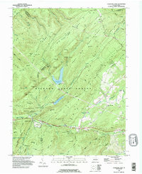 1990 Caledonia Park1995 Print · USGSSouth Mountain and the thick timberlands of Adams and Franklin counties are shown here in the early nineties. Genealogists and hikers can trace the Appalachian Trail past Caledonia State Park and the historic St Ignatius-Loyola Ch.
 - 1990 Map of Scotland, 1995 Print
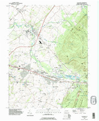 1990 Scotland1995 Print · USGSFranklin County in the early nineties shows a landscape of growing towns and deep forest roots. Genealogists can trace family sites at Mentzers Cem and Park Lawns Cem or locate the historic Scotland School for Veterans Children.
 - 1999 Map of Walnut Bottom, 2001 Print
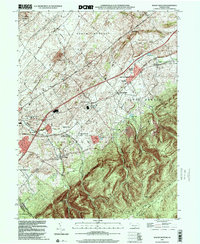 1999 Walnut Bottom2001 Print · USGSThe Cumberland Valley countryside meets the forested slopes of the Blue Ridge late in the twentieth century. Genealogists can trace family footprints near Walnut Bottom, Cleversburg, and old school sites like Spring Hill School.
End of results
Showing maps 1-3 of 3
Top cities near Southampton Township
- Chambersburg historical maps
- Quincy Township historical maps
- Shippensburg historical maps
- Dickinson historical maps
- Fayetteville historical maps
- Lurgan Township historical maps
See more
Top neighborhoods of Southampton Township
Frequently asked questions
- What are the different types of historical maps available for Southampton Township?
- What is the oldest map of Southampton Township?
- Where can I purchase historical maps of Southampton Township for my home or office?
- Where can I download high-res historical maps of Southampton Township?
- Are there historical topographic maps available for Southampton Township?
- Is there historical aerial imagery available for Southampton Township?
- Where are historical maps of Southampton Township sourced from?